
The Red River, or sometimes the Red River of the South to differentiate it from the Red River in the north of the continent, is a major river in the Southern United States. It was named for its reddish water color from passing through red-bed country in its watershed. It is known as the Red River of the South to distinguish it from the Red River of the North, which flows between Minnesota and North Dakota into the Canadian province of Manitoba. Although once a tributary of the Mississippi River, the Red River is now a tributary of the Atchafalaya River, a distributary of the Mississippi that flows separately into the Gulf of Mexico. This confluence is connected to the Mississippi River by the Old River Control Structure.

The Boston Mountains is a Level III ecoregion designated by the Environmental Protection Agency (EPA) in the U.S. states of Arkansas and Oklahoma. Part of the Ozarks, the Boston Mountains are a deeply dissected plateau. The ecoregion is steeper than the adjacent Springfield Plateau to the north, and bordered on the south by the Arkansas Valley. The Oklahoma portion of the range is locally referred to as the Cookson Hills. There are several theories of how the mountains were named, though apparently none are related to the Massachusetts city.

The Ouachita Mountains, simply referred to as the Ouachitas, are a mountain range in western Arkansas and southeastern Oklahoma. They are formed by a thick succession of highly deformed Paleozoic strata constituting the Ouachita Fold and Thrust Belt, one of the important orogenic belts of North America. The Ouachitas continue in the subsurface to the northeast, where they make a poorly understood connection with the Appalachians and to the southwest, where they join with the Marathon uplift area of West Texas. Together with the Ozark Plateaus, the Ouachitas form the U.S. Interior Highlands. The highest natural point is Mount Magazine at 2,753 feet (839 m).

The New Madrid Seismic Zone (NMSZ), sometimes called the New Madrid Fault Line, is a major seismic zone and a prolific source of intraplate earthquakes in the Southern and Midwestern United States, stretching to the southwest from New Madrid, Missouri.

Novaculite, also called Arkansas Stone, is a microcrystalline to cryptocrystalline rock type that consists of silica in the form of chert or flint. It is commonly white to grey or black in color, with a specific gravity that ranges from 2.2 to 2.5. It is used in the production of sharpening stones. It occurs in parts of Arkansas, Oklahoma, and Texas, as well as in Japan and parts of the Middle East. The name novaculite is derived from the Latin word novacula, meaning a sharp knife, dagger, or razor, in reference to its use in sharpening. The first recorded use of the term whetstone was in reference to a honing stone from Arkansas.

Canehill, also known as Cane Hill and Boonsboro, is an unincorporated community and census-designated place (CDP) in Washington County, Arkansas, United States. It was first listed as a CDP in the 2020 census with a population of 74.
Savoy is an unincorporated community in Litteral Township, Washington County, Arkansas, United States. It is located on County Route 845 east of Lake Wedington. The Ozark National Forest is just west of the community. The Savoy area is marked with bluffs and streams. A distinctive feature is the dam on Clear Creek where a flour mill was once in operation. Savoy had a post office and businesses that no longer exist.
Home Township is a civil township of Montcalm County in the U.S. state of Michigan. As of the 2020 census, the township population was 2,716.

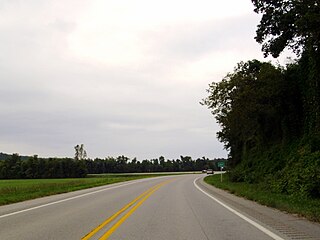
Clyde is an unincorporated community in Cane Hill Township, Washington County, Arkansas, United States. Clyde is on Arkansas Highway 45, approximately 26 miles southwest of Fayetteville and six miles east of the Oklahoma border.
Wyola, Arkansas is an unincorporated community in Crawford Township, Washington County, Arkansas, United States. It is located on Arkansas Highway 74, south of Arnett and east of Brentwood.
Harris is an unincorporated community in Elkins Township, Washington County, Arkansas, United States. It is located east of Fayetteville and within the city limits of Elkins near Arkansas Highway 16.

The Fayetteville Shale is a geologic formation of Mississippian age composed of tight shale within the Arkoma Basin of Arkansas and Oklahoma. It is named for the city of Fayetteville, Arkansas, and requires hydraulic fracturing to release the natural gas contained within.
Baldwin is a former unincorporated community in Fayetteville Township, Washington County, Arkansas, United States. It has since been annexed by Fayetteville. It is located in east Fayetteville along Huntsville Road near Lake Sequoyah toward Elkins.

Goshen Township is one of thirty-seven townships in Washington County, Arkansas. As of the 2000 census, its total population was 1,656. The township contains the Town of Goshen and some surrounding unincorporated areas. Goshen Township was established in 1878.

Prairie Township is one of 37 townships in Washington County, Arkansas, USA. As of the 2000 census, its total population was 3,526.
Little Arkansaw is an unincorporated community in Boone County, Arkansas, United States. Little Arkansaw is located on Arkansas Highway 392 near its junction with U.S. Route 62 and U.S. Route 412, 3.1 miles (5.0 km) east of Alpena.
Sonora is an unincorporated community in Springdale Township in northeastern Washington County, Arkansas, United States. It is located at the intersection of US 412 and Sonora Road, east of Springdale. The upper reaches of Beaver Lake on the White River lie less than two miles to the east and south.
Number Nine is an unincorporated community in Mississippi County, Arkansas, United States. Number Nine is located on Arkansas Highway 150, 7.5 miles (12.1 km) east-northeast of Blytheville.
Suttle is an unincorporated community in Starr Hill Township, in western Washington County, Arkansas, United States. It is located on Washington County Road 33 and on the east bank of Moores Creek. Lincoln lies about two miles to the southwest.


