Related Research Articles

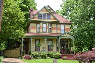
Washington County is a regional economic, educational, and cultural hub in the Northwest Arkansas region. Created as Arkansas's 17th county on November 30, 1848, Washington County has 13 incorporated municipalities, including Fayetteville, the county seat, and Springdale. The county is also the site of small towns, bedroom communities, and unincorporated places. The county is named for George Washington, the first President of the United States.

Sevier County is a county located in the U.S. state of Arkansas. As of the 2020 census, the population was 15,839. The county seat is De Queen. Sevier County is Arkansas's 16th county, formed on October 17, 1828, and named for Ambrose Sevier, U.S. Senator from Arkansas. On November 3, 2020, voters in Sevier County, AR approved alcohol sales by a vote of 3,499 to 1,699.
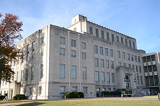
Sebastian County is a county located in the U.S. state of Arkansas. As of the 2020 census, the population was 127,799, making it the fourth-most populous county in Arkansas. The county has two county seats, Greenwood and Fort Smith.

Scott County is a county located in the U.S. state of Arkansas. As of the 2020 census, the population was 9,836. The county seat is Waldron. Scott County is Arkansas' 28th county, formed on November 5, 1833, and named for Andrew Scott, a justice of the Supreme Court of the Arkansas Territory. It is an alcohol-prohibited or dry county.

Johnson County is a county located in the U.S. state of Arkansas. As of the 2020 census, the population was 25,749. The county seat is Clarksville. Johnson County is Arkansas's 30th county, formed on November 16, 1833, from a portion of Pope County and named for Benjamin Johnson, a Territorial Judge. It is an alcohol prohibition or dry county.
Independence County is a county located in the U.S. state of Arkansas. As of the 2020 census, the population was 37,938. The county seat is Batesville. Independence County is Arkansas's ninth county, formed on October 20, 1820, from a portion of Lawrence County and named in commemoration of the Declaration of Independence. It is an alcohol prohibition or dry county.
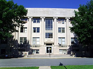
Drew County is a county located in the southeast region of the U.S. state of Arkansas. As of the 2020 census, the population was 17,350. The county seat and largest city is Monticello. Drew County was formed on November 26, 1846, and named for Thomas Drew, the third governor of Arkansas.

Crawford County is a county located in the Ozarks region of the U.S. state of Arkansas. As of the 2020 census, the population was 60,133. The county seat and largest city is Van Buren. Crawford County was formed on October 18, 1820, from the former Lovely County and Indian Territory, and was named for William H. Crawford, the United States Secretary of War in 1815.

Benton County is a county in the Northwest region of the U.S. state of Arkansas. Created as Arkansas' 35th county on September 30, 1836, Benton County contains thirteen incorporated municipalities, including Bentonville, the county seat, and Rogers, the most populous city. The county was named after Thomas Hart Benton, a U.S. Senator from Missouri influential in Arkansas statehood.

Winslow is a city in southern Washington County, Arkansas, United States. The population was 365 as of the 2020 census. It is part of the Northwest Arkansas region.

Area code 479 is a telephone area code in the North American Numbering Plan (NANP) for thirteen counties in the northwestern part of the U.S. state of Arkansas. The numbering plan area (NPA) includes the cities of Bentonville, Fayetteville, Fort Smith, Rogers, Siloam Springs and Springdale. It was created on January 19, 2002 in an area code split of area code 501.
Graphic is an unincorporated community in Crawford County, Arkansas, in the United States.
West Fork Township is an inactive township in Washington County, Arkansas, United States.
Starr Hill Township is an inactive township in Washington County, Arkansas, United States.
Wedington Township is an inactive township in Washington County, Arkansas, United States.
Bowen Township is one of 21 inactive townships in Madison County, Arkansas, USA. As of the 2010 census, its population was 486.
Hilburn Township is one of 21 inactive townships in Madison County, Arkansas, USA. As of the 2010 census, its population was 310.
Boston Township is one of 21 inactive townships in Madison County, Arkansas, USA. As of the 2010 census, its population was 168.
Kentucky Township is one of 21 inactive townships in Madison County, Arkansas, USA. As of the 2010 census, its population was 265.
Valley Township is one of 21 inactive townships in Madison County, Arkansas, United States. As of the 2010 census, its population was 517.
References

35°47′38″N94°06′32″W / 35.794°N 94.109°W
| | This article about a location in Washington County, Arkansas is a stub. You can help Wikipedia by expanding it. |