
Washington County is a regional economic, educational, and cultural hub in the Northwest Arkansas region. Created as Arkansas's 17th county on November 30, 1848, Washington County has 13 incorporated municipalities, including Fayetteville, the county seat, and Springdale. The county is also the site of small towns, bedroom communities, and unincorporated places. The county is named for George Washington, the first President of the United States.

Jefferson County, Arkansas is a county located in the U.S. state of Arkansas in the area known as the Arkansas Delta that extends west of the Mississippi River. Jefferson County consists of five cities, two towns, and 20 townships. It is bisected by the Arkansas River, which was critical to its development and long the chief transportation byway. In 2020, Jefferson County's population was estimated at 67,260. The county seat and largest city is Pine Bluff. The county is included in the Pine Bluff metropolitan statistical area. The county seat and the most populous city is Pine Bluff.

Springdale is the fourth-most populous city in Arkansas, United States. It is located in both Washington and Benton counties in Northwest Arkansas. Located on the Springfield Plateau deep in the Ozark Mountains, Springdale has long been an important industrial city for the region. In addition to several trucking companies, the city is home to the world headquarters of Tyson Foods, the world's largest meat producing company. Originally named Shiloh, the city changed its name to Springdale when applying for a post office in 1872. It is included in the four-county Northwest Arkansas Metropolitan Statistical Area, which is ranked 102nd in terms of population in the United States with 546,725 in 2020 according to the United States Census Bureau. The city had a population of 84,161 at the 2020 Census.

Fayetteville is the second-most populous city in the U.S. state of Arkansas, the county seat of Washington County, and the most populous city in Northwest Arkansas. The city had a population of 93,949 as of the 2020 census, which was estimated to have increased to 101,680 by 2023. The city is on the outskirts of the Boston Mountains, deep within the Ozarks. It was named after Fayetteville, Tennessee, from which many settlers had come, and was incorporated on November 3, 1836. Fayetteville is included in the three-county Fayetteville–Springdale–Rogers metropolitan statistical area, with 576,403 residents in 2020.

Augustus Hill Garland was an American lawyer and Democratic politician from Arkansas, who initially opposed Arkansas' secession from the United States, but later served in both houses of the Congress of the Confederate States and the United States Senate, as well as becoming the 11th governor of Arkansas (1874–1877) and the 38th attorney general of the United States (1885–1889). He wrote several books.
This is a list of properties and historic districts in Arkansas that are listed on the National Register of Historic Places. There are more than 2,600 listings in the state, including at least 8 listings in each of Arkansas's 75 counties.

Highway 180 is a state highway of 1.723 miles (2.773 km) in Fayetteville. The route begins at Interstate 49/US 62/US 71/Highway 16 and runs east through Fayetteville to School Avenue. Highway 180 is designated as part of the Trail of Tears National Historic Trail as well as Arkansas Heritage Trails System designations as the Butterfield Trail, Trail of Tears, and Civil War Trails.

Sixteen special routes of U.S. Route 62 currently exist. Seven of them lie within the state of Arkansas. Three existed in the past but have since been decommissioned.

The Arkansas Highway System is made up of all the highways designated as Interstates, U.S. Highways and State Highways in the US state of Arkansas. The system is maintained by the Arkansas Department of Transportation (ArDOT), known as the Arkansas State Highway Department (AHD) until 1977 and the Arkansas State Highway and Transportation Department (AHTD) from 1977 to 2017. The system contains 16,442.90 miles (26,462.28 km) of Interstates, U.S. Routes, state highways, and special routes. The shortest members are unsigned state highways Arkansas Highway 806 and Arkansas Highway 885, both 0.09 miles (0.14 km) in length. The longest route is U.S. Route 67, which runs 296.95 miles (477.89 km) from Texarkana to Missouri.
Hogeye is an unincorporated community in Valley Township, Washington County, Arkansas, United States. It is located on Arkansas Highway 265 and Arkansas Highway 156.
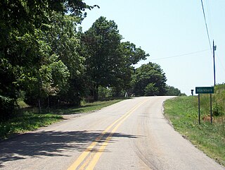
Blackburn is an unincorporated community in Lee's Creek Township, Washington County, Arkansas, United States. It is located on Arkansas Highway 74, northeast of Devil's Den State Park.
Pitkin Corner is an unincorporated community in West Fork Township, Washington County, Arkansas, United States. It is located on Washington County Road 35 west of the Woolsey Bridge.
Strain is an unincorporated community in Richland Township, Washington County, Arkansas, United States. It is located between Fayetteville and Elkins. The community consists of a small number of homes located around a road junction near the Middle Fork White River.
Viney Grove is an unincorporated community in Marrs Hill Township, Washington County, Arkansas, United States. It is located north of Prairie Grove and Prairie Grove Battlefield State Park along County Road 37.
Hazel Valley is an unincorporated community in Reed Township, Washington County, Arkansas, United States. It is located along County Route 47 northeast of Winslow.
Sunset is an unincorporated community in Reed Township, Washington County, Arkansas, United States. It is located at the intersection of Sunset Road and CR 110.
Tolu is an unincorporated community in Vineyard Township in western Washington County, Arkansas, United States. It is located at the intersection of Highway 59 and Bellamy Road about one half mile from the Arkansas - Oklahoma border. The community of Evansville lies approximately 1.3 miles to the south, across Evansville Creek.
Caesar Perkins was a member of the Virginia General Assembly, elected in both 1869 and 1887. He represented Buckingham County as a Republican.


