Blackburn, Arkansas

Last updated

Blackburn, Arkansas
Blackburn, Arkansas.jpg
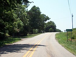
Entrance to Blackburn on Highway 74
USA Arkansas location map.svg
Red pog.svg
Blackburn, Arkansas
Blackburn's position in Arkansas.
Coordinates: 35°48′59″N94°13′11″W / 35.81639°N 94.21972°W / 35.81639; -94.21972
Country United States
State Arkansas
County Washington
Township Lee's Creek
Elevation
[1]
1,890 ft (576 m)
Time zone UTC-6 (Central (CST))
  Summer (DST) UTC-5 (CDT)
Area code 479
GNIS feature ID70703
U.S. Geological Survey Geographic Names Information System: Blackburn, Arkansas

Blackburn is an unincorporated community in Lee's Creek Township, Washington County, Arkansas, United States. [1] It is located on Arkansas Highway 74, northeast of Devil's Den State Park. [2]

A post office called Blackburn was established in 1880, and remained in operation until 1952. [3] [4]

Related Research Articles

<span class="mw-page-title-main">Washington County, Arkansas</span> County in Arkansas, United States

Washington County is a regional economic, educational, and cultural hub in the Northwest Arkansas region. Created as Arkansas's 17th county on November 30, 1848, Washington County has 13 incorporated municipalities, including Fayetteville, the county seat, and Springdale. The county is also the site of small towns, bedroom communities, and unincorporated places. The county is named for George Washington, the first President of the United States.

<span class="mw-page-title-main">Historic Washington State Park</span>

Historic Washington State Park is a 101-acre (41 ha) Arkansas state park in Hempstead County, Arkansas in the United States. The museum village contains a collection of pioneer artifacts from the town of Washington, Arkansas, which is a former pioneer settlement along the Southwest Trail. Walking interpretive tours are available throughout the 54 buildings. Washington served as a major trading point along the Southwest Trail, evolving into the Hempstead county seat and later the capital of Arkansas from 1863 to 1865 when Little Rock was threatened during the Civil War. The original plat of Washington was added to the National Register of Historic Places in 1972 as the Washington Historic District.

<span class="mw-page-title-main">J. C. S. Blackburn</span> American politician (1838–1918)

Joseph Clay Stiles Blackburn was a Democratic Representative and Senator from Kentucky. Blackburn, a skilled and spirited orator, was also a prominent trial lawyer known for his skill at swaying juries.

<span class="mw-page-title-main">Canehill, Arkansas</span> Unincorporated community in Arkansas

Canehill is an unincorporated community and census-designated place (CDP) in Washington County, Arkansas, United States. It was first listed as a CDP in the 2020 census with a population of 74.

<span class="mw-page-title-main">War Eagle, Arkansas</span> Unincorporated community in Arkansas, United States

War Eagle is an unincorporated community in Benton County, Arkansas, United States. It is the location of War Eagle Bridge, which carries CR 98 over War Eagle Creek and is listed on the National Register of Historic Places.

Durham is an unincorporated community in eastern Washington County, Arkansas, United States. The community is on Arkansas Highway 16 along the White River valley between Elkins to the northwest and Thompson in Madison County to the southeast. Its elevation is 1,247 feet (380 m).

Harris is an unincorporated community in Elkins Township, Washington County, Arkansas, United States. It is located east of Fayetteville and within the city limits of Elkins near Arkansas Highway 16.

<span class="mw-page-title-main">Evansville, Arkansas</span> Census-designated place in Arkansas, United States

Evansville is an unincorporated community and census-designated place (CDP) in southwest Washington County, Arkansas, United States. It was first listed as a CDP in the 2020 census with a population of 102.

Hogeye is an unincorporated community in Valley Township, Washington County, Arkansas, United States. It is located on Arkansas Highway 265 and Arkansas Highway 156.

Hubbard is an unincorporated community in Valley Township, Washington County, Arkansas, United States. It is located near the intersection of Washington County Road 21 and Hubbard Road.

Pitkin Corner is an unincorporated community in West Fork Township, Washington County, Arkansas, United States. It is located on Washington County Road 35 west of the Woolsey Bridge.

Strain is an unincorporated community in Richland Township, Washington County, Arkansas, United States. It is located between Fayetteville and Elkins. The community consists of a small number of homes located around a road junction near the Middle Fork White River.

Arnett is an unincorporated community in White River Township, Washington County, Arkansas, United States. It is located on Arkansas Highway 74.

Morrow is an unincorporated community and census-designated place (CDP) in Washington County, Arkansas, United States. A post office has been in operation at Morrow since 1883; The community had the name of G. W. Morrow, an early postmaster. it was first listed as a CDP in the 2020 census with a population of 263;

<span class="mw-page-title-main">Lee's Creek Township, Washington County, Arkansas</span> Township in Arkansas, United States

Lee's Creek Township is one of thirty-seven townships in Washington County, Arkansas, USA. As of the 2000 census, its total population was 640.

Viney Grove is an unincorporated community in Marrs Hill Township, Washington County, Arkansas, United States. It is located north of Prairie Grove and Prairie Grove Battlefield State Park along County Road 37.

Rhea is an unincorporated community in Rhea's Mill Township, Washington County, Arkansas, United States. It is located on a county road north of Lincoln and Lincoln Lake. Weddington Mountain is just to the west.

Sunset is an unincorporated community in Reed Township, Washington County, Arkansas, United States. It is located at the intersection of Sunset Road and CR 110.

Carter (1960–2018) was an unincorporated community in Washington County, Arkansas, United States. It is located on Arkansas Highway 74 between Arnett and Sulphur City. At times it was also known as Carter's Store, Carter Store, and Hicks. A post office, for all these names at different times existed from 1875 to 1953. The community has the name of John C. Carter, first postmaster.

Tolu is an unincorporated community in Vineyard Township in western Washington County, Arkansas, United States. It is located at the intersection of Highway 59 and Bellamy Road about one half mile from the Arkansas - Oklahoma border. The community of Evansville lies approximately 1.3 miles to the south, across Evansville Creek.

References

  1. 1 2 "Feature Detail Report for: Blackburn, Arkansas." USGS. U.S. Geological Survey Geographic Names Information System: Blackburn, Arkansas Retrieved April 26, 2011.
  2. Arkansas Atlas and Gazetteer (Map) (Second ed.). DeLorme. 2002. p. 30. ISBN   0-89933-345-1.
  3. "Post Offices". Jim Forte Postal History. Retrieved February 4, 2018.
  4. History of Benton, Washington, Carroll, Madison, Crawford, Franklin, and Sebastian Counties, Arkansas. Higginson Book Company. 1889. p. 318.