U.S. Route 412 is an east–west United States highway, first commissioned in 1982. U.S. 412 overlaps expressway-grade Cimarron Turnpike from Tulsa west to Interstate 35 and the Cherokee Turnpike from 5 miles (8.0 km) east of Chouteau, Oklahoma, to 8 miles (13 km) west of the Arkansas state line. It runs the entire length of the Oklahoma Panhandle and traverses the Missouri Bootheel.
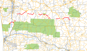
U.S. Route 371 is a north–south United States highway in the U.S. states of Arkansas and Louisiana. The highway's northern terminus is in De Queen, Arkansas at an intersection with U.S. Highway 70. It is co-signed for its last 13 miles (21 km) between Lockesburg, Arkansas and DeQueen with U.S. Highway 59 and U.S. Highway 71. Its southern terminus is 5 miles (8.0 km) west of Coushatta, Louisiana at an intersection with Interstate 49.

Arkansas Highway 27 is a designation for two north–south state highways in Arkansas. One route begins at US Highway 59 (US 59) and US 71 near Ben Lomond north to Highway 7 in Dardanelle. A second segment begins at Highway 7 in Dover and runs north to Highway 14 at Harriet. An original Arkansas state highway, Highway 27 was created as one continuous route in 1926, but was split around Russellville in 1961.
Arkansas Highway 23 is a north–south state highway in north Arkansas. The route runs 129.88 miles (209.02 km) from US 71 near Elm Park north to the Missouri state line through Ozark and Eureka Springs. Between AR 16 at Brashears and Interstate 40 north of Ozark, Highway 23 winds through the Ozark National Forest and is designated as the Pig Trail Scenic Byway due to its steep hills and hairpin turns. The route has a strong connection with the University of Arkansas Razorbacks, connecting fans in Central Arkansas with the Northwest Arkansas area.

Highway 295 is a designation for four north–south state highways in Madison County. One segment of 5.50 miles (8.85 km) runs from the Ozark National Forest north to Highway 16 at Crosses. A second segment of 3.07 miles (4.94 km) runs northeast from Combs to Madison County Road 4554 (CR 4554). The third segment runs 4.71 miles (7.58 km) north from CR 5395 at Japton through Georgetown to Highway 74 at Drake's Creek. A fourth segment of 10.88 miles (17.51 km) begins at Highway 74 at Wesley and runs north to US Route 412 (US 412).

Highway 72 is a designation for two east–west state highways in Benton County, Arkansas. A western route of 26.32 miles (42.36 km) runs east from Highway 43 at Maysville to U.S. Route 71B (US 71B) in Bentonville. A second route of 12.67 miles (20.39 km) begins at Interstate 49/US Route 71 (I-49/US 71) in Bentonville and runs northeast to US 62 near Avoca. The route is one of the original Arkansas state highways.
Highway 88 is a designation for five state highways in Arkansas. All routes are maintained by the Arkansas Department of Transportation (ArDOT).

Arkansas Highway 170 is a designation for two state highways in Washington County, Arkansas. The main segment of 17.31 miles (27.86 km) runs from Devil's Den State Park to West Fork. A shorter segment of 5.44 miles (8.75 km) runs from U.S. Route 62 (US 62) through Appleby before reconnecting with US 62.

Arkansas Highway 60 is a state highway that exists in five separate sections in Arkansas. The longest and most well-known segment of 54.19 miles (87.21 km) runs from Highway 28 in Plainview east to U.S. Route 65B (US 65B) in Conway. A segment in western Logan County of 2.64 miles (4.25 km) begins at the Old Highway 10 at the Sebastian County line and runs east to Highway 10. A third segment of 10.80 miles (17.38 km) begins at Highway 252 near Lavaca and runs east to Highway 41 at Peter Pender. A fourth segment runs 1.34 miles (2.16 km) from US 64 and runs across Interstate 40/Interstate 540 (I-40/I-540) to Highway 282. A fifth route of 2.34 miles (3.77 km) begins at Highway 282 near Rudy and runs north to County Road 23 (CR 23).

Highway 160 is a designation for four state highways in South Arkansas. The northernmost segment of 51.55 miles (82.96 km) runs from Farm to Market Road 249 at the Texas state line near Bloomburg, Texas east to Highway 19 at Macedonia. A second segment of 14.73 miles (23.71 km) runs east from Highway 57 east to Highway 7 Business in Smackover. In southern Calhoun County, Highway 160 begins at US Route 278 (US 278) and runs east to US 425 in Fountain Hill. A fourth segment begins at US 82 and runs 22.73 miles (36.58 km) east to US 65 at Chicot Junction.

Highway 45 is a designation for three state highways in northwest Arkansas. The southern segment of 26.97 miles (43.40 km) runs from Highway 96 north across US Route 71 (US 71) to Interstate 540/US 71 (I-540/US 71) in Fort Smith. Another segment of 10.64 miles (17.12 km) runs Highway 59 at Dutch Mills to US 62 in rural Washington County. A third route of 25.42 miles (40.91 km) runs from U.S. Route 71B (US 71B) in Fayetteville to Highway 12 near Clifty. These routes were formerly connected until a portion of approximately 50 miles (80 km) was redesignated Arkansas Highway 59 and many United States highways were rerouted through Fayetteville.

Highway 118 is a designation for two state highways in the Upper Arkansas Delta. One route of 41.43 miles (66.68 km) begins at US Highway 64 (US 64) and Highway 149 east to Mississippi County Road 495 near the Mississippi River levee. A second route of 4.29 miles (6.90 km) runs from US 70/US 79 in West Memphis to US 64 in Marion. Both routes are maintained by the Arkansas State Highway and Transportation Department (AHTD).
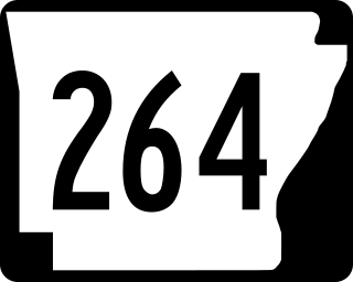
Arkansas Highway 264 is a designation for three state highways in Benton County, Arkansas. The eastern route begins at US 71B and runs 7.75 miles (12.47 km) east to terminate at Beaver Lake. At 13.15 miles (21.16 km), the Highfill to Lowell route is the longest alignment. The westernmost routes runs 2.73 miles (4.39 km) in Siloam Springs.

Highway 58 is an east–west state highway in north central Arkansas. The route of 53.37 miles (85.89 km) begins at Highway 14 and runs east to US Highway 67 in Donaldson. There is also an alternate route of 2.71 miles (4.36 km) designated as Highway 58E near Williford. Both routes are maintained by the Arkansas State Highway and Transportation Department (AHTD).

Arkansas Highway 119 is a series of state highways that run in Northeast Arkansas. All routes are maintained by the Arkansas Department of Transportation (ArDOT).

Highway 333 is a designation of three north–south state highways in Arkansas. One route begins at US Highway 64 (US 64) and runs north 17.20 miles (27.68 km) to Highway 7. A second highway begins at Searcy County Road 8 (CR 8) and runs north to US 65 near Marshall. A third segment connects Gilbert to the state highway system. All three highways were created and modified to their existing alignments between 1965 and 1974, and are maintained by the Arkansas Department of Transportation (ArDOT).
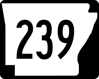
Highway 239 is the name of three state highways in Mississippi County.
Six special routes of U.S. Route 412 exist.

U.S. Highway 71 is a U.S. highway that runs from Krotz Springs, LA to the Fort Frances–International Falls International Bridge at the Canadian border. In Arkansas, the highway runs from the Louisiana state line near Doddridge to the Missouri state line near Bella Vista. In Texarkana, the highway runs along State Line Avenue with US 59 and partially runs in Texas. Other areas served by the highway include Fort Smith and Northwest Arkansas.

Highway 17 is a designation a state highway in the U.S. state of Arkansas. The highway is located mainly in Eastern Arkansas and is split into seven segments, though two sets of segments are directly connected. The first section of the highway is about 4.9 miles (7.9 km) long, with its southern terminus located near Ward Reservoir, in southern Arkansas County, which travels north and ends at a dead-end near La Grue Bayou. The second section is about 53.7 miles (86.4 km) long, starting south of the town of Ethel and ending at U.S. Route 70 (US 70) southwest of Brinkley. The third and longest section begins at US Route 49 north of Brinkley and ends at AR 14 in Newport. The fourth section is about 7.1 miles (11.4 km) long and begins at Arkansas Highway 18 in Diaz and ends at Arkansas Highway 37 west of Tuckerman.