U.S. Route 278 is a parallel route of US 78. It currently runs for 1,074 miles (1,728 km) from Hilton Head Island, South Carolina, to Wickes, Arkansas at US 71/US 59, passing through five states in the process. Landmarks along its route include the Department of Energy's Savannah River Site in South Carolina and the Tennessee-Tombigbee Waterway in eastern Mississippi. There are several universities located along the highway including Georgia State University, the University of Mississippi, and the University of Arkansas at Monticello.

Highway 32 is a designation for three state highways in South Arkansas. One route of 34.22 miles (55.07 km) runs from Oklahoma State Highway 3 (SH-3) at the Oklahoma state line east to Highway 355 at Saratoga. A second route of 3.96 miles (6.37 km) begins near Hope Municipal Airport and runs through Oakhaven to Highway 29. A third segment of 18.87 miles (30.37 km) begins at US 278 and runs east to US 371 in Willisville.

Highway 101 is a designation for two north–south state highways in north central Arkansas. A western route of 11.17 miles (17.98 km) runs north from US Route 62/US Route 412 (US 62/US 412) to Missouri Route 101 at the Missouri state line. A second route of 7.13 miles (11.47 km) begins at Hand Valley and runs north to US 62/US 412.

Highway 321 is a designation for two north–south state highways in central Arkansas. One route of 11.20 miles (18.02 km) runs from Highway 5/Highway 367 in Cabot north to Highway 38 east of Austin. A second route of 3.79 miles (6.10 km) begins at AR 31 north of Beebe and runs north to Highway 267.

Highway 355 is a designation for three north–south state highways in Southwest Arkansas. The routes are maintained by the Arkansas Department of Transportation (ArDOT).

Arkansas Highway 121 is a designation for two state highways in Lee County, Arkansas. One route of 9.49 miles (15.27 km) runs from the St. Francis River to US Route 79 (US 79) northeast of Marianna. A second routing begins north of Marianna at Highway 1 and runs essentially in a half-loop counterclockwise to LaGrange.

Arkansas Highway 133 is a designation for three state highways in South Arkansas. One route of 24.20 miles (38.95 km) runs from Louisiana Highway 142 north through Crossett to Highway 8 near Fountain Hill. A second segment runs from Highway 160 north to US Route 425 (US 425) at Lacey. A third segment begins in Rison at Highway 35 and runs north to Highway 54 south of Pine Bluff.

Highway 160 is a designation for four state highways in South Arkansas. The northernmost segment of 51.55 miles (82.96 km) runs from Farm to Market Road 249 at the Texas state line near Bloomburg, Texas east to Highway 19 at Macedonia. A second segment of 14.73 miles (23.71 km) runs east from Highway 57 east to Highway 7 Business in Smackover. In southern Calhoun County, Highway 160 begins at US Route 278 (US 278) and runs east to US 425 in Fountain Hill. A fourth segment begins at US 82 and runs 22.73 miles (36.58 km) east to US 65 at Chicot Junction.

Highway 328 is a designation of two east–west state highway in Northeast Arkansas, United States. One route begins at Highway 251 and runs east 18.37 miles (29.56 km) to US 62/US 67 in Reyno. A second highway begins at Highway 211 in Success and runs 7.81 miles (12.57 km) to US 67. The first segment was created in 1965, with the Clay County route forming in 1973. The route is maintained by the Arkansas Department of Transportation (ArDOT). A small portion of the route is designated as an Arkansas Heritage Trail for its use as the Trail of Tears during the Indian Removal.

Highway 308 is a designation for two east–west state highways in Northeast Arkansas. One segment runs east from AR 149 in Marked Tree to Spear Lake. A second route, of 10.94 miles (17.61 km) begins at Highway 118 at Whitton and runs east to US 61 at Frenchman's Bayou. The highway also includes a business route and spur route in Marked Tree. All four routes are maintained by the Arkansas Department of Transportation (ArDOT).
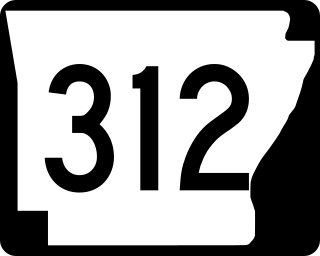
Highway 312 is a designation for three east–west state highways in northern Mississippi County, Arkansas. Two highways are rural, two-lane highways connecting agricultural areas around Blytheville. A third route runs in Blytheville as a city street. The highways were established during a ten-year period, beginning in 1963, and have remained unchanged since establishment. All routes are maintained by the Arkansas Department of Transportation (ArDOT).
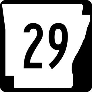
Arkansas Highway 29 is a state highway that extends 77.2 miles (124.2 km) in South Arkansas. It runs north from the Louisiana state line to its terminus at AR 301 in Antoine. It is intersected by many major thoroughfares including Interstate 30. Part of the highway is known as Bill Clinton Drive.
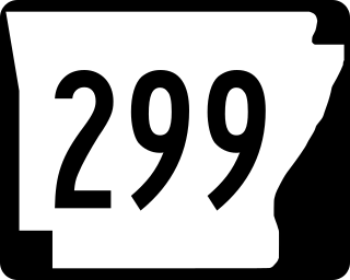
Highway 299 is a north–south state highway in Arkansas. The route of 26.40 miles (42.49 km) runs from Interstate 30 to AR 24 in White Oak Lake State Park. The route is two–lane, undivided.
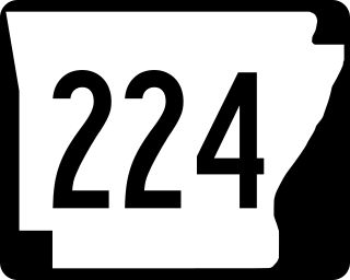
Arkansas Highway 224 is a designation for two east–west state highways in Jackson County, Arkansas. A northern route of 8.25 miles (13.28 km) runs east from Highway 367 to the city limits of Swifton. A second route of 8.26 miles (13.29 km) begins at US Route 67 (US 67) and runs to Highway 14 after serving as a frontage road of US 67.
Nine special routes of U.S. Route 278 currently exist. Four of them lie within the state of Arkansas. One more existed in the past but has since been decommissioned.

Highway 267 is a designation for two state highways in White County. One route of 15.47 miles (24.90 km) begins at Highway 31 and runs northeast to Highway 367 in Searcy. A second route of 2.25 miles (3.62 km) begins at Highway 31 and runs east to Highway 13. Highway 267 Spur, a spur route of 0.90 miles (1.45 km) connects Highway 267 and Highway 31 north of Beebe. The highways are maintained by the Arkansas Department of Transportation (ARDOT).

Highway 144 is a designation for two state highways in Southeast Arkansas. One route of 7.82 miles (12.59 km) begins at Big Bayou Meto Use Area and runs east to US Highway 165 (US 165), Highway 1, and the Great River Road (GRR). A second route of 20.50 miles (32.99 km) begins at US 165 near Jerome and runs east through Lake Village to a levee near the Mississippi River. Both routes are maintained by the Arkansas Department of Transportation (ArDOT). While overlapping US 65/US 278 in Chicot County, the route is part of the Great River Road, a national scenic byway following the Mississippi River.

Highway 343 is a designation for three state highways in the Arkansas Grand Prairie. One route runs 4.04 miles (6.50 km) north from a county road to Highway 11. A second route begins at Highway 152 and runs 9.56 miles (15.39 km) to US Highway 63 (US 63) and US 79 west of Stuttgart. A third route begins at US 165 and runs 8.59 miles (13.82 km) north to Highway 86 near Slovak. All three routes are maintained by the Arkansas Department of Transportation (ArDOT).

Arkansas Highway 174 is a designation for a state highway in Southwest Arkansas. The route is split into two sections. The first section begins at AR 355 in Spring Hill and ends at US Route 67 (US 67) in Hope. The second section begins at US 67 in Perrytown and ends at AR 299 just south of Interstate 30 (I-30). AR 174 is one of the few exceptions to the rule of an even-numbered state highway traveling north to south, rather than east to west.

Arkansas Highway 195 is the designation for a state highway in the U.S. state of Arkansas. The route is split into three sections, all of which are located in southwest Arkansas. The first section begins at AR 355 in Fulton, and ends at US 278 in Washington. The second section begins at AR 332 in De Ann, and ends at US 371 just east of Blevins. The third section begins at US 371 just east of McCaskill, and ends at AR 26 in Delight. All three routes are maintained by the Arkansas Department of Transportation (ARDOT).