
Wyola is a census-designated place (CDP) in Big Horn County, Montana, United States. The population was 215 at the 2010 census. 79% of the residents are Native American, and the majority are members of the Crow Tribe.

The Little Bighorn River is a 138-mile-long (222 km) tributary of the Bighorn River in the United States in the states of Montana and Wyoming. The Battle of the Little Bighorn, also known as the Battle of the Greasy Grass, was fought on its banks on June 25–26, 1876, as well as the Battle of Crow Agency in 1887.
KEZA is a commercial FM radio station in Fayetteville, Arkansas, broadcasting to Northwest Arkansas, including Bentonville and Fort Smith. KEZA is owned by iHeartMedia and airs an adult contemporary radio format branded as "Magic 107.9." For much of November and December, it switches to all-Christmas music. In the evening, KEZA carries the nationally syndicated Delilah. On Saturday mornings, it carries Ellen K. Both shows are supplied by co-owned Premiere Networks.
Wyola is an unincorporated community in Delaware County, Pennsylvania, United States. Wyola is located at 40°0'29"N 75°25'8"W. The location is now a traffic circle connecting St. David's Road to Pennsylvania Route 252 near the campus of the Episcopal Academy.
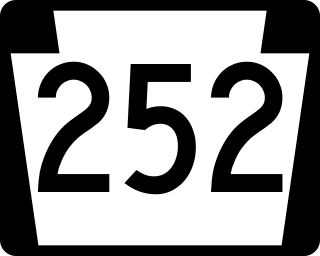
Pennsylvania Route 252 is a north–south state highway in the U.S. state of Pennsylvania that connects PA 320 in Nether Providence Township at its southern terminus to PA 23 in Valley Forge at its northern terminus. The route runs through the western suburbs of Philadelphia in Delaware, Chester, and Montgomery counties, including Nether Providence Township, the borough of Media, Upper Providence Township, Marple Township, Newtown Township, Easttown Township, Tredyffrin Township, and Upper Merion Township. The route intersects many roads including U.S. Route 1 north of Media, PA 3 in Newtown Square, US 30 in Paoli, and US 202 near Berwyn.

Lake Wyola State Park, also known as the Carroll A. Holmes Recreation Area, is located in the town of Shutesbury, Massachusetts. It is a state-run recreation area located on the shores of Lake Wyola.
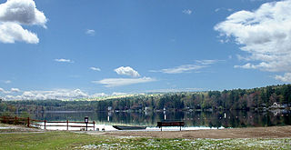
Lake Wyola is a lake located in Shutesbury, Massachusetts, United States.
KUAF is a non-commercial FM radio station licensed to Fayetteville, Arkansas, serving Northwest Arkansas. The station is owned by the University of Arkansas, with studios and offices near the school's campus in Downtown Fayetteville.

Township of Crawford is one of 37 townships in Washington County, Arkansas, United States. As of the 2000 census, its total population was 800.

SS Wyola was a 306 GRT steam tug built in 1912 by JT Eltringham & Co of South Shields, England for the Swan River Shipping Company of Western Australia. Wyola was 125 ft (38 m) long between perpendiculars, had a beam of 24.7 ft (7.5 m), a depth of 13.1 ft (4.0 m) and a draught of 14 ft 0 in (4.3 m). Her 179 NHP triple-expansion engine gave Wyola a speed of 11.5 kn (21.3 km/h). She was also fitted with a powerful salvage pump, making her one of the most powerful tugs in Australia at that time.
The following television stations operate on virtual channel 42 in the United States:
The following television stations operate on virtual channel 40 in the United States:
The following television stations operate on virtual channel 30 in the United States:
The following television stations operate on virtual channel 21 in the United States:
The following television stations broadcast on digital channel 40 in the United States:
The following television stations broadcast on digital channel 42 in the United States:
The following low-power television stations broadcast on digital or analog channel 42 in the United States:
The following low-power television stations broadcast on digital or analog channel 40 in the United States:

The R.S.L. Club also known as the Wyola Club or the Fremantle RSL Wyola Club Inc., is a heritage listed building located at 81-83 High Street. It was one of many commercial buildings constructed in Fremantle during the gold boom period in the late nineteenth and early twentieth century.


