Fayetteville Township, Washington County, Arkansas

Last updated
Township of Fayetteville
Township
Washington County Arkansas Incorporated and Unincorporated areas Fayetteville Highlighted.svg
Fayetteville Township in Washington County, Arkansas (boundaries are identical to City of Fayetteville)
Coordinates: 36°04′23″N94°9′55″W / 36.07306°N 94.16528°W / 36.07306; -94.16528 Coordinates: 36°04′23″N94°9′55″W / 36.07306°N 94.16528°W / 36.07306; -94.16528
Country Flag of the United States.svg  United States
State Flag of Arkansas.svg  Arkansas
County Washington
Area
  Total 44.5 sq mi (115 km2)
  Land 43.5 sq mi (113 km2)
  Water 1.1 sq mi (3 km2)  0%
Elevation 1,339 ft (408 m)
Population (2000)
  Total 58,047
  Density 1,337/sq mi (516/km2)
Time zone CST (UTC-6)
  Summer (DST) CDT (UTC-5)
Area code(s) 479
GNIS feature ID 2406952
U.S. Geological Survey Geographic Names Information System: Fayetteville Township, Washington County, Arkansas

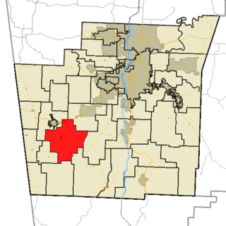
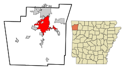
Fayetteville Township is one of thirty-seven townships in Washington County, Arkansas, USA. [1] The township had a population of 73,580 at the 2010 Census. The township contains the City of Fayetteville in its entirety, as the township and the city have identical boundaries.

A civil township is a widely used unit of local government in the United States that is subordinate to a county. The term town is used in New England, New York, and Wisconsin to refer to the equivalent of the civil township in these states. Specific responsibilities and the degree of autonomy vary based on each state. Civil townships are distinct from survey townships, but in states that have both, the boundaries often coincide and may completely geographically subdivide a county. The U.S. Census Bureau classifies civil townships as minor civil divisions. Currently, there are 20 states with civil townships.

Washington County, Arkansas County in the United States

Washington County is a county located in the northwest part of the U.S. state of Arkansas. As of the 2010 census, the population was 203,065, making it the third-most populous county in Arkansas. The county seat is Fayetteville. It is Arkansas's 17th county, formed on October 17, 1828, and named for George Washington, the first President of the United States. Washington County is part of the Fayetteville-Springdale-Rogers, AR-MO Metropolitan Statistical Area.

Arkansas State of the United States of America

Arkansas is a state in the southern region of the United States, home to over 3 million people as of 2018. Its name is of Siouan derivation from the language of the Osage denoting their related kin, the Quapaw Indians. The state's diverse geography ranges from the mountainous regions of the Ozark and the Ouachita Mountains, which make up the U.S. Interior Highlands, to the densely forested land in the south known as the Arkansas Timberlands, to the eastern lowlands along the Mississippi River and the Arkansas Delta.

Contents

Geography

According to the United States Census Bureau, Fayetteville Township covers an area of 44.5 square miles (115 km2), with 43.4 square miles (112 km2) land and the remaining 1.1 square miles (2.8 km2) water. [1] The boundaries of Fayetteville Township are identical to the City of Fayetteville, which has taken from its neighboring township many times. As a result of the expansion of Fayetteville, the boundaries have become gerrymandered and follow the major routes as they leave town.

United States Census Bureau Bureau of the United States responsible for the census and related statistics

The United States Census Bureau is a principal agency of the U.S. Federal Statistical System, responsible for producing data about the American people and economy. The Census Bureau is part of the U.S. Department of Commerce and its director is appointed by the President of the United States.

Gerrymandering manipulation of electoral borders to favor certain electoral outcomes, or an electoral district thus manipulated

Gerrymandering is a practice intended to establish a political advantage for a particular party or group by manipulating district boundaries. The resulting district is known as a gerrymander ; however, that word is also a verb for the process. The term gerrymandering has negative connotations. Two principal tactics are used in gerrymandering: "cracking" and "packing". A third tactic, shown in the top-left diagram in the graphic to the right, is homogenization of all districts.

Neighborhoods

Baldwin, Arkansas Unincorporated community in Arkansas, United States

Baldwin is a former unincorporated community in Fayetteville Township, Washington County, Arkansas, United States. It has since been annexed by Fayetteville. It is located in east Fayetteville along Huntsville Road near Lake Sequoyah toward Elkins.

Fayette Junction, Arkansas Unincorporated community in Arkansas, United States

Fayette Junction is an unincorporated community in Fayetteville Township, Washington County, Arkansas, United States. It is located in south Fayetteville near the intersection of Arkansas Highway 265 and the Burlington Railroad line.

McNair, Arkansas Unincorporated community in Arkansas, United States

McNair is an unincorporated community in Fayetteville Township, Washington County, Arkansas, United States. It is located within Fayetteville in the southwest part of town near Baum Stadium. McNair was primarily the location of the switching board off the main Frisco line to the Ozark and Cherokee Central branch which went to Tahlequah.

Evergreen Cemetery is located near the University of Arkansas in the central part of Fayetteville. Evergreen Cemetery Fayetteville, Arkansas.jpg
Evergreen Cemetery is located near the University of Arkansas in the central part of Fayetteville.

Cemeteries

The township contains eleven cemeteries:

Fayetteville Confederate Cemetery Confederate US Civil War cemetery in Arkansas

Fayetteville Confederate Cemetery is a cemetery for soldiers of the Confederate States of America located on the eastern side of Fayetteville in Washington County, Arkansas. Added to the National Register of Historic Places (NRHP) in 1993, the cemetery encompasses 3.5 acres (1.4 ha).

Evergreen Cemetery (Fayetteville, Arkansas) cemetery in Fayetteville, Arkansas

Evergreen Cemetery, located at William and University Streets in Fayetteville, Arkansas, is one of the largest early historic cemeteries in the region, with burials dating to 1838. Evergreen is included in the National Register of Historic Places for its age, and because numerous important historical figures are buried there. These include Senator J. William Fulbright, Governor Archibald Yell, educator Sophia Sawyer, industrialist Lafayette Gregg, and many others.

Fayetteville National Cemetery

Fayetteville National Cemetery is a United States National Cemetery located on the southern side of the city of Fayetteville in Washington County, Arkansas. It encompasses nearly 15 acres (6.1 ha). As of 2013, around 8000 veterans were interred in this location, with approximately 200 new burials per year.

  • Stearns Cemetery
  • Tharp Cemetery
  • Walker Cemetery
U.S. Route 71 is concurrent with Interstate 49 throughout Fayetteville Township, serving as the only freeway in the township. I-540 and US 71 run in Fayetteville.jpg
U.S. Route 71 is concurrent with Interstate 49 throughout Fayetteville Township, serving as the only freeway in the township.

Major routes

Arkansas Highway 112 highway in Arkansas

Highway 112 is a north–south state highway in Northwest Arkansas. The route of 25.84 miles (41.59 km) runs from Highway 265 north through Fayetteville, across Interstate 49/US 62/US 71 (I-49/US 62/US 71) to Highway 12 in Bentonville. The route serves the University of Arkansas, and thus a portion is named Razorback Road.

Highway 156 is a designation for three east–west state highways in Washington County. One segment of 0.30 miles (0.48 km) runs east from Oklahoma State Highway 100 to Highway 59 near Evansville. A second route of 4.21 miles (6.78 km) begins at Highway 265 near Hogeye and runs east to Highway 170 in West Fork. A third segment of 2.81 miles (4.52 km) begins in Fayetteville at US Highway 71 and runs east to Pump Station Rd.

Arkansas Highway 180 highway in Arkansas

Highway 180 is a state highway of 1.65 miles (2.66 km) in Fayetteville. The route begins at Interstate 49/US 62/US 71/Highway 16 and runs east through Fayetteville to US 71 Business. Highway 180 is designated as part of the Trail of Tears National Historic Trail as well as Arkansas Heritage Trails System designations as the Butterfield Trail, Trail of Tears, and Civil War Trails.

See also

Related Research Articles

Sevier County, Arkansas County in the United States

Sevier County is a county located in the U.S. state of Arkansas. As of the 2010 census, the population was 17,058. The county seat is De Queen. Sevier County is Arkansas's 16th county, formed on October 17, 1828, and named for Ambrose Sevier, U.S. Senator from Arkansas. It is an alcohol prohibition or dry county.

Saline County, Arkansas County in the United States

Saline County is a county located in the U.S. state of Arkansas. As of the 2010 census, the population was 107,118. at the 2010 census. Its county seat and largest city is Benton. Saline County was formed on November 2, 1835, and named for the salt water (brine) springs in the area, however, it is pronounced "suh-LEAN" instead of the typical pronunciation, "SAY-lean". Until November 2014, it was an alcohol prohibition or dry county.

Independence County, Arkansas County in the United States

Independence County is a county located in the U.S. state of Arkansas. As of the 2010 census, the population was 36,647. The county seat is Batesville. Independence County is Arkansas's ninth county, formed on October 20, 1820, from a portion of Lawrence County and named in commemoration of the Declaration of Independence. It is an alcohol prohibition or dry county.

Hempstead County, Arkansas County in the United States

Hempstead County is a county located in the U.S. state of Arkansas. As of the 2010 census, the population was 22,609. The county seat is Hope. Hempstead County is Arkansas's fourth county, formed on December 15, 1818, alongside Clark and Pulaski counties. The county is named for Edward Hempstead, a delegate to the U.S. Congress from the Missouri Territory, which included present-day Arkansas at the time. It is an alcohol prohibition or dry county.

Drew County, Arkansas County in the United States

Drew County is a county located in the southeast region of the U.S. state of Arkansas. As of the 2010 census, the population was 18,509, making it the thirty-ninth most populous of Arkansas's seventy-five counties. The county seat and largest city is Monticello. Drew County was formed on November 26, 1846, and named for Thomas Drew, the third governor of Arkansas.

Benton County, Arkansas County in the United States

Benton County is a county located in the U.S. state of Arkansas. As of the 2010 census, the population was 221,339, making it the second-most populous county in Arkansas. The county seat is Bentonville. The county was formed on September 30, 1836 and was named after Thomas Hart Benton, a U.S. Senator from Missouri. In 2012, Benton County voters elected to make the county wet, or a non-alcohol prohibition location.

Boston Township, Washington County, Arkansas Township in Arkansas, United States

Boston Township is one of thirty-seven townships in Washington County, Arkansas, USA. As of the 2010 census, its unincorporated population was 392.

Brush Creek Township, Washington County, Arkansas Township in Arkansas, United States

Brush Creek Township is one of thirty-seven townships in Washington County, Arkansas, USA. As of the 2010 census, its unincorporated population was 2,877.

Cane Hill Township, Washington County, Arkansas Township in Arkansas, United States

Cane Hill Township is one of thirty-seven townships in Washington County, Arkansas, USA. As of the 2010 census, its unincorporated population was 1,530.

Dutch Mills Township, Washington County, Arkansas Township in Arkansas, United States

Dutch Mills is one of thirty-seven townships in Washington County, Arkansas, USA. As of the 2000 census, its total population was 321.

Litteral Township, Washington County, Arkansas Township in Arkansas, United States

Litteral Township is one of thirty-seven townships in Washington County, Arkansas, USA. As of the 2000 census, its total population was 1,410.

Goshen Township, Washington County, Arkansas Township in Arkansas, United States

Goshen Township is one of thirty-seven townships in Washington County, Arkansas, USA. As of the 2000 census, its total population was 1,656. The township contains the Town of Goshen and some surrounding unincorporated areas.

Harmon Township, Washington County, Arkansas Township in Arkansas, United States

Harmon Township is one of thirty-seven townships in Washington County, Arkansas, USA. As of the 2000 census, its total population was 1,394.

Greenland Township, Washington County, Arkansas Township in Arkansas, United States

Greenland Township is one of thirty-seven townships in Washington County, Arkansas, USA. As of the 2000 census, its total population was 2,114.

Marrs Hill Township, Washington County, Arkansas Township in Arkansas, United States

Marrs Hill Township is one of thirty-seven townships in Washington County, Arkansas, USA. As of the 2000 census, its total population was 898.

Prairie Township, Washington County, Arkansas Township in Arkansas, United States

Prairie Township is one of 37 townships in Washington County, Arkansas, USA. As of the 2000 census, its total population was 3,526.

Rheas Mill Township, Washington County, Arkansas Township in Arkansas, United States

Rhea's Mill Township is one of thirty-seven townships in Washington County, Arkansas, USA. As of the 2000 census, its total population was 480.

North Harrison Township, Boone County, Arkansas Township in Arkansas, United States

North Harrison Township is one of twenty current townships in Boone County, Arkansas, USA. As of the 2010 census, its total population was 8,057.

South Harrison Township, Boone County, Arkansas Township in Arkansas, United States

South Harrison Township is one of twenty current townships in Boone County, Arkansas, USA. As of the 2010 census, its total population was 7,590.

References

  1. 1 2 "Township of Fayetteville, Washington County, Arkansas." U.S. Census Bureau. Breakdown. Retrieved July 18, 2010.