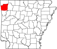
Washington County is a regional economic, educational, and cultural hub in the Northwest Arkansas region. Created as Arkansas's 17th county on November 30, 1848, Washington County has 13 incorporated municipalities, including Fayetteville, the county seat, and Springdale. The county is also the site of small towns, bedroom communities, and unincorporated places. The county is named for George Washington, the first President of the United States.

Prairie County is in the Central Arkansas region of the U.S. state of Arkansas. The county is named for the Grand Prairie, a subregion of the Arkansas Delta known for rice cultivation and aquaculture that runs through the county. Created as Arkansas's 54th county in 1846, Prairie County is home to four incorporated towns, including DeValls Bluff, the southern district county seat, and two incorporated cities, including Des Arc, the northern district county seat. The county is also the site of numerous unincorporated communities and ghost towns. Occupying 676 square miles (175,000 ha), Prairie County is the median-sized county in Arkansas. As of the 2020 Census, the county's population was 8,282. Based on population, the county is the ninth-smallest county of the 75 in Arkansas.

Lonoke County is a county located in the Central Arkansas region of the U.S. state of Arkansas. As of the 2020 census, the population was 74,015, making it the 10th-most populous of Arkansas's 75 counties. The county seat is Lonoke and largest city is Cabot. Included in the Central Arkansas metropolitan area, with Little Rock as the principal city, it is an alcohol prohibition or dry county.

Benton County is a county in the Northwest region of the U.S. state of Arkansas. Created as Arkansas' 35th county on September 30, 1836, Benton County contains thirteen incorporated municipalities, including Bentonville, the county seat, and Rogers, the most populous city. The county was named after Thomas Hart Benton, a U.S. Senator from Missouri influential in Arkansas statehood.

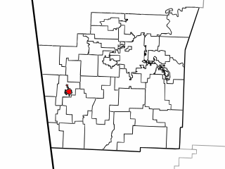
Farmington is a city in Washington County, Arkansas, United States. The community is nestled in a valley among the Boston Mountains, a subset of the Ozark Mountains. Although the first settlers came from the Deep South in 1828, the community did not incorporate until 1946. Located immediately west of Fayetteville in the Northwest Arkansas metropolitan statistical area, Farmington has been experiencing a population boom in recent years, as indicated by a 66% growth in population between the 2000 and 2010 censuses. It has been characterized as a bedroom community by the University of Arkansas Community Design Center.

Fayetteville is the second-most populous city in the U.S. state of Arkansas, the county seat of Washington County, and the most populous city in Northwest Arkansas. The city had a population of 93,949 as of the 2020 census, which was estimated to have increased to 101,680 by 2023. The city is on the outskirts of the Boston Mountains, deep within the Ozarks. It was named after Fayetteville, Tennessee, from which many settlers had come, and was incorporated on November 3, 1836. Fayetteville is included in the three-county Fayetteville–Springdale–Rogers metropolitan statistical area, with 576,403 residents in 2020.

Highway 180 is a state highway of 1.723 miles (2.773 km) in Fayetteville. The route begins at Interstate 49/US 62/US 71/Highway 16 and runs east through Fayetteville to School Avenue. Highway 180 is designated as part of the Trail of Tears National Historic Trail as well as Arkansas Heritage Trails System designations as the Butterfield Trail, Trail of Tears, and Civil War Trails.

Boston Township is one of 37 townships in Washington County, Arkansas, USA. As of the 2010 census, its unincorporated population was 392.
Cane Hill Township is one of 37 townships in Washington County, Arkansas, USA. As of the 2010 census, its unincorporated population was 1,530.

Center Township is one of 37 townships in Washington County, Arkansas, USA. At the 2010 census, its total population was 1,518.

Township of Cove Creek is one of 37 townships in Washington County, Arkansas, USA. As of the 2000 census, its total population was 683. Part of Devil's Den State Park is located in Cove Creek Township.

Township of Crawford is one of 37 townships in Washington County, Arkansas, United States. As of the 2000 census, its total population was 800.

The Township of Elm Springs is one of thirty-seven townships in Washington County, Arkansas, US. As of the 2000 census, its total population was 1,912.

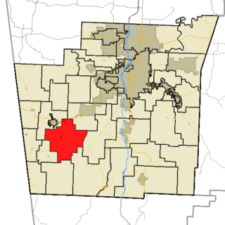
Fayetteville Township is one of thirty-seven townships in Washington County, Arkansas, USA. The township had a population of 73,580 at the 2010 Census. The township contains the City of Fayetteville in its entirety, as the township and the city have identical boundaries.

Goshen Township is one of thirty-seven townships in Washington County, Arkansas. As of the 2000 census, its total population was 1,656. The township contains the Town of Goshen and some surrounding unincorporated areas. Goshen Township was established in 1878.

Greenland Township is one of thirty-seven townships in Washington County, Arkansas, USA. As of the 2020 census, its total population was 1,213.
Lincoln Township is one of thirty-seven townships in Washington County, Arkansas, USA. As of the 2000 census, its total population was 1,752.

Morrow Township is one of thirty-seven townships in Washington County, Arkansas, USA.
Prairie Township is one of twenty-one current townships in Carroll County, Arkansas, USA. As of the 2010 census, its total population was 7,555.

Northwest Arkansas (NWA) is a metropolitan area and region in Arkansas within the Ozark Mountains. It includes four of the ten largest cities in the state: Fayetteville, Springdale, Rogers, and Bentonville, the surrounding towns of Benton and Washington counties, and adjacent rural Madison County, Arkansas. The United States Census Bureau-defined Fayetteville–Springdale–Rogers Metropolitan Statistical Area includes 3,213.01 square miles (8,321.7 km2) and 590,337 residents, ranking NWA as the 98th most-populous metropolitan statistical area in the U.S. and the 13th fastest growing in the United States.