Pearcy, Arkansas

Last updated

Pearcy, Arkansas
USA Arkansas location map.svg
Red pog.svg
Pearcy
Usa edcp location map.svg
Red pog.svg
Pearcy
Coordinates: 34°25′43″N93°17′24″W / 34.42861°N 93.29000°W / 34.42861; -93.29000
Country Flag of the United States (23px).png  United States
State Flag of Arkansas.svg  Arkansas
County Garland
Elevation
[1]
184 m (604 ft)
Population
 (2020)
  Total306
Time zone UTC-6 (Central (CST))
  Summer (DST) UTC-5 (CDT)
GNIS feature ID73029 [1]

Pearcy is an unincorporated community and census-designated place (CDP) in Garland County, Arkansas, United States. It was first listed as a CDP in the 2020 census with a population of 306. [2] [3]

Contents

In 2009 the rural community became noted as the site of the Pearcy murders, said to be a "robbery gone wrong." On November 12, 2009, 80-year-old Edward Gentry Sr., his 56-year-old son Edward Jr., Edward Jr.'s 52-year-old wife Pam, Pam and Edward Jr.'s 24-year-old son Jeremy, and Jeremy's 19-year-old girlfriend were burglarized and shot to death in Pearcy. The charred bodies of the last four victims were found together in Gentry Jr's mobile home, which had been burned to destroy evidence. Samuel Conway and Jeremy Pickney were charged with murdering the family and a third suspect, Marvin Stringer, was killed in a shootout when police sought to arrest the suspects. [4] The motive was said to be revenge for 24-year-old Jeremy Gentry's having stolen tires and rims from Conway's older brother. [5] Conway was convicted of capital murder and aggravated burglary, and sentenced to life in prison without parole; Pickney pleaded guilty to lesser charges and was sentenced to 50 years in prison.

On April 25, 2011, a tornado associated with the 2011 Super Outbreak hit the Pearcy area, destroying houses in nearby Sunshine. [6]

Bruce Cozart, Republican member of the Arkansas House of Representatives from District 24, is a Pearcy native and a developer in Hot Springs.

Demographics

Historical population
CensusPop.Note
2020 306
U.S. Decennial Census [7]
2020 [8]

2020 census

Pearcy CDP, Arkansas – Demographic Profile
(NH = Non-Hispanic)
Note: the US Census treats Hispanic/Latino as an ethnic category. This table excludes Latinos from the racial categories and assigns them to a separate category. Hispanics/Latinos may be of any race.
Race / EthnicityPop 2020 [8] % 2020
White alone (NH)25783.99%
Black or African American alone (NH)41.31%
Native American or Alaska Native alone (NH)51.63%
Asian alone (NH)10.33%
Pacific Islander alone (NH)00.00%
Some Other Race alone (NH)00.00%
Mixed Race/Multi-Racial (NH)289.15%
Hispanic or Latino (any race)113.59%
Total306100.00%

Education

It is in the Lake Hamilton School District. [9]

Related Research Articles

<span class="mw-page-title-main">Hot Springs Village, Arkansas</span> Census-designated place in Arkansas, United States

Hot Springs Village is a census-designated place (CDP) in Garland and Saline counties in the U.S. state of Arkansas. As it is situated in two counties, it is also part of two metropolitan statistical areas. The portion in Garland County is within the Hot Springs Metropolitan Statistical Area, while the portion extending into Saline County is part of the Little Rock–North Little Rock–Conway Metropolitan Statistical Area. The population was 12,807 at the 2010 census. It is the largest gated community in the United States.

<span class="mw-page-title-main">Lake Hamilton, Arkansas</span> Census-designated place in Arkansas, United States

Lake Hamilton is a census-designated place (CDP) in Garland County, Arkansas, United States. It is part of the Hot Springs Metropolitan Statistical Area. The population was 2,135 at the 2010 census. It is named after Lake Hamilton, one of the area's man-made lakes.

<span class="mw-page-title-main">Piney, Garland County, Arkansas</span> CDP in Arkansas, United States

Piney is a census-designated place (CDP) in Garland County, Arkansas, United States. The population was 4,699 at the 2010 census.

<span class="mw-page-title-main">Hensley, Arkansas</span> Census-designated place in Arkansas, United States

Hensley is a census-designated place (CDP) in Pulaski County, Arkansas, United States. The population was 139 at the 2010 census. It is part of the Little Rock–North Little Rock–Conway Metropolitan Statistical Area.

<span class="mw-page-title-main">Landmark, Arkansas</span> CDP in Arkansas, United States

Landmark is a census-designated place (CDP) in Pulaski County, Arkansas, United States. Per the 2020 census, the population was 3,585. It is part of the Little Rock–North Little Rock–Conway Metropolitan Statistical Area.

<span class="mw-page-title-main">Salem, Saline County, Arkansas</span> CDP in Arkansas, United States

Salem is a census-designated place (CDP) in Saline County, Arkansas, United States. Per the 2020 census, the population was 2,544. It is part of the Little Rock–North Little Rock–Conway Metropolitan Statistical Area.

<span class="mw-page-title-main">Pine Ridge, South Dakota</span> CDP in South Dakota, United States

Pine Ridge is a census-designated place (CDP) and the most populous community in Oglala Lakota County, South Dakota, United States. The population was 3,138 at the 2020 census. It is the tribal headquarters of the Oglala Sioux Tribe on the Pine Ridge Indian Reservation.

Magnet Cove is a census-designated place (CDP) and former town in Hot Spring County, Arkansas, United States. It is located in the Ouachita Mountains southeast of Hot Springs, on Arkansas Highway 51 north of U.S. Highway 270. As of the 2020 census, the town of Magnet Cove had a population of 692.

<span class="mw-page-title-main">Center Ridge, Arkansas</span> Census-designated place in Arkansas, United States

Center Ridge is an unincorporated census-designated place in Conway County, Arkansas, United States. Per the 2020 census, the population was 2,235.

<span class="mw-page-title-main">Roland, Arkansas</span> Census-designated place in Arkansas, United States

Roland is a census-designated place in Pulaski County, Arkansas, United States. It is part of the Central Arkansas metropolitan area. Per the 2020 census, the population was 820.

<span class="mw-page-title-main">Cherokee City, Arkansas</span> Census-designated place in Arkansas, United States

Cherokee City is an unincorporated census-designated place (CDP) in Benton County, Arkansas, United States. Per the 2020 census, the population was 73. It is the location of Coon Creek Bridge, which is located on Cty Rd. 24 and is listed on the National Register of Historic Places. The community was named for the Cherokee, since the Trail of Tears crossed the landscape when the Cherokee migrated west to Indian territory, now Oklahoma in the late 1830s. The town is within the Northwest Arkansas region, located about 5 miles east of Oklahoma and 4 miles south of the Missouri state line.
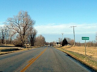
<span class="mw-page-title-main">Maysville, Arkansas</span> Census-designated place in Arkansas, United States

Maysville is an unincorporated community and census-designated place (CDP) in Benton County, Arkansas, United States. It is the westernmost settlement in the state of Arkansas. Per the 2020 census, the population was 117. It is located in the Northwest Arkansas region.

<span class="mw-page-title-main">New Blaine, Arkansas</span> Census-designated place in Arkansas, United States

New Blaine is an unincorporated community and census-designated place (CDP) in Logan County, Arkansas, United States. Per the 2020 census, the population was 173.

Oak Grove is an unincorporated community and census-designated place (CDP) in Moreland Township, Pope County, Arkansas, United States. It was first listed as a CDP in the 2020 census with a population of 177.

Springfield is an unincorporated community and census-designated place (CDP) located in the north central part of Arkansas in Conway County. It was first listed as a CDP in the 2020 census with a population of 223.

Crystal Springs is an unincorporated community and census-designated place (CDP) in Garland County, Arkansas, United States. It was first listed as a CDP in the 2020 census with a population of 129.

<span class="mw-page-title-main">Lost Bridge Village, Arkansas</span> Census-designated place in Arkansas, United States

Lost Bridge Village is a residential subdivision near the town of Garfield in Benton County, Arkansas, United States. Per the 2020 census, the population was 397. It is located in the Northwest Arkansas region.

Hattieville is an unincorporated community and census-designated place (CDP) in Conway County, Arkansas, United States. It was first listed as a CDP in the 2020 census with a population of 132. Hattieville is located on Arkansas Highway 213, 9.5 miles (15.3 km) north-northwest of Morrilton. Hattieville has a post office with ZIP code 72063.

Jerusalem is an unincorporated community and census-designated place (CDP) in Conway County, Arkansas, United States. It was first listed as a CDP in the 2020 census with a population of 137. Jerusalem is located on Arkansas Highway 124, 18 miles (29 km) north-northwest of Morrilton. Jerusalem has a post office with ZIP code 72080.

The Pearcy murders took place on November 11 or 12, 2009 in Pearcy, Arkansas, a small town in the center of the state right outside of Hot Springs. A total of four related people and the girlfriend of one victim were shot to death during two burglaries; four bodies were found in a mobile home belonging to victims Edward Gentry, Jr. and his wife Pam. The mobile home had been burned to destroy evidence. The fifth victim, Edward Gentry Sr., was found in another structure on the property. Jeremy Pickney, Marvin Stringer and Samuel Conway, all in their early twenties, were quickly identified as suspects due to their possessing stolen goods from the Gentry trailer. Stringer was killed during a shootout in a police raid when authorities attempted to arrest him at the Red Roof Inn on East Grand Ave.

References

  1. 1 2 U.S. Geological Survey Geographic Names Information System: Pearcy, Arkansas
  2. "Pearcy CDP, Arkansas". United States Census Bureau . Retrieved April 7, 2022.
  3. "Feature Detail Report for: Pearcy, Arkansas." USGS. U.S. Geological Survey Geographic Names Information System: Pearcy, Arkansas Retrieved April 29, 2011.
  4. CNN
  5. Lauer, Claudia. "State ties suspect to goods stolen from site of 5 killing". arkansasonline. Arkansas Online. Retrieved August 9, 2015.
  6. NOAA report
  7. "Decennial Census of Population and Housing by Decades". US Census Bureau.
  8. 1 2 "P2 HISPANIC OR LATINO, AND NOT HISPANIC OR LATINO BY RACE – 2020: DEC Redistricting Data (PL 94-171) – Pearcy CDP, Arkansas". United States Census Bureau .
  9. "SCHOOL DISTRICT REFERENCE MAP (2010 CENSUS): Garland County, AR" (PDF). U.S. Census Bureau . Retrieved March 3, 2021.