Fountain Lake, Arkansas

Last updated

Fountain Lake, Arkansas
Town of Fountain Lake
Garland County Arkansas Incorporated and Unincorporated areas Fountain Lake Highlighted 0524700.svg
Location in Garland County and Arkansas
Usa edcp relief location map.png
Red pog.svg
Fountain Lake
Location in the United States
Coordinates: 34°37′03″N92°55′21″W / 34.61750°N 92.92250°W / 34.61750; -92.92250
Country Flag of the United States.svg  United States
State Flag of Arkansas.svg  Arkansas
County Garland
Township Whittington
Incorporated July 13, 1999 (1999-07-13)
Named for Fountain Lake Resort
Government
  Type Mayor–Council
   Council Town Council
Area
[1]
  Total4.25 sq mi (11.01 km2)
  Land4.25 sq mi (11.01 km2)
  Water0.00 sq mi (0.00 km2)
Elevation
[2]
522 ft (159 m)
Population
 (2020)
  Total475
  Density111.79/sq mi (43.16/km2)
Time zone UTC-6 (Central (CST))
  Summer (DST) UTC-5 (CDT)
ZIP code
71901
Area code 501
FIPS code 05-24700
GNIS feature ID2406514 [2]
Highways
Major airport Clinton National Airport (LIT)
Website townoffountainlake.com OOjs UI icon edit-ltr-progressive.svg

Fountain Lake is a town in Garland County, Arkansas, United States. [3] Bordering Hot Springs Village, the town is part of the Hot Springs Metropolitan Statistical Area. The population was 503 at the 2010 census. [4]

Contents

Geography

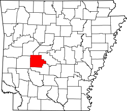
Fountain Lake is located in eastern Garland County. According to the United States Census Bureau, the town has a total area of 3.9 square miles (10.1 km2), all land. [4] The town is 12 miles (19 km) northeast of downtown Hot Springs and is bordered to the north by unincorporated Hot Springs Village.

The community is named for a former resort on the southern edge of the area. The location is directly off Highway 7, across from Fountain Lake Center (a strip mall), and can be identified by a large stucco entrance gate and a long tree-lined drive. The property contains remnants of a large home, barn, and other out-buildings. A small lake with an ornamental fountain are intact. The property is privately owned.

The Fountain Lake Center, historical Fountain Lake estate, and Fountain Lake School are not actually in the town limits of Fountain Lake. The town limits include approximately 3 miles (5 km) (and community roads attached) along Highway 5 and 2 miles (3 km) along Highway 128. All other associated property outside these limits is part of Garland County, not the town of Fountain Lake.

Demographics

Historical population
CensusPop.Note
2000 409
2010 50323.0%
2020 475−5.6%
U.S. Decennial Census [5]
2018 Estimate [6]

As of the census [7] of 2000, there were 409 people, 161 households, and 126 families residing in the town. The population density was 115.4 inhabitants per square mile (44.6/km2). There were 174 housing units at an average density of 49.1 per square mile (19.0/km2). The racial makeup of the town was 97.56% White, 0.24% Black or African American, 0.98% Native American, 0.73% from other races, and 0.49% from two or more races. 0.73% of the population were Hispanic or Latino of any race.

There were 161 households, out of which 32.3% had children under the age of 18 living with them, 59.0% were married couples living together, 13.7% had a female householder with no husband present, and 21.7% were non-families. 16.8% of all households were made up of individuals, and 4.3% had someone living alone who was 65 years of age or older. The average household size was 2.54 and the average family size was 2.85.

In the town, the population was spread out, with 23.2% under the age of 18, 8.1% from 18 to 24, 30.1% from 25 to 44, 26.7% from 45 to 64, and 12.0% who were 65 years of age or older. The median age was 38 years. For every 100 females, there were 101.5 males. For every 100 females age 18 and over, there were 97.5 males.

The median income for a household in the town was $30,469, and the median income for a family was $31,188. Males had a median income of $25,547 versus $11,731 for females. The per capita income for the town was $15,943. About 8.1% of families and 16.2% of the population were below the poverty line, including 23.5% of those under age 18 and none of those age 65 or over.

Education

Fountain Lake is home to the Fountain Lake School District, [8] which operates Fountain Lake High School. Their mascot is the Cobra, originally proposed by Buster Clemmons from the class of 1934. The Fountain Lake School District, as of 2013, offers six Advance Placement Courses, ten sports, and has over twenty clubs and organizations available for students. The Fountain Lake School District has multiple state titles. Among the state titles, The Fountain Lake Football Team won their first State Championship in 2009 against Prescott High School, the Senior High Women's Chorus, in 2013, received scores of superior (being a first for Fountain Lake) and excellent at State Choir Competition, and had various students receive state awards for outstanding performance. The Fountain Lake School District has hosted nineteen yearly musicals, as of 2012, in the auditorium, and has two tornado shelters, built in 2012, that hosts various community events.

Related Research Articles

<span class="mw-page-title-main">Saline County, Arkansas</span> County in Arkansas, United States

Saline County is located in the U.S. state of Arkansas. As of the 2020 census, the population was 123,416. Its county seat and largest city is Benton. Saline County was formed on November 2, 1835, and named for the salt water (brine) springs in the area, despite a differing pronunciation from saline. Until November 2014, it was an alcohol prohibition or dry county.

<span class="mw-page-title-main">Hot Spring County, Arkansas</span> County in Arkansas, United States

Hot Spring County is located in the U.S. state of Arkansas. As of the 2020 census, the population was 33,040. The county seat is Malvern. Established on November 2, 1829, in the Arkansas Territory from a part of Clark County; it was named after the hot springs at Hot Springs, Arkansas, which were formerly in the county.

<span class="mw-page-title-main">Garland County, Arkansas</span> County in Arkansas, United States

Garland County is located in the U.S. state of Arkansas. As of the 2020 census, the population was 100,180. The county seat is Hot Springs.

<span class="mw-page-title-main">Fulton County, Arkansas</span> County in Arkansas, United States

Fulton County is a county located in the U.S. state of Arkansas. As of the 2020 census, the population was 12,075. The county seat is Salem. Fulton County was formed on December 21, 1842, and named for William Fulton, the last governor of the Arkansas Territory. It is an alcohol prohibition or dry county.

<span class="mw-page-title-main">Gateway, Arkansas</span> Town in Arkansas, United States

Gateway is a town in Benton County, Arkansas, United States. The population was 436 at the 2020 census, up from 405 in 2010. It is part of the Northwest Arkansas region. The town's name reflects its situation as the "gateway" to and from Arkansas.

<span class="mw-page-title-main">Beaver, Arkansas</span> Town in Arkansas, United States

Beaver is a town in Carroll County, Arkansas, United States. As of the 2020 census it had a population of 67. The community is located on the White River at the western limits of Table Rock Lake deep in the Ozark Mountains. Located north of Eureka Springs, the small town has been featured in movies for its picturesque scenery. The town is known for the Beaver Bridge, a two-panel suspension bridge over the White River listed on the National Register of Historic Places.

<span class="mw-page-title-main">Caddo Valley, Arkansas</span> Town in Arkansas, United States

Caddo Valley is a town in Clark County, Arkansas, United States. The population was 635 at the 2010 census.

<span class="mw-page-title-main">Heber Springs, Arkansas</span> City in Arkansas, United States

Heber Springs is a city in and the county seat of Cleburne County, Arkansas, United States. The population was 7,165 at the 2010 census.

<span class="mw-page-title-main">Lake City, Arkansas</span> City in Arkansas, United States

Lake City is a city in Craighead County, Arkansas, United States, along the St. Francis River. Lake City is one of two county seats in Craighead County. The population was 2,326 as of the 2020 census. It is included in the Jonesboro, Arkansas Metropolitan Statistical Area.

<span class="mw-page-title-main">Salem, Fulton County, Arkansas</span> City in Arkansas, United States

Salem is the county seat of Fulton County, Arkansas, United States. Salem was first incorporated in 1900. As of the 2010 census the population stood at 1,635.

<span class="mw-page-title-main">Hot Springs Village, Arkansas</span> Census-designated place in Arkansas, United States

Hot Springs Village is a census-designated place (CDP) in Garland and Saline counties in the U.S. state of Arkansas. As it is situated in two counties, it is also part of two metropolitan statistical areas. The portion in Garland County is within the Hot Springs Metropolitan Statistical Area, while the portion extending into Saline County is part of the Little Rock–North Little Rock–Conway Metropolitan Statistical Area. The population was 12,807 at the 2010 census. It is the largest gated community in the United States.

<span class="mw-page-title-main">Lake Hamilton, Arkansas</span> Census-designated place in Arkansas, United States

Lake Hamilton is a census-designated place (CDP) in Garland County, Arkansas, United States. It is part of the Hot Springs Metropolitan Statistical Area. The population was 2,135 at the 2010 census. It is named after Lake Hamilton, one of the area's man-made lakes.

<span class="mw-page-title-main">Lonsdale, Arkansas</span> Town in Arkansas, United States

Lonsdale is a town in Garland County, Arkansas, United States. It is part of the Hot Springs Metropolitan Statistical Area. The population was 103 at the 2020 census.

<span class="mw-page-title-main">Mountain Pine, Arkansas</span> City in Arkansas, United States

Mountain Pine is a city in Garland County, Arkansas, United States. It is part of the Hot Springs Metropolitan Statistical Area. The population was 770 at the 2010 United States Census. It is located immediately southeast of Lake Ouachita below the Blakely Mountain Dam. The city consists of five defined neighborhoods, Pinewood (north), South Mountain Pine, a business district, Cozy Acres (southwest) and Mountain View/Timberland area.

<span class="mw-page-title-main">Donaldson, Arkansas</span> Town in Arkansas, United States

Donaldson is a town in Hot Spring County, Arkansas, United States. The population was 301 at the 2010 census.

<span class="mw-page-title-main">Friendship, Arkansas</span> Town in Arkansas, United States

Friendship is a town in Hot Spring County, Arkansas, United States. The population was 176 at the 2010 census, down from 206 at the 2000 census.

<span class="mw-page-title-main">Stamps, Arkansas</span> City in Arkansas, United States

Stamps is a city in Lafayette County, Arkansas, United States. The population was 1,693 at the 2010 census, down from 2,131 at the 2000 census.

<span class="mw-page-title-main">Garland, Arkansas</span> Town in Arkansas, United States

Garland, also known as Garland City, is a town in Miller County, Arkansas, United States. It is part of the Texarkana, Texas - Texarkana, Arkansas Metropolitan Statistical Area. The population was 195 at the 2020 census, down from 242 in 2010.

<span class="mw-page-title-main">Norman, Arkansas</span> Town in Arkansas, United States

Norman is a town in Montgomery County, Arkansas, United States. It was known as Womble until 1925. The population was 303 at the 2020 census, down from 378 in 2010.

<span class="mw-page-title-main">Bryant, Arkansas</span> City in Arkansas, United States

Bryant is a city in Saline County, Arkansas, United States and a suburb of Little Rock. According to the 2010 Census, the population of the city was 16,688. It is part of the Central Arkansas region.

References

  1. "2020 U.S. Gazetteer Files". United States Census Bureau. Retrieved October 29, 2021.
  2. 1 2 U.S. Geological Survey Geographic Names Information System: Fountain Lake, Arkansas
  3. "The Town of Fountain Lake, Arkansas" . Retrieved November 23, 2023.
  4. 1 2 "Geographic Identifiers: 2010 Demographic Profile Data (G001): Fountain Lake town, Arkansas". U.S. Census Bureau, American Factfinder. Retrieved November 10, 2016.[ dead link ]
  5. "Census of Population and Housing". Census.gov. Retrieved June 4, 2015.
  6. "Population Estimates". United States Census Bureau . Retrieved June 8, 2018.
  7. "U.S. Census website". United States Census Bureau . Retrieved January 31, 2008.
  8. "2020 CENSUS - SCHOOL DISTRICT REFERENCE MAP: Garland County, AR" (PDF). U.S. Census Bureau . Retrieved September 13, 2022. - 2010 map