Rye, Arkansas

Last updated

Rye, Arkansas
Cleveland County Arkansas Incorporated and Unincorporated areas Rye Highlighted 0561730.svg
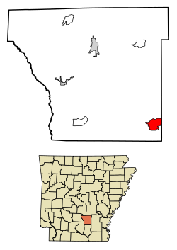
Location of Rye in Cleveland County, Arkansas.
USA Arkansas location map.svg
Red pog.svg
Rye
Coordinates: 33°44′46″N91°59′52″W / 33.74611°N 91.99778°W / 33.74611; -91.99778
Country United States
State Arkansas
County Cleveland
Area
[1]
  Total4.37 sq mi (11.31 km2)
  Land4.37 sq mi (11.31 km2)
  Water0.00 sq mi (0.00 km2)
Elevation
187 ft (57 m)
Population
 (2020)
  Total123
  Density28.18/sq mi (10.88/km2)
Time zone UTC-6 (Central (CST))
  Summer (DST) UTC-5 (CDT)
Area code 870
GNIS feature ID57175 [2]

Rye is a census-designated place in Cleveland County, Arkansas, United States. Per the 2020 census, the population was 123. [3]

Contents

Demographics

Historical population
CensusPop.Note
2010 146
2020 123−15.8%
U.S. Decennial Census [4]
2010 [5] 2020 [6]

2020 census

Rye CDP, Arkansas – Demographic Profile
(NH = Non-Hispanic)
Note: the US Census treats Hispanic/Latino as an ethnic category. This table excludes Latinos from the racial categories and assigns them to a separate category. Hispanics/Latinos may be of any race.
Race / EthnicityPop 2010 [5] Pop 2020 [6] % 2010% 2020
White alone (NH)13411791.78%95.12%
Black or African American alone (NH)000.00%0.00%
Native American or Alaska Native alone (NH)000.00%0.00%
Asian alone (NH)000.00%0.00%
Pacific Islander alone (NH)000.00%0.00%
Some Other Race alone (NH)010.00%0.81%
Mixed Race/Multi-Racial (NH)221.37%1.63%
Hispanic or Latino (any race)1036.85%2.44%
Total146123100.00%100.00%

Education

Public education for elementary and secondary students is available from the Woodlawn School District, which leads to graduation from Woodlawn High School.

Related Research Articles

<span class="mw-page-title-main">Woodlawn, Prince George's County, Maryland</span> Census-designated place in Maryland

Woodlawn is an unincorporated area and census-designated place (CDP) in Prince George's County, Maryland, United States. As of the 2020 census it had a population of 7,541.

<span class="mw-page-title-main">Kirby, Arkansas</span> Census-designated place in Arkansas, United States

Kirby is an unincorporated census-designated place in northern Pike County, Arkansas, United States. The community lies on U.S. Route 70; it is located halfway between Daisy and Glenwood. Per the 2020 census, the population was 721.

Genoa is an unincorporated community and census-designated place (CDP) in Miller County, Arkansas, United States. It was first listed as a CDP in the 2020 census with a population of 972. It is located 6 to 12 miles east of Texarkana along Highway 196. Although unincorporated, Genoa has a post office, with the ZIP code of 71840 for a specific post office box. Most of the community is served by ZIP code 71854 (Texarkana). Genoa also has its own school district, Genoa Central School District.

<span class="mw-page-title-main">Center Ridge, Arkansas</span> Census-designated place in Arkansas, United States

Center Ridge is an unincorporated census-designated place in Conway County, Arkansas, United States. Per the 2020 census, the population was 2,235.

Midway is an unincorporated community in southern Santa Rosa County, Florida, United States. It is part of the Pensacola–Ferry Pass–Brent Metropolitan Statistical Area. The area is located between the communities of Gulf Breeze and Navarre, on the Fairpoint Peninsula. Midway is often considered to be part of one, if not both, of these communities. Its actual boundaries vary from source to source, but unofficially include most areas from the intersection of Soundside Drive with U.S. Highway 98, eastward until Highway 98 becomes Navarre Parkway.

<span class="mw-page-title-main">Roland, Arkansas</span> Census-designated place in Arkansas, United States

Roland is a census-designated place in Pulaski County, Arkansas, United States. It is part of the Central Arkansas metropolitan area. Per the 2020 census, the population was 820.

<span class="mw-page-title-main">Cherokee City, Arkansas</span> Census-designated place in Arkansas, United States

Cherokee City is an unincorporated census-designated place (CDP) in Benton County, Arkansas, United States. Per the 2020 census, the population was 73. It is the location of Coon Creek Bridge, which is located on Cty Rd. 24 and is listed on the National Register of Historic Places. The community was named for the Cherokee, since the Trail of Tears crossed the landscape when the Cherokee migrated west to Indian territory, now Oklahoma in the late 1830s. The town is within the Northwest Arkansas region, located about 5 miles east of Oklahoma and 4 miles south of the Missouri state line.

<span class="mw-page-title-main">Maysville, Arkansas</span> Census-designated place in Arkansas, United States

Maysville is an unincorporated community and census-designated place (CDP) in Benton County, Arkansas, United States. It is the westernmost settlement in the state of Arkansas. Per the 2020 census, the population was 117. It is located in the Northwest Arkansas region.

Midway is a census-designated place in Baxter County, Arkansas, United States. Midway is 5.5 miles (8.9 km) northwest of Mountain Home. Per the 2020 census, the population was 1,036. Midway has a post office with ZIP code 72651.

<span class="mw-page-title-main">Kingston, Arkansas</span> Census-designated place in Arkansas, United States

Kingston is an unincorporated community and census-designated place (CDP) in northeast Madison County, Arkansas, United States. It was first listed as a CDP in the 2020 census with a population of 97.

<span class="mw-page-title-main">Pencil Bluff, Arkansas</span> Census-designated place in Arkansas, United States

Pencil Bluff is an unincorporated community and census-designated place (CDP) in Montgomery County, Arkansas, United States. Pencil Bluff is located at the junction of U.S. Route 270 and Arkansas Highway 88, 7.5 miles (12.1 km) northwest of Mount Ida. It was first listed as a CDP in the 2020 census with a population of 72.

<span class="mw-page-title-main">Avilla, Arkansas</span> Census-designated place in Arkansas, United States

Avilla is a census-designated place in Saline County, Arkansas, United States. Per the 2020 census, the population was 1,325.

<span class="mw-page-title-main">Hagarville, Arkansas</span> Census-designated place in Arkansas, United States

Hagarville is a census-designated place in Johnson County, Arkansas, United States. Per the 2020 census, the population was 142.

<span class="mw-page-title-main">Lost Bridge Village, Arkansas</span> Census-designated place in Arkansas, United States

Lost Bridge Village is a census-designated place in Benton County, Arkansas, United States. Per the 2020 census, the population was 397. It is located in the Northwest Arkansas region.

<span class="mw-page-title-main">Staves, Arkansas</span> Census-designated place in Arkansas, United States

Staves is a census-designated place in Cleveland County, Arkansas, United States. Per the 2020 census, the population was 133.

<span class="mw-page-title-main">Tumbling Shoals, Arkansas</span> Census-designated place in Arkansas, United States

Tumbling Shoals is a census-designated place in Cleburne County, Arkansas, United States. Per the 2020 census, the population was 902.

Woodlawn is a census-designated place in Cleveland County, Arkansas, United States. Per the 2020 census, the population was 174.

Wesley is an unincorporated community and census-designated place (CDP) in western Madison County, Arkansas, United States. Wesley is located at the junction of Arkansas highways 74 and 295, 13 miles (21 km) by road west-southwest of Huntsville. Wesley has a post office with ZIP code 72773. It was first listed as a CDP in the 2020 census with a population of 161.

Oakland is an unincorporated community and census-designated place (CDP) in northeastern Marion County, Arkansas, United States. Oakland, located on Arkansas Highway 202, is 20 miles (32 km) by road northwest of Mountain Home. Oakland has a post office with ZIP code 72661. The Oakland Campground on Bull Shoals Lake lies about three miles to the west at the end of Route 202. It was first listed as a CDP in the 2020 census, with a population of 72.

Monroe is an unincorporated community and census-designated place (CDP) in Monroe County, Arkansas, United States. The unincorporated community extends beyond the CDP slightly into Lee County. It was first listed as a CDP in the 2020 census with a population of 51.

References

  1. "2020 U.S. Gazetteer Files". United States Census Bureau. Retrieved October 29, 2021.
  2. U.S. Geological Survey Geographic Names Information System: Rye, Arkansas
  3. "Rye CDP, Arkansas". United States Census Bureau . Retrieved April 15, 2022.
  4. "Decennial Census of Population and Housing by Decades". US Census Bureau.
  5. 1 2 "P2 HISPANIC OR LATINO, AND NOT HISPANIC OR LATINO BY RACE – 2010: DEC Redistricting Data (PL 94-171) – Rye CDP, Arkansas". United States Census Bureau .
  6. 1 2 "P2 HISPANIC OR LATINO, AND NOT HISPANIC OR LATINO BY RACE – 2020: DEC Redistricting Data (PL 94-171) – Rye CDP, Arkansas". United States Census Bureau .