East Dunseith, North Dakota

Last updated

East Dunseith, North Dakota
CDP
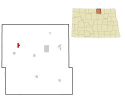
ND Rolette County East Dunseith.svg
Location of East Dunseith, North Dakota
Coordinates: 48°51′17″N100°01′42″W / 48.85472°N 100.02833°W / 48.85472; -100.02833
CountryUnited States
State North Dakota
County Rolette
Area
[1]
  Total5.21 sq mi (13.48 km2)
  Land5.13 sq mi (13.28 km2)
  Water0.08 sq mi (0.20 km2)
Elevation
[2]
2,064 ft (629 m)
Population
 (2020)
  Total500
  Density97.54/sq mi (37.66/km2)
Time zone UTC-6 (Central (CST))
  Summer (DST) UTC-5 (CDT)
Area code 701
FIPS code 38-21520 [3]
GNIS feature ID2392984 [2]

East Dunseith is a census-designated place (CDP) in Rolette County, North Dakota, United States. The population was 500 at the 2020 census. [4]

Contents

Geography

According to the United States Census Bureau, the CDP has a total area of 5.2 square miles (13 km2), of which 5.1 square miles (13 km2) is land and 0.1 square miles (0.26 km2) (1.52%) is water.

Demographics

Historical population
CensusPop.Note
1990 260
2000 219−15.8%
2010 500128.3%
2020 5000.0%
U.S. Decennial Census [5]
2020 Census [4]

As of the census [3] of 2000, there were 219 people, 59 households, and 50 families residing in the CDP. The population density was 181.7 inhabitants per square mile (70.2/km2). There were 60 housing units at an average density of 49.8/sq mi (19.3/km2). The racial makeup of the CDP was 3.20% White and 96.80% Native American. Hispanic or Latino of any race were 1.37% of the population.

There were 59 households, out of which 67.8% had children under the age of 18 living with them, 23.7% were married couples living together, 55.9% had a female householder with no husband present, and 13.6% were non-families. 10.2% of all households were made up of individuals, and 1.7% had someone living alone who was 65 years of age or older. The average household size was 3.71 and the average family size was 3.80.

In the CDP, the population was spread out, with 53.0% under the age of 18, 9.1% from 18 to 24, 27.9% from 25 to 44, 8.7% from 45 to 64, and 1.4% who were 65 years of age or older. The median age was 16 years. For every 100 females, there were 85.6 males. For every 100 females age 18 and over, there were 60.9 males.

The median income for a household in the CDP was $8,667, and the median income for a family was $7,083. Males had a median income of $21,250 versus $13,750 for females. The per capita income for the CDP was $3,026. About 85.7% of families and 86.6% of the population were below the poverty line, including 93.6% of those under the age of 18 and 100.0% of those 65 or over.

Related Research Articles

<span class="mw-page-title-main">Dunseith, North Dakota</span> City in North Dakota, United States

Dunseith is a city in Rolette County, North Dakota, United States. The population was 632 at the 2020 census. Dunseith is best known for its proximity to the International Peace Garden. The port of entry at the Peace Garden is one of three 24-hour ports in North Dakota. Dunseith is also the home of the world's largest turtle sculpture, the "W'eel Turtle", made of more than 2,000 wheels painted green.

<span class="mw-page-title-main">Aurora Center, South Dakota</span> CDP in South Dakota, United States

Aurora Center is a census-designated place (CDP) in Aurora County, South Dakota, United States. The population was 22 at the 2020 census.

<span class="mw-page-title-main">Storla, South Dakota</span> CDP in South Dakota, United States

Storla is a census-designated place (CDP) in Aurora County, South Dakota, United States. The population was 6 in the 2020 census.

<span class="mw-page-title-main">Loomis, South Dakota</span> CDP in South Dakota, United States

Loomis is a census-designated place (CDP) in Davison County, South Dakota, United States. The population was 33 at the 2020 census. It is part of the Mitchell, South Dakota Micropolitan Statistical Area.

<span class="mw-page-title-main">North Eagle Butte, South Dakota</span> Census-designated place in South Dakota, United States

North Eagle Butte is a census-designated place (CDP) in Dewey County, South Dakota, United States, along the 45th parallel. The population was 1,879 at the 2020 census.

<span class="mw-page-title-main">Whitehorse, South Dakota</span> CDP in South Dakota, United States

Whitehorse is a census-designated place (CDP) in Dewey County, South Dakota, United States. The population was 106 at the 2020 census.

<span class="mw-page-title-main">Kaylor, South Dakota</span> CDP in South Dakota, United States

Kaylor is a census-designated place (CDP) in Hutchinson County, South Dakota, United States. The population was 30 at the 2020 census.

<span class="mw-page-title-main">Milltown, South Dakota</span> CDP in South Dakota, United States

Milltown is a census-designated place (CDP) in Hutchinson County, South Dakota, United States. The population was 8 at the 2020 census.

<span class="mw-page-title-main">Ashland Heights, South Dakota</span> CDP in South Dakota, United States

Ashland Heights is a census-designated place (CDP) and unincorporated community in Pennington County, South Dakota, United States. The population was 678 at the 2020 census.

<span class="mw-page-title-main">Colonial Pine Hills, South Dakota</span> CDP in South Dakota, United States

Colonial Pine Hills is a census-designated place (CDP) and unincorporated community in Pennington County, South Dakota, United States. The population was 1,903 at the 2020 census.

<span class="mw-page-title-main">Green Valley, South Dakota</span> CDP in South Dakota, United States

Green Valley is a census-designated place (CDP) and unincorporated community in Pennington County, South Dakota, United States. The population was 1,051 at the 2020 census.

<span class="mw-page-title-main">Rapid Valley, South Dakota</span> CDP in South Dakota, United States

Rapid Valley is a census-designated place (CDP) and unincorporated community in Pennington County, South Dakota, United States, and a suburb of Rapid City. The population was 8,098 at the 2020 census. Rapid Valley has been a retreat for people living in Rapid City due to its low crime, cheap land, and views of the Black Hills. Rapid Valley is home to many industrial and financial businesses, and is the headquarters for many corporations specializing in transport and engineering.
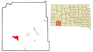
<span class="mw-page-title-main">Oglala, South Dakota</span> CDP in South Dakota, United States

Oglala is a census-designated place (CDP) in West Oglala Lakota Unorganized Territory equivalent, Oglala Lakota County, South Dakota, United States. The population was 1,282 at the 2020 census. Its location is in the northwest of the Pine Ridge Indian Reservation.
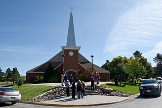
<span class="mw-page-title-main">Pine Ridge, South Dakota</span> CDP in South Dakota, United States

Pine Ridge is a census-designated place (CDP) and the most populous community in Oglala Lakota County, South Dakota, United States. The population was 3,138 at the 2020 census. It is the tribal headquarters of the Oglala Sioux Tribe on the Pine Ridge Indian Reservation.

<span class="mw-page-title-main">Antelope, South Dakota</span> CDP in South Dakota, United States

Antelope is a census-designated place (CDP) in Todd County, South Dakota, United States. The population was 830 at the 2020 census.

<span class="mw-page-title-main">Parmelee, South Dakota</span> CDP in South Dakota, United States

Parmelee also Wósoso is a census-designated place (CDP) in Todd County, South Dakota, United States, which lies within the Rosebud Indian Reservation. The population was 606 at the 2020 census.
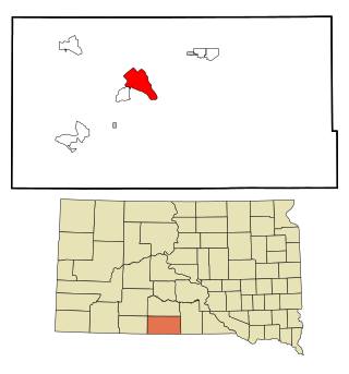
<span class="mw-page-title-main">Rosebud, South Dakota</span> CDP in South Dakota, United States

Rosebud also Sicanġu is a census-designated place (CDP) in Todd County, South Dakota, United States. The population was 1,455 at the 2020 census.

<span class="mw-page-title-main">Two Strike, South Dakota</span> CDP in South Dakota, United States

Two Strike is a census-designated place (CDP) in Todd County, South Dakota, United States, named after Brulé, Lakota chief Two Strike who lived at that location for a period of time. The population was 282 at the 2020 census.

<span class="mw-page-title-main">White Horse, South Dakota</span> CDP in South Dakota, United States

White Horse also Šuŋgská oyáŋke is a census-designated place (CDP) in Todd County, South Dakota, United States. The population was 234 at the 2020 census.

<span class="mw-page-title-main">Hamill, South Dakota</span> CDP in South Dakota, United States

Hamill is a rural hamlet in Tripp County, South Dakota, United States. The population was 14 at the 2020 census. There is a post office at Hamill, also two churches and a community hall; otherwise, no businesses or services.
References

  1. "ArcGIS REST Services Directory". United States Census Bureau. Retrieved September 20, 2022.
  2. 1 2 U.S. Geological Survey Geographic Names Information System: East Dunseith, North Dakota
  3. 1 2 "U.S. Census website". United States Census Bureau . Retrieved January 31, 2008.
  4. 1 2 "Explore Census Data". Explore Census Data. United States Census Bureau . Retrieved May 24, 2022.
  5. United States Census Bureau. "Census of Population and Housing" . Retrieved January 19, 2014.

See also