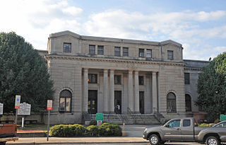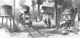
Scotland County is a county located in the southern part of the U.S. state of North Carolina. Its county seat is and largest community is Laurinburg. The county was formed in 1899 from part of Richmond County and named in honor of the Scottish settlers who occupied the area in the 1700s. As of the 2020 census, its population was 34,174.

Robeson County is a county in the southern part of the U.S. state of North Carolina and is its largest county by land area. Its county seat and largest community is Lumberton. The county was formed in 1787 from part of Bladen County and named in honor of Thomas Robeson, a colonel who had led Patriot forces in the area during the Revolutionary War. As of the 2020 census, the county's population was 116,530. It is a majority-minority county; its residents are approximately 38 percent Native American, 22 percent white, 22 percent black, and 10 percent Hispanic. It is included in the Fayetteville-Lumberton-Pinehurst, NC Combined Statistical Area. The state-recognized Lumbee Tribe of North Carolina is headquartered in Pembroke.

Richmond County is a county located on the central southern border of the U.S. state of North Carolina. Its county seat is Rockingham. The county was formed in 1779 from a portion of Anson County and named in honor of Charles Lennox, 3rd Duke of Richmond and Lennox. As of the 2020 census, the population was 42,946.

Hoke County is a county in the U.S. state of North Carolina. As of the 2020 census, its population was 52,082. Its county seat is Raeford.

Alleghany County is a county located in the U.S. state of North Carolina. As of the 2020 census, the population was 10,888. Its county seat is Sparta.

Centerville is a census-designated place (CDP) in the rural northeastern corner of Franklin County, North Carolina, United States. The population was 149 at the 2020 census. It was an incorporated town from 1965 to 2017.

East Laurinburg is an unincorporated community in Scotland County, North Carolina, United States. The population was 345 at the 2020 census. The town was incorporated in 1903 but, due to financial improprieties and failing finances, the town's charter was revoked by the state effective June 30, 2022, in which the area became an unincorporated part of Scotland County.

Laurinburg is a city in and the county seat of Scotland County, North Carolina, United States. Located in southern North Carolina near the South Carolina border, Laurinburg is southwest of Fayetteville and is home to St. Andrews University. The population at the 2010 Census was 15,962 people.

St. Andrews University is a private Presbyterian university in Laurinburg, North Carolina. It was established in 1958 as a result of a merger of Flora MacDonald College in Red Springs and Presbyterian Junior College; it was named St. Andrews Presbyterian College from 1960 until 2011 when the college changed its name to St. Andrews University. That same year, it merged with Webber International University of Babson Park, Florida. It is also home to the St. Andrews Press. In 2013, St. Andrews added its first graduate program, an MBA in business administration.

North Carolina Highway 144 (NC 144) is a primary state highway in the U.S. state of North Carolina. It runs from Laurel Hill to Wagram, in the North Carolina Sandhills.
Ladonia is an unincorporated community located in the Franklin Township of northwest Surry County, North Carolina, United States. The community generally lies on the Fisher River and is centered on the intersection of Blevins Store Road and Ladonia Church Road. Area landmarks include Ladonia Baptist Church, M & M Signs and Awnings, and the nearby Raven Knob Scout Reservation.

Bahama is an unincorporated community in northern Durham County, North Carolina, United States.
The Laurinburg Exchange is a newspaper based in Laurinburg, North Carolina covering Laurinburg and Scotland County. It was established in 1882 as a weekly publication. The newspaper is currently published Tuesday through Saturday.

Laurel Hill Presbyterian Church is a historic Presbyterian church near Laurinburg, Scotland County, North Carolina. The congregation was founded in 1797, and the current meeting house was completed in early 1856. It is a two-story, gable front Greek Revival style frame building. The land on which the church stands was donated by planter and politician Duncan McFarland. The current building was constructed between 1853 and 1856 by black freedman Jackson Graham under contract. The church was used for a short period by Union General William Tecumseh Sherman as his headquarters in March 1865 prior to the Battle of Bentonville. It is the oldest church building in Scotland County.

North Carolina Highway 79 (NC 79) is an 8.7-mile-long (14.0 km) primary state highway in the U.S. state of North Carolina. NC 79 runs from the South Carolina border as a continuation of South Carolina Highway 79 at Gibson to U.S. Route 15 (US 15), US 401, US 501, and US 74 Business in Laurinburg. While signed north–south, NC 79 physically travels in an east–west direction between its termini. NC 79 is primarily a two-lane road running through rural Scotland County and residential areas west of Laurinburg. Combined with SC 79, the highways form a coherent route between SC 9 northwest of Bennettsville, South Carolina and Laurinburg.

E. Hervey Evans House is a historic home located at Laurinburg, Scotland County, North Carolina. It was designed by architect John A. Weaver with initial plans presented to his clients on June 2, 1939. Weaver was employed in the Architectural Department of Macy's Department Store and listed his office as 1328 Broadway, NYC. Hervey Evans was an executive of various enterprises owned by his grandfather, John F. McNair. Evans was instrumental in selecting Weaver to design the Arts and Crafts style McNair's Department Store in 1938.

Edwin Maurice Gill was an American politician, lawyer, and public finance official who served as North Carolina State Treasurer from 1953 to 1977.

Moss Neck is a community in Robeson County, North Carolina, United States.
Pates is a community in Robeson County, North Carolina, United States.


