
Lenoir County is a county in the U.S. state of North Carolina. As of the 2020 census, its population was 55,122. Its county seat is Kinston, located on the Neuse River, across which the county has its territory.

Mountain View is a census-designated place (CDP) in Catawba County, North Carolina, United States. The population was 3,552 at the 2010 census. It is part of the Hickory–Lenoir–Morganton Metropolitan Statistical Area.

Kenansville is a town in Duplin County, North Carolina, United States. Its population was 855 at the 2010 census. It is the county seat of Duplin County. The town was named for James Kenan, a member of the North Carolina Senate, whose family home Liberty Hall Plantation is in Kenansville.

Ashley Heights is an unincorporated community and census-designated place (CDP) in Hoke County, North Carolina, United States. The population was 380 at the 2010 census.

Kinston is a city in Lenoir County, North Carolina, United States, with a population of 19,900 as of the 2020 census. It has been the county seat of Lenoir County since its formation in 1791. Kinston is located in the coastal plains region of eastern North Carolina.

La Grange is a town in Lenoir County, North Carolina, United States. The population was 2,873 based on the 2010 census. La Grange is located in North Carolina's Inner Banks region.

Lowesville is a census-designated place (CDP) in Lincoln County, North Carolina, United States. The population was 2,945 at the 2010 census, up from 1,440 in 2000.

Mountville is an unincorporated community and census-designated place (CDP) in Laurens County, South Carolina, United States. The population was 108 at the 2010 census, down from 130 at the 2000 census. It is part of the Greenville–Mauldin–Easley Metropolitan Statistical Area.

Grifton is a town in Lenoir and Pitt counties, North Carolina, United States. The population was 2,617 at the 2010 Census. The Pitt County portion of the town is a part of the Greenville Metropolitan Area located in North Carolina's Inner Banks region.
Iron Station is an unincorporated community and census-designated place (CDP) in Lincoln County, North Carolina, United States. A primarily industrial town, Iron Station's population was 755 as of the 2010 census. It also serves as a bedroom community for the larger cities of Charlotte, Hickory, and Lincolnton.
Tyro is an unincorporated community and census-designated place (CDP) located 7 miles (11 km) west of Lexington and 24 miles (39 km) south of Winston-Salem in Davidson County, North Carolina, United States. As of the 2010 census, the community had a population of 3,879.

North Carolina Highway 11 is a primary state highway in the U.S. state of North Carolina. Traveling 193.2 miles (310.9 km) in a north–south alignment through Eastern North Carolina, it connects the towns and cities of Wallace, Kenansville, Kinston, Greenville and Murfreesboro.
Fairfield is a census-designated place (CDP) and unincorporated community in Hyde County, North Carolina, United States. As of the 2010 census it had a population of 258. The Fairfield Historic District was listed on the National Register of Historic Places in 1985.

Lunenburg is a census-designated place (CDP) in and the county seat of Lunenburg County, Virginia, United States. The population was 165 at the 2010 census. The community is also known as Lunenburg Courthouse or Lunenburg Court House.
Evergreen is an unincorporated community and census-designated place (CDP) in Tatums Township, Columbus County, North Carolina, United States. It lies on North Carolina Highway 242, north of U.S. Route 74 and NC 130, at an elevation of 108 feet (33 m). The population was 420 at the 2010 census.
Potters Hill is an unincorporated community and census-designated place (CDP) in Duplin County, North Carolina, United States. As of the 2010 United States Census, Potters Hill had a population of 481 and a land area of 5.35 square miles (13.9 km2).
Lake Buckhorn is a census-designated place (CDP) in Mechanic Township, Holmes County, Ohio, United States. As of the 2020 census it had a population of 720. It is a private, members-only gated community. The community is built around 220-acre (89 ha) Lake Buckhorn, a reservoir impounded in 1967.
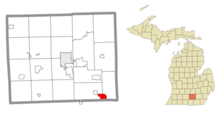
Vineyard Lake is an unincorporated community and census-designated place (CDP) in Jackson County in the U.S. state of Michigan. The CDP had a population of 980 at the 2010 census. It is located within Columbia Township to the west and Norvell Township to the east.
Graingers is an unincorporated community and census-designated place (CDP) in Lenoir County, North Carolina, United States. It was first listed as a CDP in the 2020 census with a population of 229.
Sand Pillow is a census-designated place (CDP) in Jackson County, Wisconsin, United States. As of the 2020 census, it had a population of 262.


