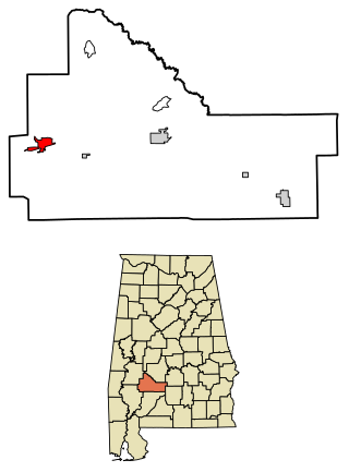
Pine Hill is a town in Wilcox County, Alabama, United States. It incorporated in 1895. Per the 2020 census, the population was 758.

Neodesha is a city in Wilson County, Kansas, United States. As of the 2020 census, the population of the city was 2,275. The name is derived from the Osage Indian word, Ni-o-sho-de, and is translated as The-Water-Is-Smoky-With-Mud.

Perham is a town in Aroostook County, Maine, United States. The population was 371 at the 2020 census. The town was named after Maine's 33rd governor, Sidney Perham.

Smithfield is a town in Somerset County, Maine, United States. The population was 925 at the 2020 census. The town was incorporated on February 29, 1840, making it the only town in Maine incorporated on Leap Day. The town was named after the Rev. Henry Smith, an early settler.

Fowler is a village in Clinton County in the U.S. state of Michigan. The population was 1,226 at the 2020 census. The village is located within Dallas Township.
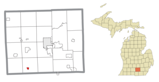
Hanover is a village in Jackson County in the U.S. state of Michigan. The population was 441 at the 2010 census. The village is located within Hanover Township.

Lake Shore is a city in Cass County, Minnesota, United States. The population was 1,056 at the 2020 census. It is part of the Brainerd Micropolitan Statistical Area.

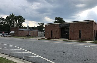
Park Hills is a city in St. Francois County, Missouri, United States. The population was 8,587 at the 2020 census.

Surry is a town in Cheshire County, New Hampshire, United States. The population was 820 at the 2020 census, up from 732 at the 2010 census.

Heritage Hills is a hamlet within the town of Somers in Westchester County, New York. The population was 3,975 at the 2010 census.
Macclesfield is a town in Edgecombe County, North Carolina, United States. It is part of the Rocky Mount, North Carolina Metropolitan Statistical Area. The population was 471 at the 2010 census.

Paradise Hill is a town in the northwest corner of Sequoyah County, Oklahoma, United States. It is part of the Fort Smith, Arkansas-Oklahoma Metropolitan Statistical Area. The population was 85 at the 2010 census, a decline from the figure of 100 recorded in 2000.
Barry Township is a township in Schuylkill County, Pennsylvania. Formed in 1822, it is named for American Revolutionary War Commander John Barry and was formed from parts of Norwegian and Schuylkill Townships.
White River is a city in and the county seat of Mellette County. South Dakota, United States. The population was 533 at the 2020 census.

Westford is a town in Richland County, Wisconsin, United States. The population was 594 at the 2000 census. The unincorporated communities of Bunker Hill and Germantown are located in the town. The unincorporated community of Corwin was also located in the town.

The Town of Porter is a located in Rock County, Wisconsin, United States. The population was 925 at the 2000 census. The unincorporated communities of Cooksville and Stebbinsville are located in the town.

Washington is a town in Sauk County, Wisconsin, United States. The population was 904 at the 2000 census. The unincorporated communities of Hill Point and Sandusky are located in the town.

Harrison is a town in Waupaca County, Wisconsin, United States. The population was 509 at the 2000 census. The unincorporated communities of Northland, Norske, and Schmidt Corner are located in the town.

Ranchester is a town in Sheridan County, Wyoming, United States. The population was 1,064 at the 2020 census.

Mechanic Falls is a census-designated place (CDP) in the town of Mechanic Falls in Androscoggin County, Maine, United States. The population of the CDP was 2,237 at the 2010 census, out of a total town population of 3,031.

