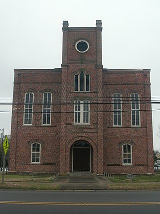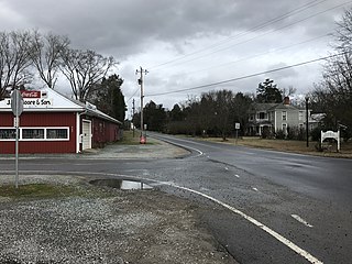
Dillon County is a county located in the U.S. state of South Carolina. As of the 2020 census, the county's population was 28,292. The county seat is Dillon.

Warren County is a county located in the northeastern Piedmont region of the U.S. state of North Carolina, on the northern border with Virginia, made famous for a landfill and birthplace of the environmental justice movement. As of the 2020 census, its population was 18,642. Its county seat is Warrenton. It was a center of tobacco and cotton plantations, education, and later textile mills.

Pender County is a county located in the U.S. state of North Carolina. As of the 2020 census, the population was 60,203. Its county seat is Burgaw. Pender County is part of the Wilmington, NC Metropolitan Statistical Area.

Martin County is a county located in the U.S. state of North Carolina. As of the 2020 census, the population was 22,031. Its county seat is Williamston.

Lenoir County is a county in the U.S. state of North Carolina. As of the 2020 census, its population was 55,122. Its county seat is Kinston, located on the Neuse River, across which the county has its territory.

Buies Creek is a census-designated place (CDP) located in the Neills Creek Township of Harnett County, North Carolina, United States. It is the home of Campbell University. The population was 3,253 at the 2020 census, up from 2,942 in 2010. Buies Creek is a part of the Dunn Micropolitan Area, which is also a part of the greater Raleigh–Durham–Cary Combined Statistical Area (CSA) as defined by the United States Census Bureau.

North Augusta is a city in Aiken and Edgefield counties in the U.S. state of South Carolina, on the north bank of the Savannah River. It lies directly across the river, and state border, from Augusta, Georgia. The population was 24,379 at the 2020 census. The city is included in the Central Savannah River Area (CSRA) and is part of the Augusta, Georgia, metropolitan area.
Iron Station is an unincorporated community and census-designated place (CDP) in Lincoln County, North Carolina, United States. A primarily industrial town, Iron Station's population was 755 as of the 2010 census. It also serves as a bedroom community for the larger cities of Charlotte, Hickory, and Lincolnton.
Tyro is an unincorporated community and census-designated place (CDP) located 7 miles (11 km) west of Lexington and 24 miles (39 km) south of Winston-Salem in Davidson County, North Carolina, United States. As of the 2010 census, the community had a population of 3,879.
Tigerville is an unincorporated community and census-designated place in Greenville County, South Carolina, United States. As of the 2010 United States Census the population was 1,312. It lies 12 miles (19 km) north of Taylors, 10 miles (16 km) northeast of Travelers Rest, and 14 miles (23 km) northwest of Greer. North Greenville University, a private institution of higher education affiliated with the Southern Baptist Convention, and whose baseball team won the national NCAA Division II baseball tournament in 2022, is located in Tigerville. The community is part of the Greenville–Mauldin–Easley Metropolitan Statistical Area.

Gulf is an unincorporated community and census-designated place (CDP) in southwestern Chatham County, North Carolina, United States, southeast of the town of Goldston. As of the 2010 census, the Gulf CDP had a population of 144. The community is home to a general store and several historic homes. It received its name from its location at a wide bend in the Deep River.
Bunnlevel is an unincorporated community and census-designated place (CDP) along U.S. Highway 401 in Stewarts Creek Township, Harnett County, North Carolina, United States. The population was 552 at the 2010 census. It is a part of the Dunn Micropolitan Area, which is also a part of the greater Raleigh–Durham–Cary Combined Statistical Area (CSA) as defined by the United States Census Bureau.
Mamers is an unincorporated community and census-designated place (CDP) in Harnett County, North Carolina, United States. The population was 826 at the 2010 census. It is a part of the Dunn Micropolitan Area, which is also a part of the greater Raleigh–Durham–Cary Combined Statistical Area (CSA) as defined by the United States Census Bureau.
Hollister is a census-designated place and unincorporated community in Halifax County in northeastern North Carolina, United States. As of the 2010 census it had a population of 674. Hollister's ZIP code is 27844.

Gadsden is a census-designated place in Richland County, South Carolina, United States. The population was 1,632 at the 2010 census. It is part of the Columbia, South Carolina metropolitan area.

Pinetown is an unincorporated community and census-designated place (CDP) in Beaufort County, North Carolina, United States. As of the 2010 census it had a population of 155.

South Mills is an unincorporated community and census-designated place (CDP) in Camden County, North Carolina, United States. Its population was 454 as of the 2010 census. South Mills has a post office with ZIP code 27976, which opened on March 2, 1840. The community is located near U.S. Route 17, and U.S. Route 17 Business and North Carolina Highway 343, and future Interstate 87 pass through the community.
Blue Clay Farms is an unincorporated community and census-designated place in New Hanover County, North Carolina, United States. Its population was 33 as of the 2010 census.
Northchase is an unincorporated community and census-designated place in New Hanover County, North Carolina, United States. Its population was 3,747 as of the 2010 census. U.S. Route 117 passes through the community.
Cove Creek is an unincorporated community and census-designated place in Watauga County, North Carolina, United States. Its population was 1,171 as of the 2010 census.


