Misenheimer, North Carolina

Last updated

Misenheimer with Pfeiffer University buildings in the background, Norfolk Southern Railroad line in the foreground Misenheimer, North Carolina.jpg
Misenheimer with Pfeiffer University buildings in the background, Norfolk Southern Railroad line in the foreground

Misenheimer is an incorporated village in Stanly County, North Carolina, United States. [1] It is in the southern Piedmont region of North Carolina, near the city of Richfield. The population was 728 as of the 2010 Census.

Contents

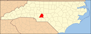
The college town is dominated by the main campus of Pfeiffer University, a university which was upgraded from a high school to a college largely due to financial support by Henry and Annie Merner Pfeiffer. Pfeiffer also housed Gray Stone Day School, a charter high school. On January 6, 2011, Gray Stone moved to its new campus on what was previously Pfeiffer land in the town.

U.S. Route 52 passes through Misenheimer along its route from Salisbury to Albemarle, and bisects the Pfeiffer campus along with a Norfolk Southern Railroad line. Misenheimer may have been the only municipality in America whose only traffic light is not at an intersection of two or more streets, but at a crosswalk to accommodate pedestrian traffic (the crosswalk being across US 52 connecting the two parts of Pfeiffer's campus on opposite sides of the highway).

History

In 1825, Matthias Tobias Barringer discovered gold nuggets along a section of Long Creek that ran through his farm. He found $8,000 worth of gold ($179,000 in 2020 dollars), and eventually the country's first gold vein in quartz. Newspapers in 24 states reported the find, and North Carolina's gold rush began. Meanwhile, Barringer was sued because of uncertainty over whether he owned the land he mined; he won the case in the 1880s. By 1888, new owners were working the mine and they moved Long Creek. In 1903, the Whitney Company, which was also working on damming the Yadkin River, bought the mine. Workers removed six tons of ore worth $20,000 per ton ($640,000 in 2020) and much more was still available. The gold financed the Yadkin River project. However, on August 11, 1904, a flood caused the deaths of eight men in the mine, and it eventually shut down, not to reopen until 1998. [2]

In the late 1800’s Misenheimer was a stop called Gladstone on a railroad spur that served a nearby early tourist destination, Misenheimer Springs. [3]

Incorporation resulted June 26, 2003 from a bill passed by the North Carolina General Assembly. [4] A major reason for the action was the planned widening of U.S. 52 and N.C. 49, expected to bring growth to the area. [5] One of the first actions taken by the interim board was to block heavy industry such as re-opening the former Barringer gold mine by Joe Carter, who owned about 250 acres, or about a fourth of the village land, [6] but did not live in the community. Carter had been working to restart the mine since 1998, and county commissioners stopped his plan for a quarry after residents protested, but Peter Edquist, a leader of the incorporation effort and the first mayor, denied that the mine was the reason for incorporation. [7] [8]

Government

Misenheimer has a mayor-council government with five total council members serving staggered four-year terms. The council elects one of its own members as the mayor every two years, and may remove and replace the mayor as well. This system prevents the direct general election of a mayor by the citizens of the town. Members are elected at-large (without districts) and in a non-partisan manner. The local legislation creating the city specified that elections were to be held in even-numbered years, while the rest of the state always uses odd-numbered ones.

35°29′06″N80°17′18″W / 35.48500°N 80.28833°W / 35.48500; -80.28833

Demographics

Historical population
CensusPop.Note
2010 728
2020 650−10.7%
U.S. Decennial Census [9]

2020 census

Misenheimer racial composition [10]
RaceNumberPercentage
White (non-Hispanic)42565.38%
Black or African American (non-Hispanic)14021.54%
Native American 40.62%
Asian 81.23%
Other/Mixed 264.0%
Hispanic or Latino 477.23%

As of the 2020 United States census, there were 650 people, 111 households, and 62 families residing in the village.

Related Research Articles

<span class="mw-page-title-main">Surry County, North Carolina</span> County in North Carolina, United States

Surry County is a county located in the U.S. state of North Carolina. As of the 2020 census, the population was 71,359. Its county seat is Dobson, and its largest community is Mount Airy.

<span class="mw-page-title-main">Stanly County, North Carolina</span> County in North Carolina, United States

Stanly County is a county in the U.S. state of North Carolina. As of the 2020 census, the population was 62,504. Its county seat is Albemarle.

<span class="mw-page-title-main">Rowan County, North Carolina</span> County in North Carolina, United States

Rowan County is a county in the U.S. state of North Carolina that was formed in 1753, as part of the British Province of North Carolina. It was originally a vast territory with unlimited western boundaries, but its size was reduced to 524 square miles (1,360 km2) after several counties were formed from Rowan County in the 18th and 19th centuries. As of the 2020 census, its population was 146,875. Its county seat, Salisbury, is the oldest continuously populated European-American town in the western half of North Carolina. Rowan County is located northeast of Charlotte, and is considered part of the Charlotte-Concord-Gastonia, NC-SC Metropolitan Statistical Area.

<span class="mw-page-title-main">Forsyth County, North Carolina</span> County in North Carolina, United States

Forsyth County is located in the northwest Piedmont of the U.S. state of North Carolina. As of the 2020 census, the population was 382,590, making it the fourth-most populous county in North Carolina. Its county seat is Winston-Salem. Forsyth County is part of the Winston-Salem, NC, Metropolitan Statistical Area, which is also included in the Greensboro–Winston-Salem–High Point, NC, Combined Statistical Area. Portions of Forsyth County are in the Yadkin Valley wine region.

<span class="mw-page-title-main">Davidson County, North Carolina</span> County in North Carolina, United States

Davidson County is a county located in the U.S. state of North Carolina. As of the 2020 census, the population was 168,930. Its county seat is Lexington, and its largest community is Thomasville.

<span class="mw-page-title-main">Cabarrus County, North Carolina</span> County in North Carolina, United States

Cabarrus County is a county located in the south-central part of the U.S. state of North Carolina. As of the 2020 census, the population was 225,804. The county seat is Concord, which was incorporated in 1803. Cabarrus County is included in the Charlotte-Concord-Gastonia, NC-SC Metropolitan Statistical Area.

<span class="mw-page-title-main">Lexington, North Carolina</span> City in North Carolina, United States

Lexington is the county seat of Davidson County, North Carolina, United States. As of the 2020 census, the town had a population of 19,632. It is located in central North Carolina, 20 miles (32 km) south of Winston-Salem. Major highways include I-85, I-85B, U.S. Route 29, U.S. Route 70, U.S. Route 52 / I-285 and U.S. Route 64. Lexington is part of the Piedmont Triad region of the state.

<span class="mw-page-title-main">Rural Hall, North Carolina</span> Town in North Carolina, United States

Rural Hall is a town in Forsyth County, North Carolina, United States. It is a part of the Piedmont Triad. The population was 3,360 at the 2020 census. The town has one public park: Covington Memorial Park.

<span class="mw-page-title-main">Albemarle, North Carolina</span> City in North Carolina, United States

Albemarle is a city in and the county seat of Stanly County, North Carolina, United States. The population was 15,903 in the 2010 census.

<span class="mw-page-title-main">New London, North Carolina</span> Town in North Carolina, United States

New London is a town in Stanly County, North Carolina, United States. The population was 600 at the 2010 census, and was estimated to be 724 as of 2019. The town lies between Albemarle and Richfield along U.S. 52 in the southern Piedmont region of the state, approximately 45 miles (72 km) east-northeast of Charlotte. It was the site of a gold mine, which was active during periods of the mid-1800s and early 1900s.

<span class="mw-page-title-main">Norwood, North Carolina</span> Town in North Carolina, United States

Norwood is a town in Stanly County, North Carolina, United States. The population was 2,379 at the 2010 census.

<span class="mw-page-title-main">Richfield, North Carolina</span> Town in North Carolina, United States

Richfield is a town in Stanly County, North Carolina, United States. The town was originally called "Ritchie's Field," for the prominent Ritchie family who established the post office, sawmill, and streets of the settlement.

<span class="mw-page-title-main">Elkin, North Carolina</span> Town in North Carolina, United States

Elkin is a town in Surry and Wilkes counties in the U.S. state of North Carolina, along the Yadkin River. Elkin shares its name with the surrounding township of Elkin Township. The population was 4,083 at the 2020 census.

<span class="mw-page-title-main">Pfeiffer University</span> Private university in Misenheimer, North Carolina, U.S.

Pfeiffer University is a private university in Misenheimer, North Carolina. It is affiliated with the United Methodist Church.

Gold Hill is an unincorporated community and census-designated place (CDP) in southeastern Rowan County, North Carolina, United States near the Cabarrus County line. It was first listed as a CDP in the 2020 census with a population of 372. It is situated near the Yadkin River and is served by U.S. Highway 52 and Old Beatty Ford Road.

<span class="mw-page-title-main">U.S. Route 52 in North Carolina</span> Section of U.S. Highway in North Carolina, United States

U.S. Route 52 (US 52) is a north–south United States highway that runs for 150 miles (240 km) from the South Carolina state line, near McFarlan, to the Virginia state line, near Mount Airy. It serves as a strategic highway through the central North Carolina Piedmont. Because of its alignment in the state, US 52 does not follow the standard convention of an even U.S. route number going east–west.

Gray Stone Day School in Misenheimer, North Carolina, named for Gray Stone Inn in Misenheimer, opened in Fall 2002, is a charter high school and middle school. Previously located in Pfeiffer University's Harris Building, its philosophy has been "what better way to prepare for college than on a college campus". Gray Stone began planning for its own facility in 2005. Pfeiffer donated 18 acres of land and groundbreaking took place in April 2010. On January 4, 2011, Gray Stone students moved into a new $7 million, 53,000-square-foot (4,900 m2) building. In 2012 the school opened a new wing of classrooms to accommodate the largest freshman class in school history.

<span class="mw-page-title-main">Egbert Hambley</span> British-born American mining engineer and power company executive

Egbert Barry Cornwall Hambley was a British-born mining engineer and power company executive, who worked for much of his career in North Carolina.

<span class="mw-page-title-main">Eldorado Township, Montgomery County, North Carolina</span> Township in North Carolina, United States

Eldorado Township, population 1,873, is one of eleven townships in Montgomery County, North Carolina, United States. Eldorado Township is 48.97 square miles (126.8 km2) in size and is located in the northwestern corner of the county.

References

  1. U.S. Geological Survey Geographic Names Information System: Misenheimer, North Carolina
  2. Drye, Willie (March 2020). "Misfortune in the Barringer Gold Mine". Our State . Retrieved March 25, 2020.
  3. "Village of Misenheimer - Our History". Village of Misenheimer. Retrieved December 12, 2023.
  4. Beth McLain, "Misenheimer wants county's help with zoning ordinance enforcement," The Weekly Post, September 24, 2003, p. 14.
  5. Beth McLain, "Welcome to the Village of Misenheimer," The Weekly Post, July 2, 2003, p. 1.
  6. Jenny Darby Roberson, "Zoning causes upset," Stanly News and Press , August 24, 2003, p. 1A.
  7. Jenny Darby Roberson, "Village approval gets closer," Stanly News and Press, July 26, 2003, p. 1A.
  8. Shannon Beamon, "Residents look back at 10 years in the village," Stanly News and Press, September 15, 2013, p. 1A.
  9. "Census of Population and Housing". Census.gov. Archived from the original on July 19, 2018. Retrieved June 4, 2015.
  10. "Explore Census Data". data.census.gov. Retrieved December 21, 2021.