Whittier, North Carolina

Last updated
Whittier, North Carolina
Moody House and Store, Whittier, NC (32766796188).jpg
USA North Carolina location map.svg
Red pog.svg
Whittier
Usa edcp location map.svg
Red pog.svg
Whittier
Coordinates: 35°26′02″N83°21′23″W / 35.43389°N 83.35639°W / 35.43389; -83.35639
Country United States
State North Carolina
County Jackson and Swain
Named for Dr. Clarke Whittier [1]
Area
[2]
  Total0.18 sq mi (0.48 km2)
  Land0.18 sq mi (0.47 km2)
  Water0.00 sq mi (0.00 km2)
Elevation
[3]
1,926 ft (587 m)
Population
 (2020)
  Total6,990
  Density136.61/sq mi (52.80/km2)
Time zone UTC-5 (Eastern (EST))
  Summer (DST) UTC-4 (EDT)
ZIP codes
28789
Area code 828
FIPS code 37-73780
GNIS feature ID2805285 [3]

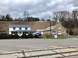
Whittier is an unincorporated community and census-designated place (CDP) in Jackson and Swain counties in the western part of the U.S. state of North Carolina. It was first listed as a CDP in the 2020 census with a population of 6,990. [4]

Contents

Whittier is located on the Tuckasegee River, between Bryson City downstream to the west, and Dillsboro upstream to the southeast. The town of Whittier has its own Post Office, located at 22 Main Street.

History

Founded in 1881 by Dr. Clarke Whittier when he purchased 60,000 acres (24,000 ha) of land in the area, it was incorporated as a town from 1887 to 1933. The town declined following the collapse of the lumber industry during the Great Depression. [5]

Demographics

Historical population
CensusPop.Note
2020 25
U.S. Decennial Census [6]
2020 [7]

2020 census

Whittier CDP, North Carolina – Racial and Ethnic Composition
(NH = Non-Hispanic)
Note: the US Census treats Hispanic/Latino as an ethnic category. This table excludes Latinos from the racial categories and assigns them to a separate category. Hispanics/Latinos may be of any race.
Race / EthnicityPop 2020 [7] % 2020
White alone (NH)2184.00%
Black or African American alone (NH)00.00%
Native American or Alaska Native alone (NH)00.00%
Asian alone (NH)00.00%
Pacific Islander alone (NH)00.00%
Some Other Race alone (NH)00.00%
Mixed Race/Multi-Racial (NH)14.00%
Hispanic or Latino (any race)312.00%
Total25100.00%

Related Research Articles

Floyd Dale, shown on federal maps as Floydale, is an unincorporated community and census-designated place (CDP) in Dillon County, South Carolina, United States. It was first listed as a CDP in the 2020 census with a population of 421.

Magnet Cove is a census-designated place (CDP) and former town in Hot Spring County, Arkansas, United States. It is located in the Ouachita Mountains southeast of Hot Springs, on Arkansas Highway 51 north of U.S. Highway 270. As of the 2020 census, the town of Magnet Cove had a population of 692.

Grandy is an unincorporated community and census-designated place (CDP) in Currituck County, North Carolina, USA. It was first listed as a CDP in the 2020 census with a population of 2,776. It is located along US 158 between the Currituck Sound and the North River.

Beech Island is an unincorporated community and census-designated place (CDP) in Aiken County, South Carolina, United States. It was first listed as a CDP in the 2020 census with a population of 1,421.

<span class="mw-page-title-main">Barnardsville, North Carolina</span> Census-designated place in North Carolina, United States

Barnardsville is an unincorporated community and census-designated place (CDP) in Buncombe County, North Carolina, United States. It was first listed as a CDP in the 2020 census with a population of 559.

Spout Springs is a Census-designated place in Johnsonville Township of Harnett County, North Carolina, United States. It was first listed as a CDP in the 2020 census with a population of 11,040.

<span class="mw-page-title-main">Alexis, North Carolina</span> Census-designated place in North Carolina, United States

Alexis is an unincorporated community and census-designated place (CDP) in Gaston County, North Carolina, United States. It is located approximately three miles north of Stanley. It was first listed as a CDP in the 2020 census with a population of 589.

<span class="mw-page-title-main">Springdale, North Carolina</span> Census-designated place in North Carolina, United States

Springdale is an unincorporated community and census-designated place (CDP) in Gaston County, North Carolina, United States. It was first listed as a CDP in the 2020 census with a population of 1,203. It is bordered on the west and south by the City of Gastonia, on the east by the town of Ranlo, and on the north by the unincorporated community of Monterey Park.

The Governors Village is a 450+ acre New Urbanism neighborhood and census-designated place (CDP) in Chatham County, North Carolina, United States, with an address of Chapel Hill. It was first listed as a CDP in the 2020 census with a population of 1,512.

Lobeco is an unincorporated community and census-designated place (CDP) located in Beaufort County, South Carolina, United States. Per the 2020 census, the population was 292.

Milwaukee is an unincorporated community and census-designated place (CDP) in Northampton County, North Carolina, United States. It was first listed as a CDP in the 2020 census with a population of 157.

<span class="mw-page-title-main">Conestee, South Carolina</span> Census-designated place in South Carolina, United States

Conestee is an unincorporated community and census-designated place (CDP) in Greenville County, South Carolina, United States. It was first listed as a CDP in the 2020 census with a population of 904.

<span class="mw-page-title-main">Jackson Springs, North Carolina</span> Census-designated place in North Carolina, United States

Jackson Springs is an unincorporated community and census-designated place (CDP) in Moore County, North Carolina, United States. It was first listed as a CDP in the 2020 census with a population of 154.

<span class="mw-page-title-main">Farmington, North Carolina</span> Census-designated place in North Carolina, United States

Farmington is an unincorporated community and census-designated place (CDP) in Davie County, North Carolina, United States, located at the intersection of NC 801 and Farmington Road (SR 1410). It was first listed as a CDP in the 2020 census with a population of 291. Located nearby is the Farmington Dragway.

Cypress Landing is a planned community and census-designated place (CDP) in Beaufort County, North Carolina, United States. It was first listed as a CDP in the 2020 census with a population of 1,257.

Emma is an unincorporated community and census-designated place (CDP) in Buncombe County, North Carolina, United States. It was first listed as a CDP in the 2020 census with a population of 2,174.

Carolina Meadows is a planned community and census-designated place (CDP) in Chatham County, North Carolina, United States. It was first listed as a CDP in the 2020 census with a population of 727.

Governors Club is a golf course community and census-designated place (CDP) in Chatham County, North Carolina, United States. It was first listed as a CDP in the 2020 census with a population of 1,969.

Roberdel, also known as Roberdell, is an unincorporated community and census-designated place (CDP) in Richmond County, North Carolina, United States. It was first listed as a CDP in the 2020 census with a population of 246.

Arkwright is an unincorporated area and census-designated place (CDP) adjacent to the city of Spartanburg in Spartanburg County, South Carolina, United States. It was first listed as a CDP prior to the 2020 census with a population of 2,311.

References

  1. "North Carolina Gazetteer" . Retrieved December 24, 2020.
  2. "ArcGIS REST Services Directory". United States Census Bureau. Retrieved September 20, 2022.
  3. 1 2 U.S. Geological Survey Geographic Names Information System: Whittier, North Carolina
  4. "Whittier CDP, North Carolina". United States Census Bureau . Retrieved April 7, 2022.
  5. Whittier, NC – The Way It Used to Be, Postcards from the Smokies (retrieved 2 July 2014)
  6. "Decennial Census by Decade". US Census Bureau.
  7. 1 2 "P2 HISPANIC OR LATINO, AND NOT HISPANIC OR LATINO BY RACE – 2020: DEC Redistricting Data (PL 94-171) – Whittier CDP, North Carolina". United States Census Bureau .