Ela, North Carolina

Last updated
Ela, North Carolina
Unincorporated community
USA North Carolina location map.svg
Red pog.svg
Ela, North Carolina
Usa edcp location map.svg
Red pog.svg
Ela, North Carolina
Coordinates: 35°26′58″N83°23′27″W / 35.44944°N 83.39083°W / 35.44944; -83.39083 Coordinates: 35°26′58″N83°23′27″W / 35.44944°N 83.39083°W / 35.44944; -83.39083
Country United States
State North Carolina
County Swain
Elevation 1,795 ft (547 m)
Time zone Eastern (EST) (UTC-5)
  Summer (DST) EDT (UTC-4)
ZIP Code(s) 28713, 28719
Area code(s) 828
GNIS feature ID 1011035 [1]

Ela is an unincorporated community in Swain County, North Carolina, United States, located along US 19, northwest of Whittier and east of Bryson City. The name is derived from ᎡᎳᏬᏗ (Elawodi) in the Cherokee language, which translates as "yellow hill."

Swain County, North Carolina County in the United States

Swain County is a county located in the western portion of the U.S. state of North Carolina. As of the 2010 census, the population was 13,981. Its county seat is Bryson City.

North Carolina State of the United States of America

North Carolina is a state in the southeastern region of the United States. It borders South Carolina and Georgia to the south, Tennessee to the west, Virginia to the north, and the Atlantic Ocean to the east. North Carolina is the 28th-most extensive and the 9th-most populous of the U.S. states. The state is divided into 100 counties. The capital is Raleigh, which along with Durham and Chapel Hill is home to the largest research park in the United States. The most populous municipality is Charlotte, which is the second-largest banking center in the United States after New York City.

Whittier, North Carolina Unincorporated community in North Carolina, United States

Whittier is an unincorporated community in Jackson and Swain counties in the western part of the U.S. state of North Carolina. Whittier is located on the Tuckasegee River, between Bryson City downstream to the west, and Dillsboro upstream to the southeast.

Ela was once the junction of the Appalachian Railway (1906-1935) and Southern Railway's Murphy Branch. [2]

Southern Railway (U.S.) railway company in the United States, active 1894–1990

The Southern Railway is a name of a class 1 railroad that was based in the Southern United States. The railroad is the product of nearly 150 predecessor lines that were combined, reorganized and recombined beginning in the 1830s, formally becoming the Southern Railway in 1894.
Murphy Branch

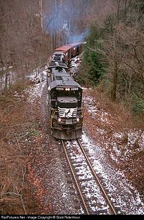
The historically important Murphy Branch is the westernmost part of what was the Western North Carolina Railroad, later the Richmond and Danville, Southern Railway, the Norfolk Southern Railway (NS) and today the Blue Ridge Southern Railroad. The branch runs between Asheville, North Carolina in the east and Murphy in the west. It roughly follows I-40 from Asheville to Canton and US Route 74, also known as the Great Smoky Mountains Expressway, from Canton to Murphy.

Related Research Articles

Salem may refer to:

Asheville, North Carolina City in North Carolina, United States

Asheville is a city and the county seat of Buncombe County, North Carolina, United States. It is the largest city in Western North Carolina, and the 12th-most populous city in the U.S. state of North Carolina. The city's population was 89,121 according to 2016 estimates. It is the principal city in the four-county Asheville metropolitan area, with a population of 424,858 in 2010.

Sanford, North Carolina City in North Carolina, United States

Sanford is a city in Lee County, North Carolina, United States. The population was 28,518 at the 2010 census. It is the county seat of Lee County.

Wilson, North Carolina City in North Carolina, United States

Wilson is a city in and the county seat of Wilson County, North Carolina, United States. Located approximately 40 mi (64 km) east of the capital city of Raleigh, it is served by the interchange of Interstate 95 and U.S. Route 264. Wilson had an estimated population of 49,610 in 2012, according to the Census Bureau.

Caldwell may refer to:

<i>Crescent</i> (train) Amtrak passenger train

The Crescent is a daily long-distance passenger train operated by Amtrak in the eastern United States. It operates 1,377 miles (2,216 km) daily between Pennsylvania Station in New York City and Union Passenger Terminal in New Orleans as train numbers 19 and 20. Major service stops outside the Northeast Corridor include Birmingham, Alabama; Atlanta, Georgia and Charlotte, North Carolina.

Roanoke River river in Virginia and North Carolina, United States

The Roanoke River is a river in southern Virginia and northeastern North Carolina in the United States, 410 miles (660 km) long. A major river of the southeastern United States, it drains a largely rural area of the coastal plain from the eastern edge of the Appalachian Mountains southeast across the Piedmont to Albemarle Sound. An important river throughout the history of the United States, it was the site of early settlement in the Virginia Colony and the Carolina Colony. An 81-mile (130 km) section of its lower course in Virginia between the Leesville Lake and Kerr Lake is known as the Staunton River, pronounced, as is the Shenandoah Valley city of that name. It is impounded along much of its middle course to form a chain of reservoirs.

Zhuzhou Prefecture-level city in Hunan, Peoples Republic of China

Zhuzhou, formerly Jianning, is a prefecture-level city of Hunan Province, China, straddling the Xiang River southeast of the provincial capital, Changsha, and bordering Jiangxi province to the east. It is part of the "Changzhutan Golden Triangle". The city has jurisdiction over 5 counties and four districts, and covers an area of 11,420 km2 (4,410 sq mi).

Atlantic and Western Railway

The Atlantic and Western Railway is a Class III short-line railroad operating about 10 miles (16 km) of track in Lee County, North Carolina. Atlantic and Western is part of Genesee & Wyoming Inc. and formerly part of Rail Management and Consulting. It was reorganized in 1927 from the Atlantic and Western Railroad.

Ela or ELA may refer to:

The following is a list of lists of the cities, towns and villages of the United States separated by state, territory or district name.

Gulf, North Carolina Census-designated place in North Carolina, United States

Gulf is an unincorporated community and census-designated place (CDP) in southwestern Chatham County, North Carolina, United States, southeast of the town of Goldston. As of the 2010 census, the Gulf CDP had a population of 144. The community is home to a general store and several historic homes. It received its name from its location at a wide bend in the Deep River.

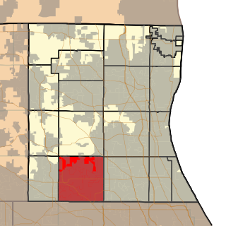
Ela Township, Lake County, Illinois Township in Illinois, United States

Ela Township is a township in Lake County, Illinois, USA. As of the 2010 census, its population was 42,654.

Langley, South Carolina Census-designated place in South Carolina, United States of America

Langley is a census-designated place (CDP) in Aiken County, South Carolina, United States. The population was 1,447 at the 2010 census. It is bordered by Gloverville to the northeast and Burnettown to the west.

Ja-Ela Suburb in Gampaha District, Western Province, Sri Lanka

Ja-Ela is a suburb of Colombo, located approximately 20 km (12 mi) north of the Colombo city centre. Ja-Ela lies on the A3 road which overlaps with the Colombo – Katunayake Expressway at the Ja-Ela Interchange.

The following television stations broadcast on digital channel 3 in the United States:

Padma Kuppa, a Democrat, is a member of the Michigan House of Representatives from the 41st district, which includes the city of Troy. Kuppa is an Indian-American. She has been named Assistant Whip in Michigan.

References

  1. "Geographic Names Information System". United States Geological Survey . Retrieved 2008-01-31.
  2. Poole, Cary Franklin (1995). A History of Railroading in Western North Carolina. Johnson City, TN: The Overmountain Press. pp. 172–3.