Forest Oaks, North Carolina

Last updated

Forest Oaks, North Carolina
Guilford County North Carolina incorporated and unincorporated areas Forest Oaks highlighted.svg
Location in Guilford County and the state of North Carolina
Coordinates: 35°59′20″N79°42′29″W / 35.98889°N 79.70806°W / 35.98889; -79.70806
Country United States
State North Carolina
County Guilford
Area
[1]
  Total4.90 sq mi (12.69 km2)
  Land4.80 sq mi (12.43 km2)
  Water0.10 sq mi (0.26 km2)
Elevation
[2]
774 ft (236 m)
Population
 (2020)
  Total4,209
  Density877.06/sq mi (338.64/km2)
Time zone UTC-5 (Eastern (EST))
  Summer (DST) UTC-4 (EDT)
ZIP code
27406
Area code 336
FIPS code 37-24198 [3]
GNIS feature ID2402491 [2]

Forest Oaks is a census-designated place (CDP) in Guilford County, North Carolina, United States. The population was 3,890 as of the 2010 census, [4] up from 3,241 in 2000.

Contents

Geography

Forest Oaks is located in southeastern Guilford County. At the center of the CDP is the Forest Oaks Country Club. The community is 10 miles (16 km) southeast of downtown Greensboro. The town is also known for Southeast Guilford Middle and High Schools, and is bordered to the west by Joseph M. Hunt Highway (U.S. Route 421).

According to the United States Census Bureau, the CDP has a total area of 4.9 square miles (12.8 km2), of which 4.9 square miles (12.6 km2) is land and 0.1 square miles (0.3 km2), or 2.13%, is water. [4] The majority of the CDP drains to Beaver Creek, a northeastward-flowing tributary of Little Alamance Creek and part of the Great Alamance CreekHaw RiverCape Fear River watershed.

Demographics

Historical population
CensusPop.Note
2020 4,209
U.S. Decennial Census [5]

As of the census [3] of 2000, there were 3,241 people, 1,227 households, and 1,065 families residing in the CDP. The population density was 638.8 inhabitants per square mile (246.6/km2). There were 1,252 housing units at an average density of 246.8 per square mile (95.3/km2). The racial makeup of the CDP was 94.29% White, 4.54% African American, 0.19% Native American, 0.19% Asian, 0.28% from other races, and 0.52% from two or more races. Hispanic or Latino of any race were 0.34% of the population.

There were 1,227 households, out of which 32.6% had children under the age of 18 living with them, 79.5% were married couples living together, 5.2% had a female householder with no husband present, and 13.2% were non-families. 12.0% of all households were made up of individuals, and 5.3% had someone living alone who was 65 years of age or older. The average household size was 2.64 and the average family size was 2.86.

In the CDP, the population was spread out, with 22.5% under the age of 18, 5.4% from 18 to 24, 23.3% from 25 to 44, 35.2% from 45 to 64, and 13.6% who were 65 years of age or older. The median age was 44 years. For every 100 females, there were 97.6 males. For every 100 females age 18 and over, there were 96.6 males.

The median income for a household in the CDP was $61,827, and the median income for a family was $67,159. Males had a median income of $45,313 versus $29,980 for females. The per capita income for the CDP was $25,682. About 5.2% of families and 4.7% of the population were below the poverty line, including 7.8% of those under age 18 and 3.6% of those age 65 or over.

Related Research Articles

<span class="mw-page-title-main">Village of Oak Creek, Arizona</span> Community in Yavapai County, Arizona

Village of Oak Creek is an unincorporated community located within Big Park a census-designated place (CDP) in Yavapai County, Arizona, United States. The population was 6,147 at the 2010 census, up from 5,245 in 2000. Big Park is the name of the CDP while the community is more commonly known as the Village of Oak Creek (VOC), and is a bedroom community for Sedona, located seven miles away. Tourism and service to retirees and second-home owners are the basis for the local economy. Big Park, the pioneers' name for the large open area that became the Village of Oak Creek in the early 1960s, is set among scenic red-rock buttes and canyons. The Bell Rock scenic area adjoins the north end of VOC, and the town is surrounded by the Coconino National Forest. A Forest Service Visitor Center is located at the south end of VOC.

<span class="mw-page-title-main">Level Park–Oak Park, Michigan</span> Census-designated place & unincorporated community in Michigan, United States

Level Park–Oak Park is a census-designated place for statistical purposes in Calhoun County in the U.S. state of Michigan. The CDP population was 3,409 at the 2010 census. The CDP is immediately northwest of the city of Battle Creek and is part of the Battle Creek Metropolitan Statistical Area.

<span class="mw-page-title-main">Altamahaw, North Carolina</span> Census-designated place in North Carolina, United States

Altamahaw is a census-designated place (CDP) in Alamance County, North Carolina, United States. It is part of the Burlington, North Carolina Metropolitan Statistical Area. As of the 2010 census it had a population of 347. The community was listed as Altamahaw-Ossipee at the 2000 census, at which time the population was 996. The town of Ossipee incorporated in 2002 and currently has a population of 543. The remainder of the territory was reassigned as the Altamahaw CDP.

<span class="mw-page-title-main">Elon, North Carolina</span> Town in North Carolina, United States

Elon is a town in Alamance County, North Carolina, United States. It is part of the Burlington metropolitan statistical area. The population as of the 2020 census was 11,324. The town of Elon is home to Elon University.

<span class="mw-page-title-main">Graham, North Carolina</span> City in North Carolina, United States

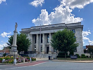
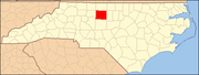
Graham is a city in Alamance County, North Carolina, United States. It is part of the Burlington, North Carolina Metropolitan Statistical Area. As of the 2020 census the population was 17,153. It is the county seat of Alamance County.

<span class="mw-page-title-main">Saxapahaw, North Carolina</span> Census-designated place in North Carolina, United States

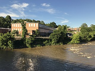
Saxapahaw is a census-designated place (CDP) and unincorporated area in Alamance County, North Carolina, United States. It is part of the Burlington, North Carolina Metropolitan Statistical Area. The population was 1,648 at the 2010 census.

<span class="mw-page-title-main">Woodlawn, North Carolina</span> Census-designated place in North Carolina, United States

Woodlawn is a census-designated place in Alamance County, North Carolina, United States.

<span class="mw-page-title-main">Avery Creek, North Carolina</span> Census-designated place in North Carolina, United States

Avery Creek is a census-designated place (CDP) in Buncombe County, North Carolina, United States. The population was 1,950 at the 2010 census. It is part of the Asheville Metropolitan Statistical Area.

<span class="mw-page-title-main">Bent Creek, Buncombe County, North Carolina</span> Census-designated place in North Carolina, United States

Bent Creek is a census-designated place (CDP) in Buncombe County, North Carolina, United States. The population was 1,287 at the 2010 census. The Bent Creek area has mountain bike trails within the Pisgah National Forest.

Brices Creek is an unincorporated area and census-designated place (CDP) in Craven County, North Carolina, United States. The population was 3,073 at the 2010 census. It is part of the New Bern, North Carolina Metropolitan Statistical Area.

<span class="mw-page-title-main">McLeansville, North Carolina</span> Census-designated place in North Carolina, United States

McLeansville is an unincorporated community and census-designated place (CDP) in Guilford County, North Carolina, United States. The population was 1,021 at the 2010 census.

<span class="mw-page-title-main">Buies Creek, North Carolina</span> Census-designated place in North Carolina, United States

Buies Creek is a census-designated place (CDP) located in the Neills Creek Township of Harnett County, North Carolina, United States. It is the home of Campbell University. The population was 3,253 at the 2020 census, up from 2,942 in 2010. Buies Creek is a part of the Dunn Micropolitan Area, which is also a part of the greater Raleigh–Durham–Cary Combined Statistical Area (CSA) as defined by the United States Census Bureau.

<span class="mw-page-title-main">Oak Hills, Pennsylvania</span> Census-designated place in Pennsylvania, United States

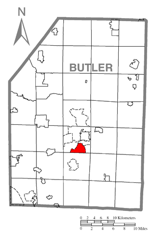
Oak Hills is a census-designated place (CDP) in Butler County, Pennsylvania, United States. The population was 2,333 at the 2010 census.

Guilford is a census-designated place (CDP) in Franklin County, Pennsylvania, United States. The population was 2,923 at the 2020 census.

<span class="mw-page-title-main">North Hartsville, South Carolina</span> Census-designated place in South Carolina, United States

North Hartsville is a census-designated place (CDP) in Darlington County, South Carolina, United States. The population was 3,251 at the 2010 census. It is part of the Florence Metropolitan Statistical Area and the Hartsville Urban Cluster.

<span class="mw-page-title-main">Little River, South Carolina</span> CDP in South Carolina, United States

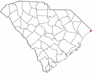
Little River is a census-designated place (CDP) in Horry County, South Carolina, United States. The population was 11,711 at the 2020 census.

<span class="mw-page-title-main">Oak Grove, South Carolina</span> Census-designated place in South Carolina, United States

Oak Grove is a census-designated place (CDP) in Lexington County, South Carolina, United States. The population was 10,291 at the 2010 census. It is part of the Columbia Metropolitan Statistical Area.

<span class="mw-page-title-main">Red Bank, South Carolina</span> Census-designated place in South Carolina, United States

Red Bank is an unincorporated community and census-designated place (CDP) in Lexington County, South Carolina, United States. The population was 9,617 at the 2010 census, up from 8,811 at the 2000 census. It is part of the Columbia, South Carolina Metropolitan Statistical Area.

Seven Oaks is a census-designated place (CDP) in Lexington County, South Carolina, United States, 8 miles (13 km) northwest of downtown Columbia, the state capital. The population of the CDP was 15,144 at the 2010 census. It is part of the Columbia Metropolitan Statistical Area.

<span class="mw-page-title-main">Gibsonville, North Carolina</span> Town in North Carolina, United States

Gibsonville is a town in both Alamance and Guilford counties in the U.S. state of North Carolina. Most of Gibsonville is situated in the Greensboro-Winston-Salem-High Point Combined Statistical Area and the eastern portion is in the Burlington, North Carolina Metropolitan Statistical Area, encompassing all of Alamance County. According to the 2020 Census, the population of Gibsonville was 8,971.

References

  1. "ArcGIS REST Services Directory". United States Census Bureau. Retrieved September 20, 2022.
  2. 1 2 U.S. Geological Survey Geographic Names Information System: Forest Oaks, North Carolina
  3. 1 2 "U.S. Census website". United States Census Bureau . Retrieved January 31, 2008.
  4. 1 2 "Geographic Identifiers: 2010 Demographic Profile Data (G001): Forest Oaks CDP, North Carolina". American Factfinder. U.S. Census Bureau. Retrieved January 11, 2017.[ dead link ]
  5. "Census of Population and Housing". Census.gov. Retrieved June 4, 2016.