Woodside East, Delaware

Last updated

Woodside East, Delaware
CDP
Kent County Delaware incorporated and unincorporated areas Woodside East highlighted.svg
Location in Kent County and the state of Delaware.
USA Delaware location map.svg
Red pog.svg
Woodside East
Location within the state of Delaware
Usa edcp location map.svg
Red pog.svg
Woodside East
Woodside East (the United States)
Coordinates: 39°04′03″N75°32′15″W / 39.06750°N 75.53750°W / 39.06750; -75.53750
Country United States
State Delaware
County Kent
Area
[1]
  Total1.71 sq mi (4.44 km2)
  Land1.71 sq mi (4.44 km2)
  Water0.00 sq mi (0.00 km2)
Elevation
[2]
46 ft (14 m)
Population
 (2020)
  Total2,570
  Density1,500.29/sq mi (579.11/km2)
Time zone UTC-5 (Eastern (EST))
  Summer (DST) UTC-4 (EDT)
Area code 302
FIPS code 10-80895
GNIS feature ID2390538 [2]

Woodside East is a census-designated place (CDP) in Kent County, Delaware, United States. It is part of the Dover, Delaware Metropolitan Statistical Area. The population was 2,316 at the 2010 census.

Contents

Geography

Woodside East is located at 39°04′03″N75°32′15″W / 39.06750°N 75.53750°W / 39.06750; -75.53750 (39.0675435, -75.5376242). [3]

According to the United States Census Bureau, the CDP has a total area of 1.7 square miles (4.4 km2), all land.

Demographics

Historical population
CensusPop.Note
1980 1,490
1990 1,65511.1%
2000 2,17431.4%
2010 2,3166.5%
2020 2,57011.0%
U.S. Decennial Census [4]

As of the census [5] of 2000, there were 2,174 people, 752 households, and 557 families residing in the CDP. The population density was 1,272.7 inhabitants per square mile (491.4/km2). There were 855 housing units at an average density of 500.5 per square mile (193.2/km2). The racial makeup of the CDP was 66.33% White, 28.24% African American, 0.55% Native American, 0.78% Asian, 0.05% Pacific Islander, 0.87% from other races, and 3.17% from two or more races. Hispanic or Latino of any race were 2.39% of the population.

There were 752 households, out of which 46.1% had children under the age of 18 living with them, 46.8% were married couples living together, 20.6% had a female householder with no husband present, and 25.8% were non-families. 18.9% of all households were made up of individuals, and 3.6% had someone living alone who was 65 years of age or older. The average household size was 2.89 and the average family size was 3.28.

In the CDP, the population was spread out, with 34.7% under the age of 18, 9.2% from 18 to 24, 30.8% from 25 to 44, 18.5% from 45 to 64, and 6.7% who were 65 years of age or older. The median age was 30 years. For every 100 females, there were 90.4 males. For every 100 females age 18 and over, there were 86.5 males.

The median income for a household in the CDP was $32,431, and the median income for a family was $32,344. Males had a median income of $29,750 versus $19,865 for females. The per capita income for the CDP was $13,542. About 15.0% of families and 16.1% of the population were below the poverty line, including 19.1% of those under age 18 and 6.8% of those age 65 or over.

Education

Most of Woodside East is located in the Caesar Rodney School District. [6] Portions are zoned to Nellie Stokes Elementary School in Camden, while others are zoned to Star Hill Elementary School, in an unincorporated area, and to Frear Elementary School in Rising Sun-Lebanon. Stokes areas are zoned to Fifer Middle School in Camden while Star Hill and Frear areas are zoned to Postlethwait Middle School, in Rising Sun-Lebanon. [7] Caesar Rodney High School in Camden is the comprehensive high school for the entire district.

Some of Woodside East is in the Lake Forest School District. [6] That area's zoned high school is Lake Forest High School.

Related Research Articles

<span class="mw-page-title-main">Kent County, Delaware</span> County in Delaware, United States

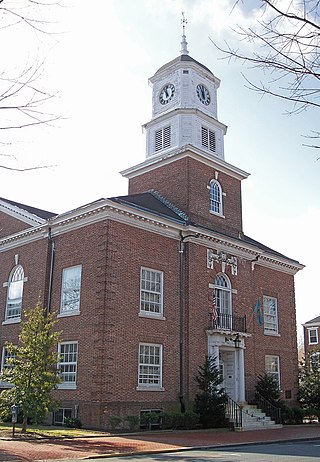
Kent County is a county located in the central part of the U.S. state of Delaware. As of the 2020 census, the population was 181,851, making it the least populous county in Delaware. The county seat is Dover, the state capital of Delaware. It is named for Kent, an English county.

<span class="mw-page-title-main">Camden, Delaware</span> Town in Delaware, United States

Camden is a town in Kent County, Delaware, United States. It is part of the Dover, Delaware Metropolitan Statistical Area. The population was 3,715 in 2020.

<span class="mw-page-title-main">Highland Acres, Delaware</span> CDP in Delaware, United States

Highland Acres is a census-designated place (CDP) in Kent County, Delaware, United States. It is part of the Dover, Delaware Metropolitan Statistical Area. The population was 3,459 at the 2010 census.

<span class="mw-page-title-main">Kent Acres, Delaware</span> CDP in Delaware, United States

Kent Acres is a census-designated place (CDP) in Kent County, Delaware, United States. It is part of the Dover, Delaware Metropolitan Statistical Area. The population was 1,890 at the 2010 census.

<span class="mw-page-title-main">Magnolia, Delaware</span> Town in Delaware, United States

Magnolia is a town in Kent County, Delaware, United States. It is part of the Dover, Delaware Metropolitan Statistical Area. Recent estimates put the population at around 235, however, the population was 277 in 2020.

<span class="mw-page-title-main">Riverview, Delaware</span> CDP in Delaware, United States

Riverview is a census-designated place (CDP) in Kent County, Delaware, United States. It is part of the Dover, Delaware Metropolitan Statistical Area. The population was 2,456 at the 2010 census.

<span class="mw-page-title-main">Rodney Village, Delaware</span> CDP in Delaware, United States

Rodney Village is a census-designated place (CDP) in Kent County, Delaware, United States. It is part of the Dover, Delaware Metropolitan Statistical Area. The population was 1,487 at the 2010 census.

<span class="mw-page-title-main">Viola, Delaware</span> Town in Delaware, United States

Viola is a town in Kent County, Delaware, United States. It is part of the Dover, Delaware Metropolitan Statistical Area. The population was 140 in 2020.

<span class="mw-page-title-main">Woodside, Delaware</span> Town in Delaware, United States

Woodside is a town in Kent County, Delaware, United States. It is part of the Dover, Delaware Metropolitan Statistical Area. The population was 190 in 2020.

<span class="mw-page-title-main">Wyoming, Delaware</span> Town in Delaware, United States

Wyoming is a town in Kent County, Delaware, United States. It was named after the Wyoming Valley in Pennsylvania. It is part of the Dover, Delaware, Metropolitan Statistical Area. The population was 1,680 in 2020.

<span class="mw-page-title-main">Brookside, Delaware</span> CDP in Delaware, United States

Brookside is a census-designated place (CDP) in New Castle County, Delaware, United States. The population was 14,353 at the 2010 census.

<span class="mw-page-title-main">Edgemoor, Delaware</span> CDP in Delaware, United States

Edgemoor is a census-designated place in New Castle County, Delaware, United States. The population was 5,677 at the 2010 census.

<span class="mw-page-title-main">Glasgow, Delaware</span> CDP in Delaware, United States

Glasgow is a census-designated place (CDP) in New Castle County, Delaware, United States. The population was 14,303 at the 2010 census.

North Star is a census-designated place (CDP) in New Castle County, Delaware, United States. The population was 7,980 at the 2010 census.

<span class="mw-page-title-main">Pike Creek, Delaware</span> CDP in Delaware, United States

Pike Creek is a census-designated place (CDP) in New Castle County, Delaware, United States and is part of the Philadelphia-Camden-Wilmington, PA-NJ-DE-MD Metropolitan statistical area. In 2007, CNN's Money Magazine ranked Pike Creek number 79 on its list of the 100 Best Places to Live in the United States. Pike Creek was the only community in Delaware to appear on the list. The population was 7,808 at the 2020 Census. Local attractions include Middle Run Natural Area, White Clay Creek State Park, Carousel Farm Park and Equestrian Center, Golf and Restaurants. Pike Creek is approximately five miles from downtown Newark, which contains the University of Delaware. Pike Creek is connected to the University of Delaware campus and the Newark downtown area by several bike trails. Pike Creek is approximately 10 miles west of the state's largest city, Wilmington, which is a national financial center.

<span class="mw-page-title-main">Wilmington Manor, Delaware</span> CDP in Delaware, United States

Wilmington Manor is a census-designated place (CDP) in north-eastern New Castle County, Delaware, United States. The population was 7,889 at the 2010 census.

<span class="mw-page-title-main">Rising Sun-Lebanon, Delaware</span> CDP in Delaware, United States

Rising Sun-Lebanon is a census-designated place (CDP) in Kent County, Delaware, United States. It is part of the Dover, Delaware Metropolitan Statistical Area. The population was 3,391 at the 2010 census.

<span class="mw-page-title-main">Boothwyn, Pennsylvania</span> Census-designated place in Pennsylvania, United States

Boothwyn is a census-designated place (CDP) in Delaware County, Pennsylvania, United States. The population was 4,933 at the 2010 census, down from 5,206 at the 2000 census. The census estimation for population circa 2019 is 6,115.

<span class="mw-page-title-main">Broomall, Pennsylvania</span> Census-designated place in Pennsylvania, United States

Broomall is a census-designated place (CDP) in Marple Township, Delaware County, Pennsylvania, United States. The population was 10,789 at the 2010 census.

The Caesar Rodney School District (CRSD) is a public school district based in Wyoming, Delaware (USA). The current superintendent is Dr. Christine Alois.

References

  1. "2020 U.S. Gazetteer Files". United States Census Bureau. Retrieved October 31, 2021.
  2. 1 2 U.S. Geological Survey Geographic Names Information System: Woodside East, Delaware
  3. "US Gazetteer files: 2010, 2000, and 1990". United States Census Bureau. February 12, 2011. Retrieved April 23, 2011.
  4. "Census of Population and Housing". Census.gov. Retrieved June 4, 2016.
  5. "U.S. Census website". United States Census Bureau . Retrieved January 31, 2008.
  6. 1 2 "2020 CENSUS - SCHOOL DISTRICT REFERENCE MAP: Kent County, DE" (PDF). U.S. Census Bureau . Retrieved June 16, 2021.
  7. "CRSD Map" (PDF). Caesar Rodney School District . Retrieved June 16, 2021.