Kenton, Delaware

Last updated

Kenton, Delaware
Kent County Delaware Incorporated and Unincorporated areas Kenton Highlighted 1039100.svg
Location of Kenton in Kent County, Delaware.
USA Delaware location map.svg
Red pog.svg
Kenton
Location within the state of Delaware
Usa edcp location map.svg
Red pog.svg
Kenton
Kenton (the United States)
Coordinates: 39°13′39″N75°39′47″W / 39.22750°N 75.66306°W / 39.22750; -75.66306
CountryFlag of the United States.svg  United States
State Flag of Delaware.svg  Delaware
County Flag placeholder.svg Kent
Area
[1]
  Total0.18 sq mi (0.46 km2)
  Land0.18 sq mi (0.46 km2)
  Water0.00 sq mi (0.00 km2)
Elevation
[2]
59 ft (18 m)
Population
 (2020)
  Total215
  Density1,221.59/sq mi (471.08/km2)
Time zone UTC−5 (Eastern (EST))
  Summer (DST) UTC−4 (EDT)
ZIP code
19955
Area code 302
FIPS code 10-39100
GNIS feature ID214191 [2]
Website kenton.delaware.gov

Kenton is a town in Kent County, Delaware, United States. It is part of the Dover metropolitan statistical area. The population was 215 in 2020. [3]

Contents

History

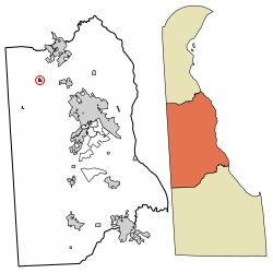
The Village of Kenton is a crossroads community located at the intersection of Route 42 and Route 300 in Kenton Hundred, Delaware. The village dates from the last decade of the 18th century, but did not achieve its peak until the last half of the 19th century when the Delaware and Maryland Railroad line was put through from Clayton to Maryland. [4]

Kenton was first laid out in 1796 by Philip Lewis who had begun to acquire property in the area five years before in 1791. The community was first known as Georgetown, then as Lewis Crossroads and finally, in 1806, by the name of Kenton. [4]

The Kenton Historic District was listed on the National Register of Historic Places in 1983. Other sites at or near Kenton on the National Register of Historic Places are the: George Arnold House, Aspendale, Thomas Attix House, J. F. Betz House, Benjamin Blackiston House, W. D. Burrows House, Scene of Cheyney Clow's Rebellion, Clark-Pratt House, Cooper House, Thomas Davis House, N. C. Downs House, T.H. Denny House, Green Mansion House (Kenton, Delaware), Robert Hill House, Hoffecker-Lockwood House, Alfred L. Hudson House, Kenton Post Office, Thomas Lamb Farm, Thomas Lamb House, Jefferson Lewis House, Delaplane McDaniel House, Poinsett House, Somerville, William Stevens House, James Williams House, and Wright-Carry House. [5]

Geography

Kenton is located at 39°13′39″N75°39′47″W / 39.2276115°N 75.6629847°W / 39.2276115; -75.6629847 . [6]

According to the United States Census Bureau, the town has a total area of 0.2 square miles (0.52 km2), all land.

Demographics

Historical population
CensusPop.Note
1880 107
1890 241125.2%
1900 192−20.3%
1910 2098.9%
1920 2121.4%
1930 175−17.5%
1940 23333.1%
1950 211−9.4%
1960 24918.0%
1970 205−17.7%
1980 24318.5%
1990 232−4.5%
2000 2372.2%
2010 26110.1%
2020 215−17.6%
U.S. Decennial Census [7]

At the 2000 census there were 237 people in 83 households, including 63 families, in the town. The population density was 1,375.8 inhabitants per square mile (531.2/km2). There were 87 housing units at an average density of 505.0 per square mile (195.0/km2). The racial makeup of the town was 94.51% White, 3.38% African American, 1.27% from other races, and 0.84% from two or more races. Hispanic or Latino of any race were 4.64%. [8]

Of the 83 households 36.1% had children under the age of 18 living with them, 59.0% were married couples living together, 9.6% had a female householder with no husband present, and 22.9% were non-families. 14.5% of households were one person and 4.8% were one person aged 65 or older. The average household size was 2.86 and the average family size was 3.11.

The age distribution was 27.8% under the age of 18, 9.3% from 18 to 24, 30.4% from 25 to 44, 24.9% from 45 to 64, and 7.6% 65 or older. The median age was 36 years. For every 100 females, there were 94.3 males. For every 100 females age 18 and over, there were 90.0 males.

The median household income was $38,250 and the median family income was $38,000. Males had a median income of $32,143 versus $27,500 for females. The per capita income for the town was $15,539. About 10.6% of families and 15.4% of the population were below the poverty line, including 19.7% of those under the age of eighteen and none of those sixty five or over.

Infrastructure

Transportation

DE 42 eastbound in Kenton 2022-07-16 14 14 19 View east along Delaware State Route 42 (East Commerce Street) at Delaware State Route 300 (Main Street) in Kenton, Kent County, Delaware.jpg
DE 42 eastbound in Kenton

Kenton is located at the intersection of Delaware Route 42 and Delaware Route 300. DE 42 passes northwest–southeast through the town on Commerce Street, heading northwest toward Blackiston and east toward Cheswold, where it has an intersection with U.S. Route 13 that provides access to the city of Dover to the south. DE 300 passes southwest–northeast through the town on Main Street, heading west toward the Maryland border and the Chesapeake Bay Bridge and northeast toward Smyrna, where it has an intersection with US 13 that provides access to the city of Wilmington to the north. [9]

Utilities

Delmarva Power, a subsidiary of Exelon, provides electricity to Kenton. [10] Chesapeake Utilities provides natural gas to the town. [11] Trash collection in Kenton is provided by private haulers including Waste Industries, RPJ Waste Services, Inc., and Waste Management. [12]

Related Research Articles

<span class="mw-page-title-main">Bowers, Delaware</span> Town in Delaware, United States

Bowers is a town in Kent County, Delaware, United States. It is part of the Dover, Delaware Metropolitan Statistical Area. According to the 2020 census, its population was 278.

<span class="mw-page-title-main">Camden, Delaware</span> Town in Delaware, United States

Camden is a town in Kent County, Delaware, United States. It is part of the Dover, Delaware Metropolitan Statistical Area. The population was 3,715 in 2020.

<span class="mw-page-title-main">Cheswold, Delaware</span> Town in Delaware, United States

Cheswold is a town in Kent County in the U.S. state of Delaware. It is part of the Dover, Delaware Metropolitan Statistical Area. The population was 1,923 in 2020.

<span class="mw-page-title-main">Clayton, Delaware</span> Town in Delaware, United States

Clayton is a town in Kent and New Castle counties in the U.S. state of Delaware. Located almost entirely in Kent County, it is part of the Dover, Delaware Metropolitan Statistical Area. The population was 2,918 at the 2010 census.

<span class="mw-page-title-main">Farmington, Delaware</span> Town in Delaware, United States

Farmington is a town in Kent County, Delaware, United States. It is part of the Dover, Delaware Metropolitan Statistical Area. The population was 92 in 2020.

<span class="mw-page-title-main">Felton, Delaware</span> Town in Delaware, United States

Felton is a town in Kent County, Delaware, United States. It is part of the Dover metropolitan statistical area. The population was 1,500 in 2020.

<span class="mw-page-title-main">Frederica, Delaware</span> Town in Delaware, United States

Frederica is a town in Kent County, Delaware, United States. It is part of the Dover, Delaware Metropolitan Statistical Area. The population was 1,073 in 2020. ILC Dover, the company which manufactured the spacesuits for the Apollo and Skylab astronauts of the 1960s and 1970s, along with fabricating the suit component of the Space Shuttle's Extravehicular Mobility Unit (EMU), is located nearby.

<span class="mw-page-title-main">Harrington, Delaware</span> City in Delaware, United States

Harrington is a city in Kent County, Delaware, United States. It is part of the Dover metropolitan statistical area. Harrington hosts the annual Delaware State Fair each July. The population was 3,774 in 2020.

<span class="mw-page-title-main">Hartly, Delaware</span> Town in Delaware, United States

Hartly is a town in Kent County, Delaware, United States. It is part of the Dover, Delaware Metropolitan Statistical Area. The population was 73 in 2020, making it the least populous municipality in Delaware.

<span class="mw-page-title-main">Houston, Delaware</span> Town in Delaware, United States

Houston is a town in Kent County, Delaware, United States. It is part of the Dover metropolitan area. The population was 381 in 2020. It was named for John W. Houston.

<span class="mw-page-title-main">Leipsic, Delaware</span> Town in Delaware, United States

Leipsic is a town in Kent County, Delaware, United States. It is part of the Dover, Delaware Metropolitan Statistical Area. The population was 178 in 2020.

<span class="mw-page-title-main">Little Creek, Delaware</span> Town in Delaware, United States

Little Creek is a town in Kent County, Delaware, United States. It is part of the Dover metropolitan statistical area. The population was 195 in 2020.

<span class="mw-page-title-main">Magnolia, Delaware</span> Town in Delaware, United States

Magnolia is a town in Kent County, Delaware, United States. It is part of the Dover, Delaware Metropolitan Statistical Area. Recent estimates put the population at around 235, however, the population was 277 in 2020.

<span class="mw-page-title-main">Smyrna, Delaware</span> Town in Delaware, United States

Smyrna is a town in Kent and New Castle counties in the U.S. state of Delaware. It is part of the Dover metropolitan statistical area. According to the U.S. Census Bureau, as of 2020, the population of the town is 12,883.

<span class="mw-page-title-main">Viola, Delaware</span> Town in Delaware, United States

Viola is a town in Kent County, Delaware, United States. It is part of the Dover, Delaware Metropolitan Statistical Area. The population was 140 in 2020.

<span class="mw-page-title-main">Woodside, Delaware</span> Town in Delaware, United States

Woodside is a town in Kent County, Delaware, United States. It is part of the Dover, Delaware Metropolitan Statistical Area. The population was 190 in 2020.

<span class="mw-page-title-main">Wyoming, Delaware</span> Town in Delaware, United States

Wyoming is a town in Kent County, Delaware, United States. It was named after the Wyoming Valley in Pennsylvania. It is part of the Dover, Delaware, Metropolitan Statistical Area. The population was 1,680 in 2020.

<span class="mw-page-title-main">Delaware City, Delaware</span> City in Delaware, United States

Delaware City is a city in New Castle County, Delaware, United States. The population was 1,885 as of 2020. It is a small port town on the eastern terminus of the Chesapeake and Delaware Canal and is the location of the Forts Ferry Crossing to Fort Delaware on Pea Patch Island.

<span class="mw-page-title-main">Odessa, Delaware</span> Town in Delaware, United States

Odessa is a town in New Castle County, Delaware, United States. The population was 364 at the 2010 census. Founded as Cantwell's Bridge in the 18th century, the name was changed in the 19th century, after the Ukrainian port city of the same name. Today a significant part of the town is a historic district list on the National Register of Historic Places.

<span class="mw-page-title-main">Townsend, Delaware</span> Town in Delaware, United States

Townsend is a town in New Castle County, Delaware, United States. The population was 2,049 at the 2010 census, an increase of 492.2% from 2000. The center of population of Delaware is located in Townsend.

References

  1. "2020 U.S. Gazetteer Files". United States Census Bureau. Retrieved October 31, 2021.
  2. 1 2 U.S. Geological Survey Geographic Names Information System: Kenton, Delaware
  3. "The Delaware Census State Data Center". Archived from the original on December 31, 2016. Retrieved April 29, 2013.
  4. 1 2 Stephen G. Del Sordo (March 1983). "National Register of Historic Places Inventory/Nomination: Kenton Historic District". National Park Service. and accompanying 33 photos
  5. "National Register Information System". National Register of Historic Places . National Park Service. July 9, 2010.
  6. "US Gazetteer files: 2010, 2000, and 1990". United States Census Bureau. February 12, 2011. Retrieved April 23, 2011.
  7. "Census of Population and Housing". Census.gov. Retrieved June 4, 2016.
  8. "U.S. Census website". United States Census Bureau . Retrieved January 31, 2008.
  9. Delaware Department of Transportation (2017). Official Travel & Transportation Map (PDF) (Map). Dover: Delaware Department of Transportation.
  10. "Service Territory". Delmarva Power. Archived from the original on May 25, 2014. Retrieved August 15, 2017.
  11. "Delmarva Service Territory". Chesapeake Utilities. Archived from the original on August 15, 2017. Retrieved August 14, 2017.
  12. "Community Area Information". Town of Kenton, Delaware. Retrieved August 28, 2018.