Smyrna, Delaware

Last updated

Smyrna, Delaware
Main Street NB approaching Commerce Street Smyrna DE.jpeg
South Main Street in Smyrna
Etymology: Ancient Greek seaport of Smyrna
Kent County and New Castle County Delaware Incorporated and Unincorporated areas Smyrna Highlighted 1067310.svg
Location of Smyrna in Kent County and New Castle County, Delaware.
USA Delaware location map.svg
Red pog.svg
Smyrna
Location within the state of Delaware
Usa edcp location map.svg
Red pog.svg
Smyrna
Smyrna (the United States)
Coordinates: 39°17′59″N75°36′17″W / 39.29972°N 75.60472°W / 39.29972; -75.60472
CountryFlag of the United States.svg  United States
State Flag of Delaware.svg  Delaware
County Kent, New Castle
Government
  Type Mayor-council
  MayorRobert C. Johnson
Area
[1]
  Total6.31 sq mi (16.34 km2)
  Land6.24 sq mi (16.17 km2)
  Water0.07 sq mi (0.17 km2)
Elevation
[2]
33 ft (10 m)
Population
 (2020)
  Total12,883
  Density2,063.26/sq mi (796.66/km2)
Time zone UTC−5 (Eastern (EST))
  Summer (DST) UTC−4 (EDT)
ZIP code
19977
Area code 302
FIPS code 10-67310
GNIS feature ID214671 [2]
Website smyrna.delaware.gov

Smyrna is a town in Kent and New Castle counties in the U.S. state of Delaware. It is part of the Dover metropolitan statistical area. According to the U.S. Census Bureau, as of 2020, the population of the town is 12,883. [3]

Contents

The international jurist John Bassett Moore was born in Smyrna, as were politicians Louis McLane and James Williams.

History

Main Street looking north, 1906 Smyrna, Delaware (1906).jpg
Main Street looking north, 1906

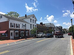
Smyrna was originally called Duck Creek Cross Roads and received its current name in 1806 after the Greek seaport of Smyrna in present-day Turkey. The town was located along the north–south King's Highway. Smyrna was originally a shipping center along the Duck Creek and was the most important port between Wilmington and Lewes, shipping grain, lumber, tanbark, and produce to points north. After the shipping industry collapsed in the 1850s, the town would continue to be an agricultural center. [4]

Another account of Smyrna's name goes back to the Second Great Awakening of 1806–1807 when Methodist preacher Frances Asbury preached a sermon on the Church at Smyrna from Revelation 2 to the local Methodist society. The sermon was so well received that the residents changed the name of the town to Smyrna in honor of the sermon.

The Bannister Hall and Baynard House, Belmont Hall, David J. Cummins House, Timothy Cummins House, Duck Creek Village, George Farmhouse, Ivy Dale Farm, Mount Pleasant, Moore House, Peterson and Mustard's Hermitage Farm, Savin-Wilson House, Short's Landing Hotel Complex, Smyrna Historic District, John M. Voshell House, and Woodlawn are listed on the National Register of Historic Places. [5]

Geography

According to the United States Census Bureau, the town has a total area of 3.8 square miles (9.8 km2), of which 3.7 square miles (9.6 km2) is land and 0.1 square miles (0.26 km2) (2.13%) is water.

Climate

The climate in this area is characterized by hot, humid summers and generally mild to cool winters. According to the Köppen Climate Classification system, Smyrna has a humid subtropical climate, abbreviated "Cfa" on climate maps.

Climate data for Smyrna, Delaware
MonthJanFebMarAprMayJunJulAugSepOctNovDecYear
Record high °F (°C)77
(25)
80
(27)
87
(31)
97
(36)
98
(37)
100
(38)
104
(40)
102
(39)
98
(37)
95
(35)
85
(29)
75
(24)
104
(40)
Mean daily maximum °F (°C)43
(6)
47
(8)
55
(13)
66
(19)
75
(24)
83
(28)
87
(31)
85
(29)
79
(26)
69
(21)
59
(15)
47
(8)
66
(19)
Mean daily minimum °F (°C)27
(−3)
29
(−2)
36
(2)
44
(7)
54
(12)
63
(17)
69
(21)
67
(19)
60
(16)
49
(9)
40
(4)
31
(−1)
47
(8)
Record low °F (°C)−7
(−22)
−11
(−24)
7
(−14)
14
(−10)
28
(−2)
41
(5)
45
(7)
35
(2)
30
(−1)
25
(−4)
11
(−12)
−3
(−19)
−11
(−24)
Average precipitation inches (mm)3.41
(87)
3.18
(81)
4.31
(109)
3.88
(99)
4.25
(108)
4.00
(102)
4.09
(104)
4.36
(111)
4.13
(105)
3.42
(87)
3.48
(88)
3.65
(93)
46.16
(1,174)
Source: The Weather Channel [6]

Demographics

Historical population
CensusPop.Note
1860 1,873
1870 2,11012.7%
1880 2,42815.1%
1890 2,4551.1%
1900 2,168−11.7%
1910 1,843−15.0%
1920 1,9536.0%
1930 1,9580.3%
1940 1,870−4.5%
1950 2,34625.5%
1960 3,24138.2%
1970 4,24330.9%
1980 4,75011.9%
1990 5,23110.1%
2000 5,6798.6%
2010 10,02376.5%
2020 12,88328.5%
U.S. Decennial Census [7]

As of the census [8] of 2000, there were 5,679 people, 2,114 households, and 1,462 families residing in the town. The population density was 1,541.9 inhabitants per square mile (595.3/km2). There were 2,242 housing units at an average density of 608.7 per square mile (235.0/km2). The racial makeup of the town was 72.88% White, 22.42% African American, 0.51% Native American, 0.56% Asian, 0.07% Pacific Islander, 1.44% from other races, and 2.11% from two or more races. Hispanic or Latino of any race were 3.42% of the population.

There were 2,114 households, out of which 36.7% had children under the age of 18 living with them, 45.9% were married couples living together, 18.4% had a female householder with no husband present, and 30.8% were non-families. 24.9% of all households were made up of individuals, and 10.4% had someone living alone who was 65 years of age or older. The average household size was 2.56 and the average family size was 3.02.

In the town, the population was spread out, with 27.1% under the age of 18, 8.7% from 18 to 24, 29.1% from 25 to 44, 18.3% from 45 to 64, and 16.9% who were 65 years of age or older. The median age was 35 years. For every 100 females, there were 82.7 males. For every 100 females age 18 and over, there were 77.0 males.

The median income for a household in the town was $36,212, and the median income for a family was $42,355. Males had a median income of $32,500 versus $22,135 for females. The per capita income for the town was $17,443. About 7.9% of families and 10.5% of the population were below the poverty line, including 14.0% of those under age 18 and 6.2% of those age 65 or over.

Government

Smyrna is governed by a mayor and a six-member council. As of 2019, the mayor of Smyrna is Robert Johnson. The Smyrna Town Council consists of: [9]

Infrastructure

Transportation

DE 1 northbound in Smyrna 2022-07-18 11 42 42 View north along Delaware State Route 1 (Korean War Veterans Memorial Highway) from the overpass for Smyrna-Leipsic Road in Smyrna, Kent County, Delaware.jpg
DE 1 northbound in Smyrna

The Delaware Route 1 toll road is the most prominent highway serving Smyrna. It passes along the eastern edge of the town, with access provided at Exit 114 (South Smyrna) and Exit 119 (North Smyrna), both connecting to US 13. U.S. Route 13 is the main north–south road through Smyrna, passing through the town on Dupont Boulevard. The Smyrna Rest Area is located north of Smyrna at the junction of US 13 and DE 1 at Exit 119. US 13 and DE 1 both run south to Dover and north to Wilmington. Delaware Route 6 runs east–west through Smyrna, heading west to Clayton and Blackiston and east to Woodland Beach. Delaware Route 300 begins at US 13 and heads west along with DE 6 through Smyrna before splitting to the southwest and heading toward Kenton. [10] DART First State provides bus service to Smyrna along Route 120, which provides local service south to Dover and connects to the local bus routes serving the Dover area; Route 301, which provides express service south to Dover and north to Wilmington from the Smyrna Rest Area; and Route 302, which provides service south to Dover and north to Middletown from the Smyrna Rest Area. [11] Smyrna Airport, a general aviation airport, is located to the east of Smyrna. [10]

Utilities

The Town of Smyrna Electric Department provides electricity to Smyrna, serving about 6,200 customers. [12] The town's electric department is a member of the Delaware Municipal Electric Corporation, a wholesale electric utility that purchases energy for its members. [13] Trash collection in the town is provided under contract by Waste Industries. [14] The Public Works department provides water and sewer service to about 4,000 customers in Smyrna. [15] Natural gas service in Smyrna is provided by Chesapeake Utilities. [16]

Health care

Bayhealth Medical Center operates the Bayhealth Emergency Center, Smyrna in Smyrna. [17] The emergency center offers a 24-hour emergency department. [18]

Notable people

Related Research Articles

<span class="mw-page-title-main">Dover, Delaware</span> Capital city of Delaware, United States

Dover is the capital and second-most populous city of the U.S. state of Delaware. It is also the county seat of Kent County and the principal city of the Dover metropolitan statistical area, which encompasses all of Kent County and is part of the Philadelphia–Wilmington–Camden, PA–NJ–DE–MD, combined statistical area. It is located on the St. Jones River in the Delaware River coastal plain. It was named by William Penn for Dover in Kent, England. As of 2020, its population was 39,403.

<span class="mw-page-title-main">Kent County, Delaware</span> County in Delaware, United States

Kent County is a county located in the central part of the U.S. state of Delaware. As of the 2020 census, the population was 181,851, making it the least populous county in Delaware. The county seat is Dover, the state capital of Delaware. It is named for Kent, an English county.

<span class="mw-page-title-main">Camden, Delaware</span> Town in Delaware, United States

Camden is a town in Kent County, Delaware, United States. It is part of the Dover, Delaware Metropolitan Statistical Area. The population was 3,715 in 2020.

<span class="mw-page-title-main">Cheswold, Delaware</span> Town in Delaware, United States

Cheswold is a town in Kent County in the U.S. state of Delaware. It is part of the Dover, Delaware Metropolitan Statistical Area. The population was 1,923 in 2020.

<span class="mw-page-title-main">Clayton, Delaware</span> Town in Delaware, United States

Clayton is a town in Kent and New Castle counties in the U.S. state of Delaware. Located almost entirely in Kent County, it is part of the Dover, Delaware Metropolitan Statistical Area. The population was 2,918 at the 2010 census.

<span class="mw-page-title-main">Felton, Delaware</span> Town in Delaware, United States

Felton is a town in Kent County, Delaware, United States. It is part of the Dover metropolitan statistical area. The population was 1,568 in 2020.

<span class="mw-page-title-main">Frederica, Delaware</span> Town in Delaware, United States

Frederica is a town in Kent County, Delaware, United States. It is part of the Dover, Delaware Metropolitan Statistical Area. The population was 1,073 in 2020. ILC Dover, the company which manufactured the spacesuits for the Apollo and Skylab astronauts of the 1960s and 1970s, along with fabricating the suit component of the Space Shuttle's Extravehicular Mobility Unit (EMU), is located nearby.

<span class="mw-page-title-main">Kenton, Delaware</span> Town in Delaware, United States

Kenton is a town in Kent County, Delaware, United States. It is part of the Dover metropolitan statistical area. The population was 215 in 2020.

<span class="mw-page-title-main">Leipsic, Delaware</span> Town in Delaware, United States

Leipsic is a town in Kent County, Delaware, United States. It is part of the Dover, Delaware Metropolitan Statistical Area. The population was 178 in 2020.

<span class="mw-page-title-main">Little Creek, Delaware</span> Town in Delaware, United States

Little Creek is a town in Kent County, Delaware, United States. It is part of the Dover metropolitan statistical area. The population was 195 in 2020.

<span class="mw-page-title-main">Milford, Delaware</span> City in Delaware, United States

Milford is a city in Kent and Sussex counties in the U.S. state of Delaware. According to the 2020 census, the population of the city is 11,190 people and 4,356 households in the city.

<span class="mw-page-title-main">Wyoming, Delaware</span> Town in Delaware, United States

Wyoming is a town in Kent County, Delaware, United States. It was named after the Wyoming Valley in Pennsylvania. It is part of the Dover, Delaware, Metropolitan Statistical Area. The population was 1,680 in 2020.

<span class="mw-page-title-main">Bellefonte, Delaware</span> Town in Delaware, United States

Bellefonte is a town in New Castle County, Delaware, United States. According to the 2010 Census, the population of the town is 1,193.

<span class="mw-page-title-main">Delaware City, Delaware</span> City in Delaware, United States

Delaware City is a city in New Castle County, Delaware, United States. The population was 1,885 as of 2020. It is a small port town on the eastern terminus of the Chesapeake and Delaware Canal and is the location of the Forts Ferry Crossing to Fort Delaware on Pea Patch Island.

<span class="mw-page-title-main">Middletown, Delaware</span> Town in Delaware, United States

Middletown is a town in New Castle County, Delaware, United States. According to the 2021 Census, the population of the town is 24,164.

<span class="mw-page-title-main">New Castle, Delaware</span> City in Delaware, United States

New Castle is a city in New Castle County, Delaware, United States. The city is located six miles (10 km) south of Wilmington and is situated on the Delaware River. As of 2020, the city's population was 5,551. New Castle constitutes part of the Delaware Valley or Philadelphia metropolitan area.

<span class="mw-page-title-main">Townsend, Delaware</span> Town in Delaware, United States

Townsend is a town in New Castle County, Delaware, United States. The population was 2,049 at the 2010 census, an increase of 492.2% from 2000. The center of population of Delaware is located in Townsend.

<span class="mw-page-title-main">Bridgeville, Delaware</span> Town in Delaware, United States

Bridgeville is a town in Sussex County, Delaware, United States. According to the 2020 census, the population is 2,568. It is part of the Salisbury, Maryland-Delaware Metropolitan Statistical Area.

<span class="mw-page-title-main">Wentworth, New Hampshire</span> Town in New Hampshire, United States

Wentworth is a town in Grafton County, New Hampshire, United States. The population was 845 at the 2020 census, down from 911 at the 2010 census. The town is home to Plummer's Ledge Natural Area, and part of the White Mountain National Forest is in the northeast. The town has a picturesque common, presided over by a Federal-style church and bordered by antique homes.

<span class="mw-page-title-main">Middlebury, Vermont</span> Town in Vermont, United States

Middlebury is the shire town of Addison County, Vermont, United States. As of the 2020 census, the population was 9,152. Middlebury is home to Middlebury College and the Henry Sheldon Museum of Vermont History.

References

  1. "2020 U.S. Gazetteer Files". United States Census Bureau. Retrieved October 31, 2021.
  2. 1 2 U.S. Geological Survey Geographic Names Information System: Smyrna, Delaware
  3. "Smyrna town, Delaware – Population Finder – American FactFinder". Population Finder. U.S. Census Bureau, Population Division. Archived from the original on February 12, 2020. Retrieved January 18, 2010.
  4. Federal Writers' Project (1938). The ocean highway: New Brunswick, New Jersey to Jacksonville, Florida. American Guide Series. New York: Modern Age Books. Retrieved April 10, 2009.
  5. "National Register Information System". National Register of Historic Places . National Park Service. July 9, 2010.
  6. "Climate Statistics for Smyrna, Delaware" . Retrieved December 26, 2019.
  7. "Census of Population and Housing". Census.gov. Retrieved June 4, 2016.
  8. "U.S. Census website". United States Census Bureau . Retrieved January 31, 2008.
  9. "Mayor & Council". Town of Smyrna. Retrieved December 26, 2019.
  10. 1 2 Delaware Department of Transportation (2008). Delaware Official Transportation Map (PDF) (Map). Dover: Delaware Department of Transportation.
  11. "Routes and Schedules". DART First State. Retrieved August 16, 2013.
  12. "Electric". Town of Smyrna. Retrieved August 13, 2017.
  13. "Delaware Municipal Electric Corporation (DEMEC)". Town of Smyrna. Retrieved August 13, 2017.
  14. "Trash". Town of Smyrna. Retrieved August 13, 2017.
  15. "Water & Sewer". Town of Smyrna. Retrieved August 13, 2017.
  16. "Delmarva Service Territory". Chesapeake Utilities. Retrieved August 14, 2017.
  17. "Hospitals & Facilities". Bayhealth. Archived from the original on May 25, 2014. Retrieved June 21, 2014.
  18. "Emergency Services". Bayhealth. Archived from the original on May 23, 2014. Retrieved June 21, 2014.
  19. Literary Digest, March 2017, P. 14
  20. Cummins, George David (1878). Memoir of George David Cummins, D.D.: First Bishop of the Reformed Episcopal Church. Dodd, Mead.
  21. "Assistant Secretaries of State, 1853–1924". 1997-2001.state.gov. Retrieved September 8, 2020.
  22. 1 2 3 "Governor of Delaware". Ballotpedia. Retrieved September 8, 2020.
  23. "List of United States Senators from Delaware". Ballotpedia. Retrieved September 8, 2020.
  24. "John B. Mayberry | U.S. Civil War | U.S. Army | Medal of Honor Recipient". Congressional Medal of Honor Society. Retrieved September 8, 2020.
  25. "Mayberry, John B". The National Medal of Honor Museum. Retrieved September 8, 2020.
  26. 1 2 3 4 5 "List of United States Representatives from Delaware". Ballotpedia. Retrieved September 8, 2020.
  27. 1 2 "government – When and how did the presidents of states became governors in the U.S.A?". History Stack Exchange. Retrieved September 8, 2020.