
Acres Green is an unincorporated community and a census-designated place (CDP) located in Douglas County, Colorado, United States. The CDP is a part of the Denver–Aurora–Lakewood, CO Metropolitan Statistical Area. The population of the Acres Green CDP was 2,922 at the 2020 United States Census. It is bordered by Lone Tree to the north, east and south and Highlands Ranch to the west. The community lies in ZIP Code 80124.
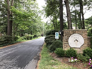
Henlopen Acres is a municipality north of Rehoboth Beach in Sussex County, Delaware, United States, and is the third smallest incorporated town in Delaware. According to 2010 census figures, the population of the town is 122, a 12.2% decrease from the 2000 census. It is part of the Salisbury, Maryland-Delaware Metropolitan Statistical Area.

The Public Land Survey System (PLSS) is the surveying method developed and used in the United States to plat, or divide, real property for sale and settling. Also known as the Rectangular Survey System, it was created by the Land Ordinance of 1785 to survey land ceded to the United States by the Treaty of Paris in 1783, following the end of the American Revolution. Beginning with the Seven Ranges in present-day Ohio, the PLSS has been used as the primary survey method in the United States. Following the passage of the Northwest Ordinance in 1787, the Surveyor General of the Northwest Territory platted lands in the Northwest Territory. The Surveyor General was later merged with the United States General Land Office, which later became a part of the U.S. Bureau of Land Management (BLM). Today, the BLM controls the survey, sale, and settling of lands acquired by the United States.

The Lackawanna River is a 42-mile-long (68 km) tributary of the Susquehanna River in Northeastern Pennsylvania. It flows through a region of the northern Pocono Mountains that was once a center of anthracite coal mining in the United States. It starts in north Wayne County, Pennsylvania and ends in east Luzerne County, Pennsylvania in Duryea, Pennsylvania. The lower reaches of the river flow through the urban areas of Scranton, which grew around its banks in the 19th century as an industrial center. Its name comes from a Lenape word meaning "stream that forks".

Titusville is an unincorporated community and census-designated place (CDP) in Hopewell Township, Mercer County, in the U.S. state of New Jersey. As of the 2020 census, the population was 633. The area includes a post office with its own ZIP Code (08560), several restaurants, gas stations, a firehouse, and a small cluster of homes. Washington Crossing State Park, dedicated to George Washington's crossing of the Delaware River in 1776, is adjacent to the community.

Cobbs Creek is an 11.8-mile-long (19.0 km) tributary of Darby Creek in Delaware County, Pennsylvania, in the United States. It forms an approximate border between Montgomery County and Delaware County. After Cobbs Creek passes underneath Township Line Road, it forms the border between Philadelphia County and Delaware County. It runs directly through the two sides of Mount Moriah Cemetery which spans the border of Southwest Philadelphia and Yeadon, Pennsylvania. It later joins Darby Creek before flowing into the Delaware River.

Pennypack Creek is a 22.6-mile-long (36.4 km) creek in southeastern Pennsylvania in the United States. It runs southeast through lower Bucks County, eastern Montgomery County and the northeast section of Philadelphia, before emptying into the Delaware River.

Frankford Creek is a minor tributary of the Delaware River in southeast Pennsylvania. It derived its name from today's Frankford, Philadelphia neighborhood.
Carole Highlands is an unincorporated community in Prince George's County, Maryland, United States. It is contained between East West Highway to the south, University Boulevard to the north, Larch Avenue, Hopewell Avenue, and 15th Avenue to the west, and Riggs Road to the east. Carole Highlands borders the adjacent neighborhoods of Chillum, Green Meadows, Lewisdale, and Langley Park in Prince George's County, while bordering the city of Takoma Park in Montgomery County. For statistical purposes, it is part of the Langley Park census-designated place (CDP). The community also has a community association and non-profit: Carole Highlands Neighborhood Association
Gwinhurst is an unincorporated community in New Castle County, Delaware, United States in the Philadelphia-Camden-Wilmington Metropolitan Statistical Area.
Foulk Woods is an unincorporated community in New Castle County, Delaware, United States.
Penarth is an unincorporated community in New Castle County, Delaware, United States, 4.6 miles (7.4 km) northeast of Wilmington in the Brandywine Hundred. Penarth is located west of the intersection of Delaware Route 261 and Silverside Road, east of Talleyville.
Tavistock is an unincorporated community in New Castle County, Delaware, United States. It is within ZIP Code Tabulation Area for 19803.
Sharpley is an unincorporated community in New Castle County, Delaware, United States in the Brandywine Hundred. It is within ZIP Code Tabulation Area for 19803.
Holly Oak is an unincorporated town in New Castle County, Delaware, United States. Holly Oak is located northwest of U.S. Route 13 Business between Silverside Road and Harvey Road to the northeast of Wilmington and southwest of Claymont. It was once served by the Philadelphia, Wilmington and Baltimore Railroad. Perkins Run, a Delaware River tributary, mouths at Holly Oak.

Mayfield is a suburban community in New Castle County, Delaware, United States. It was the teenage home of President Joe Biden.
Carrcroft is an unincorporated community in New Castle County, Delaware, United States. Carrcroft is located along Delaware Route 3, north of the interchange with Interstate 95 to the northeast of Wilmington. Stoney Creek runs along its eastern edge and creates its border with Green Acres.
Edenridge is an unincorporated community in New Castle County, Delaware, United States in the Brandywine Hundred, north of Wilmington.

Woodbrook is a suburban community in New Castle County, Delaware.
Green Meadow, originally Greenmeadow, and also called Green Meadows, is a suburban community in New Castle County, Delaware, United States.


