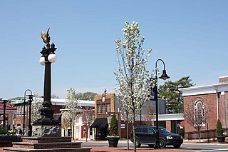
Middletown is a town in New Castle County, Delaware, United States. According to the 2021 Census, the population of the town is 24,164.

Odessa is a town in New Castle County, Delaware, United States. The population was 364 at the 2010 census. Founded as Cantwell's Bridge in the 18th century, the name was changed in the 19th century, after the Ukrainian port city of the same name. Today a significant part of the town is a historic district list on the National Register of Historic Places.

Townsend is a town in New Castle County, Delaware, United States. The population was 2,049 at the 2010 census, an increase of 492.2% from 2000. The center of population of Delaware is located in Townsend.

Blackbird Creek is a 16.9-mile-long (27.2 km) river in northern Delaware in the United States.
Brandywine Hundred is an unincorporated subdivision of New Castle County, Delaware, United States. It is located to the north and northeast of the city of Wilmington. Hundreds were once used as a basis for representation in the Delaware General Assembly. Brandywine Hundred and North Wilmington are commonly used colloquial names for this area. However, while their names still appear on all real estate transactions, all other hundreds in Delaware presently have no meaningful use or purpose except as a geographical point of reference. In the 2010 census, Brandywine had 77,182 people.
Christiana Hundred is an unincorporated subdivision of New Castle County, Delaware. Hundreds were once used as a basis for representation in the Delaware General Assembly, and while their names still appear on all real estate transactions, they presently have no meaningful use or purpose except as a geographical point of reference.
Mill Creek Hundred is an unincorporated subdivision of New Castle County, Delaware. Hundreds were once used as a basis for representation in the Delaware General Assembly, and while their names still appear on all real estate transactions, they presently have no meaningful use or purpose except as a geographical point of reference.
Blackbird Hundred is an unincorporated subdivision of New Castle County, Delaware. Hundreds were once used as a basis for representation in the Delaware General Assembly, and while their names still appear on all real estate transactions, they now have no purpose except as a geographical point of reference.
St. Georges Hundred is an unincorporated subdivision of New Castle County, Delaware. Hundreds were once used as a basis for representation in the Delaware General Assembly, and while their names still appear on all real estate transactions, they presently have no meaningful use or purpose except as a geographical point of reference.
Pencader Hundred is an unincorporated subdivision of New Castle County, Delaware. Hundreds were once used as a basis for representation in the Delaware General Assembly, and while their names still appear on all real estate transactions, they presently have no meaningful use or purpose except as a geographical point of reference. It is named after Pencader, Carmarthenshire, Wales.
Red Lion Hundred is an unincorporated subdivision of New Castle County, Delaware. Hundreds were once used as a basis for representation in the Delaware General Assembly, and while their names still appear on all real estate transactions, they presently have no meaningful use or purpose except as a geographical point of reference.
New Castle Hundred is an unincorporated subdivision of New Castle County, Delaware. Hundreds were once used as a basis for representation in the Delaware General Assembly, and while their names still appear on all real estate transactions, they presently have no meaningful use or purpose except as a geographical point of reference.
Wilmington Hundred is an unincorporated subdivision of New Castle County, Delaware. Hundreds were once used as a basis for representation in the Delaware General Assembly, and while their names still appear on all real estate transactions, they presently have no meaningful use or purpose except as a geographical point of reference.
White Clay Creek Hundred is an unincorporated subdivision of New Castle County, Delaware. Hundreds were once used as a basis for representation in the Delaware General Assembly, and while their names still appear on all real estate transactions, they presently have no meaningful use or purpose except as a geographical point of reference.

Delaware Route 20 (DE 20) is an east–west state highway in Sussex County, Delaware. Its western terminus is the Maryland state line in Reliance, where the road continues as Maryland Route 392 (MD 392). Its eastern terminus is DE 54 west of Fenwick Island. The route runs through rural areas of Sussex County and passes through the towns of Seaford, Millsboro, and Dagsboro. DE 20 intersects U.S. Route 13 (US 13) in Seaford, US 9 in Hardscrabble, US 113 and DE 24 in Millsboro, DE 26 in Dagsboro, and DE 17 in Roxana. DE 20 was originally created by 1936 to run from the Maryland border east to US 113 in Millsboro. By 1970, it was realigned to bypass Seaford. The route was extended east to DE 1 in Fenwick Island by 1994; however, the eastern terminus was cut back to DE 54 in 2005 to avoid the concurrency with that route.

Delaware Route 15 (DE 15) is a state highway in the U.S. state of Delaware. The route runs from DE 14 west of Milford in Kent County north to DE 71/DE 896 in Summit Bridge, New Castle County, just south of the Summit Bridge over the Chesapeake & Delaware Canal. DE 15 winds a path through many rural sections of Delaware, turning along many different roads. Most of the route, with the exception of the southern part of the route from Milford to Canterbury, runs to the west of U.S. Route 13 (US 13). DE 15 serves several cities and towns, including Wyoming, Dover, Clayton, and Middletown. The route intersects DE 12 near Felton, US 13 in Canterbury, DE 10 near Camden, DE 8 in Dover, DE 42 in Seven Hickories, DE 300 and DE 6 in the Clayton area, DE 299 in Middletown, and DE 286 near Summit Bridge.

Delaware Route 71 (DE 71) is a state highway in New Castle County, Delaware. The route runs from U.S. Route 13 (US 13) south of Townsend north to another intersection with US 13 in Tybouts Corner, traveling to the west of US 13 by way of Townsend, Middletown, and the Summit Bridge. The route runs concurrent with DE 896 from Mount Pleasant to just north of the Summit Bridge.

Delaware Route 299 (DE 299) is a 9.77-mile-long (15.72 km) state highway in New Castle County, Delaware. It runs from Maryland Route 282 (MD 282) at the Maryland state line east of Warwick, Maryland to DE 9 in Mathews Corners, traveling through Middletown and Odessa. The route intersects the U.S. Route 301 (US 301) toll road, DE 15, and DE 71 in Middletown, the DE 1 toll road east of Middletown, and US 13 in Odessa. The highway travels through a mix of suburban development and some farmland.
Delaware Bicycle Route 1 is a bicycle route that runs the north-south length of the U.S. state of Delaware, from the Maryland border in Fenwick Island, Sussex County north to the Pennsylvania border near Montchanin, New Castle County. The route passes through many Delaware scenes, including beaches, farmland, state parks, and towns. The route is the first of many signed bike routes planned in the state.
