Highland Acres, Delaware

Last updated
Highland Acres, Delaware
CDP
Kent County Delaware incorporated and unincorporated areas Highland Acres highlighted.svg
Location in Kent County and the state of Delaware.
USA Delaware location map.svg
Red pog.svg
Highland Acres
Location within the state of Delaware
Usa edcp location map.svg
Red pog.svg
Highland Acres
Highland Acres (the United States)
Coordinates: 39°07′15″N75°31′19″W / 39.12083°N 75.52194°W / 39.12083; -75.52194 Coordinates: 39°07′15″N75°31′19″W / 39.12083°N 75.52194°W / 39.12083; -75.52194
Country United States
State Delaware
County Kent
Area
[1]
  Total1.51 sq mi (3.93 km2)
  Land1.49 sq mi (3.87 km2)
  Water0.02 sq mi (0.06 km2)
Elevation
[2]
46 ft (14 m)
Population
 (2020)
  Total3,492
  Density2,340.48/sq mi (903.43/km2)
Time zone UTC-5 (Eastern (EST))
  Summer (DST) UTC-4 (EDT)
Area code(s) 302
FIPS code 10-34810
GNIS feature ID217510 [2]

Highland Acres is a census-designated place (CDP) in Kent County, Delaware, United States. It is part of the Dover, Delaware Metropolitan Statistical Area. The population was 3,459 at the 2010 census.

Contents

Geography

Highland Acres is located at 39°07′15″N75°31′19″W / 39.12083°N 75.52194°W / 39.12083; -75.52194 (39.1209458, -75.5218680). [3]

According to the United States Census Bureau, the CDP has a total area of 1.6 square miles (4.1 km2), of which 1.6 square miles (4.1 km2) is land and 0.04 square miles (0.10 km2) (2.50%) is water.

Demographics

Historical population
CensusPop.
1970 1,471
1980 2,994103.5%
1990 3,1515.2%
2000 3,3797.2%
2010 3,4592.4%
2020 3,4921.0%
U.S. Decennial Census [4]

As of the census [5] of 2000, there were 3,379 people, 1,254 households, and 1,005 families residing in the CDP. The population density was 2,162.9 inhabitants per square mile (835.1/km2). There were 1,293 housing units at an average density of 827.7 per square mile (319.6/km2). The racial makeup of the CDP was 82.84% White, 11.45% African American, 0.38% Native American, 2.57% Asian, 0.44% from other races, and 2.31% from two or more races. Hispanic or Latino of any race were 2.57% of the population.

There were 1,254 households, out of which 32.1% had children under the age of 18 living with them, 68.5% were married couples living together, 8.5% had a female householder with no husband present, and 19.8% were non-families. 16.6% of all households were made up of individuals, and 7.8% had someone living alone who was 65 years of age or older. The average household size was 2.69 and the average family size was 3.01.

In the CDP, the population was spread out, with 24.4% under the age of 18, 7.0% from 18 to 24, 23.8% from 25 to 44, 30.8% from 45 to 64, and 14.0% who were 65 years of age or older. The median age was 42 years. For every 100 females, there were 92.9 males. For every 100 females age 18 and over, there were 90.6 males.

The median income for a household in the CDP was $64,716, and the median income for a family was $71,974. Males had a median income of $42,841 versus $31,028 for females. The per capita income for the CDP was $27,013. About 4.6% of families and 5.6% of the population were below the poverty line, including 11.7% of those under age 18 and 4.6% of those age 65 or over.

Education

Highland Acres is located in the Caesar Rodney School District. [6] Residents north of West Lebanon Road are zoned to W. Reilly Brown Elementary School in Dover, and in turn those zoned to Brown are zoned to Fred Fifer III Middle School in Camden. Residents south of West Lebanon Road are zoned to Allen Frear Elementary School in Rising Sun-Lebanon and they in turn are zoned to Postlethwait Middle School, also in Rising Sun-Lebanon. [7] Caesar Rodney High School in Camden is the comprehensive high school for the entire district.

Related Research Articles

Kent County, Delaware County in Delaware, United States

Kent County is a county located in the central part of the U.S. state of Delaware. As of the 2010 census, the population was 162,310, making it the least populous county in Delaware. The county seat is Dover, the state capital of Delaware. It is named for Kent, an English county.

<span class="mw-page-title-main">Camden, Delaware</span> Town in Delaware, United States

Camden is a town in Kent County, Delaware, United States. It is part of the Dover, Delaware Metropolitan Statistical Area. The population was 3,464 at the 2010 census.

<span class="mw-page-title-main">Kent Acres, Delaware</span> CDP in Delaware, United States

Kent Acres is a census-designated place (CDP) in Kent County, Delaware, United States. It is part of the Dover, Delaware Metropolitan Statistical Area. The population was 1,890 at the 2010 census.

<span class="mw-page-title-main">Magnolia, Delaware</span> Town in Delaware, United States

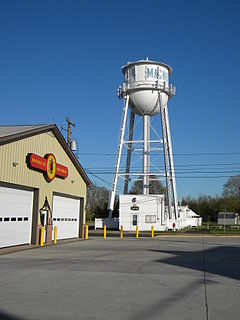
Magnolia is a town in Kent County, Delaware, United States. It is part of the Dover, Delaware Metropolitan Statistical Area. Recent estimates put the population at around 235, however, the population was 225 at the 2010 census.

<span class="mw-page-title-main">Riverview, Delaware</span> CDP in Delaware, United States

Riverview is a census-designated place (CDP) in Kent County, Delaware, United States. It is part of the Dover, Delaware Metropolitan Statistical Area. The population was 2,456 at the 2010 census.

<span class="mw-page-title-main">Rodney Village, Delaware</span> CDP in Delaware, United States

Rodney Village is a census-designated place (CDP) in Kent County, Delaware, United States. It is part of the Dover, Delaware Metropolitan Statistical Area. The population was 1,487 at the 2010 census.

<span class="mw-page-title-main">Woodside, Delaware</span> Town in Delaware, United States

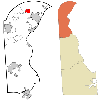
Woodside is a town in Kent County, Delaware, United States. It is part of the Dover, Delaware Metropolitan Statistical Area. The population was 181 at the 2010 census.

<span class="mw-page-title-main">Woodside East, Delaware</span> CDP in Delaware, United States

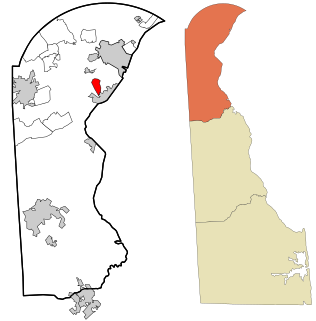
Woodside East is a census-designated place (CDP) in Kent County, Delaware, United States. It is part of the Dover, Delaware Metropolitan Statistical Area. The population was 2,316 at the 2010 census.

<span class="mw-page-title-main">Wyoming, Delaware</span> Town in Delaware, United States

Wyoming is a town in Kent County, Delaware, United States. It was named after the Wyoming Valley in Pennsylvania. It is part of the Dover, Delaware, Metropolitan Statistical Area. The population was 1,313 at the 2010 census.

<span class="mw-page-title-main">Brookside, Delaware</span> CDP in Delaware, United States

Brookside is a census-designated place (CDP) in New Castle County, Delaware, United States. The population was 14,353 at the 2010 census.

<span class="mw-page-title-main">Edgemoor, Delaware</span> CDP in Delaware, United States

Edgemoor is a census-designated place in New Castle County, Delaware, United States. The population was 5,677 at the 2010 census.

<span class="mw-page-title-main">Glasgow, Delaware</span> CDP in Delaware, United States

Glasgow is a census-designated place (CDP) in New Castle County, Delaware, United States. The population was 14,303 at the 2010 census.

<span class="mw-page-title-main">Greenville, Delaware</span> CDP in Delaware, United States

Greenville is a bedroom community in New Castle County, Delaware, United States, and a suburb of Wilmington. The population was 2,326 at the 2010 census. For statistical purposes, the United States Census Bureau has defined Greenville as a census-designated place (CDP). The community is also home to the private residence of Joe Biden, the current president of the United States, and many Du Pont family descendants.

Wilmington Manor, Delaware CDP in Delaware, United States

Wilmington Manor is a census-designated place (CDP) in north-eastern New Castle County, Delaware, United States. The population was 7,889 at the 2010 census.

<span class="mw-page-title-main">Rising Sun-Lebanon, Delaware</span> CDP in Delaware, United States

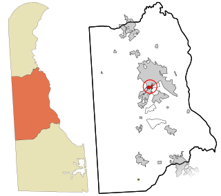
Rising Sun-Lebanon is a census-designated place (CDP) in Kent County, Delaware, United States. It is part of the Dover, Delaware Metropolitan Statistical Area. The population was 3,391 at the 2010 census.

Boles Acres, New Mexico CDP in New Mexico, United States

Boles Acres is a census-designated place (CDP) in Otero County, New Mexico, United States. The population was 1,638 at the 2010 census.

Shawnee Hills, Greene County, Ohio Census-designated place in Ohio, United States

Shawnee Hills is a census-designated place (CDP) in Greene County, Ohio, United States. Shawnee Hills consists of a planned community centered on the 250-acre (1.0 km2) Shawnee Lake. The population was 2,171 at the 2010 census, down from 2,355 at the 2000 census. It is part of the Dayton Metropolitan Statistical Area, and should not be confused with the incorporated village of Shawnee Hills in Delaware County.

Bell, Oklahoma Census-designated place in Oklahoma, United States

Bell is a census-designated place (CDP) in Adair County, Oklahoma, United States. The population was 535 at the 2010 census, an 11.1 percent decline from the figure of 602 recorded in 2000.

Highland Springs is a census-designated place (CDP) located in Henrico County, Virginia, United States, 4.3 miles (7 km) East of Richmond. The population was 16,604 at the 2020 census.

Highland Lakes, New Jersey Census-designated place in New Jersey, United States

Highland Lakes is an unincorporated community and census-designated place (CDP) located within Vernon Township, in Sussex County, New Jersey, United States. As of the 2010 United States Census, the CDP's population was 4,933. Highland Lakes has its own Post Office with the ZIP code 07422.

References

  1. "2020 U.S. Gazetteer Files". United States Census Bureau. Retrieved October 31, 2021.
  2. 1 2 U.S. Geological Survey Geographic Names Information System: Highland Acres, Delaware
  3. "US Gazetteer files: 2010, 2000, and 1990". United States Census Bureau. 2011-02-12. Retrieved 2011-04-23.
  4. "Census of Population and Housing". Census.gov. Retrieved June 4, 2016.
  5. "U.S. Census website". United States Census Bureau . Retrieved 2008-01-31.
  6. "2020 CENSUS - SCHOOL DISTRICT REFERENCE MAP: Kent County, DE" (PDF). U.S. Census Bureau . Retrieved 2021-06-16.
  7. "CRSD Map" (PDF). Caesar Rodney School District . Retrieved 2021-06-16.