Hillcrest Colony, South Dakota | |
|---|---|
 Hillcrest Colony  Hillcrest Colony | |
| Coordinates: 44°56′33″N97°40′02″W / 44.94250°N 97.66722°W | |
| Country | United States |
| State | South Dakota |
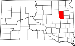
| County | Clark |
| Area | |
• Total | 1.00 sq mi (2.59 km2) |
| • Land | 1.00 sq mi (2.59 km2) |
| • Water | 0 sq mi (0.00 km2) |
| Elevation | 1,791 ft (546 m) |
| Population | |
• Total | 94 |
| • Density | 93.8/sq mi (36.22/km2) |
| Time zone | UTC-6 (Central (CST)) |
| • Summer (DST) | UTC-5 (CDT) |
| ZIP Code | 57236 (Garden City) |
| Area code | 605 |
| FIPS code | 46-29116 |
| GNIS feature ID | 2813006 [2] |
Hillcrest Colony is a Hutterite colony [4] and census-designated place (CDP) in Clark County, South Dakota, United States. The population was 94 at the 2020 census. [5] It was first listed as a CDP prior to the 2020 census. [2]
It is in the northeast part of the county, on the southeast side of Dry Lake Number 1, 9 miles (14 km) by road northeast of Clark, the county seat.