Willow Lake, South Dakota

Last updated

Willow Lake, South Dakota
City
Clark County South Dakota Incorporated and Unincorporated areas Willow Lake Highlighted.svg
Location in Clark County and the state of South Dakota
Coordinates: 44°37′40″N97°38′19″W / 44.62778°N 97.63861°W / 44.62778; -97.63861
CountryUnited States
State South Dakota
County Clark
Incorporated1910 [1]
Area
[2]
  Total0.38 sq mi (0.98 km2)
  Land0.37 sq mi (0.96 km2)
  Water0.00 sq mi (0.01 km2)
Elevation
[3]
1,778 ft (542 m)
Population
 (2020) [4]
  Total255
  Density685.48/sq mi (264.40/km2)
Time zone UTC-6 (Central (CST))
  Summer (DST) UTC-5 (CDT)
ZIP code
57278
Area code 605
FIPS code 46-71940 [5]
GNIS feature ID1267656 [3]

Willow Lake is a city in Clark County, South Dakota, United States. The population was 255 at the 2020 census. [6]

Contents

The city took its name from Willow Lake, a natural lake near the town site. [7]

Geography

According to the United States Census Bureau, the city has a total area of 0.37 square miles (0.96 km2), all land. [8]

Demographics

Historical population
CensusPop.Note
1890 240
1900 210−12.5%
1910 437108.1%
1920 4779.2%
1930 5147.8%
1940 427−16.9%
1950 48413.3%
1960 467−3.5%
1970 353−24.4%
1980 3756.2%
1990 317−15.5%
2000 294−7.3%
2010 263−10.5%
2020 255−3.0%
U.S. Decennial Census [9] [4]

2010 census

As of the census [10] of 2010, there were 263 people, 115 households, and 68 families residing in the city. The population density was 710.8 inhabitants per square mile (274.4/km2). There were 129 housing units at an average density of 348.6 per square mile (134.6/km2). The racial makeup of the city was 92.0% White, 7.2% from other races, and 0.8% from two or more races. Hispanic or Latino of any race were 8.0% of the population.

There were 115 households, of which 27.0% had children under the age of 18 living with them, 44.3% were married couples living together, 9.6% had a female householder with no husband present, 5.2% had a male householder with no wife present, and 40.9% were non-families. 37.4% of all households were made up of individuals, and 23.5% had someone living alone who was 65 years of age or older. The average household size was 2.29 and the average family size was 3.03.

The median age in the city was 42.2 years. 26.2% of residents were under the age of 18; 11.9% were between the ages of 18 and 24; 14.4% were from 25 to 44; 28.9% were from 45 to 64; and 18.6% were 65 years of age or older. The gender makeup of the city was 50.6% male and 49.4% female.

2000 census

As of the census [5] of 2000, there were 294 people, 126 households, and 75 families residing in the city. The population density was 793.7 inhabitants per square mile (306.4/km2). There were 148 housing units at an average density of 399.6 per square mile (154.3/km2). The racial makeup of the city was 93.88% White, 5.10% Native American, and 1.02% from two or more races.

There were 126 households, out of which 28.6% had children under the age of 18 living with them, 50.0% were married couples living together, 7.1% had a female householder with no husband present, and 39.7% were non-families. 37.3% of all households were made up of individuals, and 23.0% had someone living alone who was 65 years of age or older. The average household size was 2.33 and the average family size was 3.11.

In the city, the population was spread out, with 31.3% under the age of 18, 3.4% from 18 to 24, 21.1% from 25 to 44, 22.4% from 45 to 64, and 21.8% who were 65 years of age or older. The median age was 38 years. For every 100 females, there were 94.7 males. For every 100 females age 18 and over, there were 88.8 males.

The median income for a household in the city was $30,625, and the median income for a family was $34,750. Males had a median income of $25,250 versus $20,833 for females. The per capita income for the city was $13,585. About 13.6% of families and 20.1% of the population were below the poverty line, including 29.3% of those under the age of eighteen and 20.3% of those 65 or over.

Notable people

Related Research Articles

<span class="mw-page-title-main">Sargeant, Minnesota</span> City in Minnesota, United States

Sargeant is a city in Sargeant Township, Mower County, Minnesota, United States. The population was 61 at the 2010 census.

<span class="mw-page-title-main">Willow Lake Township, Redwood County, Minnesota</span> Township in Minnesota, United States

Willow Lake Township is one of the twenty-six townships of Redwood County, Minnesota, United States. The population was 247 at the 2000 census.

<span class="mw-page-title-main">Dakota, Minnesota</span> City in Minnesota, United States

Dakota is a city in Winona County, Minnesota, United States. The population was 295 at the 2020 census.

<span class="mw-page-title-main">Willow City, North Dakota</span> City in North Dakota, United States

Willow City is a city in Bottineau County, North Dakota, United States. The population was 149 at the 2020 census. Willow City was founded in 1887.

<span class="mw-page-title-main">Lakota, North Dakota</span> City in North Dakota, United States

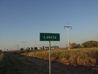
Lakota is a city in Nelson County, North Dakota, United States. It is the county seat of Nelson County Lakota is located 63 miles west of Grand Forks and 27 miles east of Devils Lake. The population was 683 at the 2020 census, making Lakota the 76th-largest city in North Dakota.

<span class="mw-page-title-main">White Lake, South Dakota</span> City in South Dakota, United States

White Lake is a city in western Aurora County, South Dakota, United States. The population was 394 at the 2020 census.

<span class="mw-page-title-main">Springfield, South Dakota</span> City in South Dakota, United States

Springfield is a city in Bon Homme County, South Dakota, United States. The population was 1,914 at the 2020 census. As of 2012, about 1,200 of the residents were inmates at Mike Durfee State Prison.

<span class="mw-page-title-main">White, South Dakota</span> City in South Dakota, United States

White is a city in Brookings County, South Dakota, United States. The population was 537 at the 2020 census.

<span class="mw-page-title-main">Lake Andes, South Dakota</span> City in South Dakota, United States

Lake Andes is a city in, and the county seat of, Charles Mix County, South Dakota, United States. The population was 710 at the 2020 census.

<span class="mw-page-title-main">Platte, South Dakota</span> City in South Dakota, United States

Platte is a city in Charles Mix County, South Dakota, United States. The population was 1,311 at the 2022 census. The community is named after the Platte Creek, a tributary of the Missouri River reservoir Lake Francis Case. Platte is located 15 miles east of Lake Francis Case on the Missouri River.

<span class="mw-page-title-main">Clear Lake, South Dakota</span> City in South Dakota, United States

Clear Lake is a city in and the county seat of Deuel County, South Dakota, United States. The population was 1,218 at the 2020 census.

<span class="mw-page-title-main">Lake Norden, South Dakota</span> City in South Dakota, United States

Lake Norden is a city in Hamlin County, South Dakota, United States. It is part of the Watertown, South Dakota Micropolitan Statistical Area. The population was 554 at the 2020 census.

<span class="mw-page-title-main">Miller, South Dakota</span> City in South Dakota, United States

Miller is a city in and county seat of Hand County, South Dakota, United States. The population was 1,349 at the 2020 census.

<span class="mw-page-title-main">Alexandria, South Dakota</span> City in South Dakota, United States

Alexandria is a city in central Hanson County, South Dakota, United States. The population was 649 at the 2020 census. It is the county seat of Hanson County.

<span class="mw-page-title-main">Wentworth, South Dakota</span> Village in South Dakota, United States

Wentworth is an incorporated village in Lake County, South Dakota, United States. It is the only incorporated village in the state of South Dakota. The population was 181 at the 2020 census.

<span class="mw-page-title-main">Lake City, South Dakota</span> Town in South Dakota, United States

Lake City is a town in Marshall County, South Dakota, United States. The population was 45 at the 2020 census. Fort Sisseton Historic State Park, whose fort is listed on the National Register of Historic Places, is located nearby.

<span class="mw-page-title-main">Crooks, South Dakota</span> City in South Dakota, United States

Crooks is a city in Minnehaha County, South Dakota, United States and is a suburb of Sioux Falls. The population was 1,362 at the 2020 census. Crooks was named New Hope until 1904. The town's present name honors W. A. Crooks, a local politician.

<span class="mw-page-title-main">Egan, South Dakota</span> City in South Dakota, United States

Egan is a city in Moody County, South Dakota, United States. The population was 241 at the 2020 census.

<span class="mw-page-title-main">Colonial Pine Hills, South Dakota</span> CDP in South Dakota, United States

Colonial Pine Hills is a census-designated place (CDP) and unincorporated community in Pennington County, South Dakota, United States. The population was 1,903 at the 2020 census.

<span class="mw-page-title-main">Elk Point, South Dakota</span> City in South Dakota, United States

Elk Point is a city in and county seat of Union County, South Dakota, United States. The population was 2,149 as of the 2020 census.

References

  1. "SD Towns" (PDF). South Dakota State Historical Society . Retrieved February 17, 2010.
  2. "ArcGIS REST Services Directory". United States Census Bureau. Retrieved October 15, 2022.
  3. 1 2 U.S. Geological Survey Geographic Names Information System: Willow Lake, South Dakota
  4. 1 2 "Census Population API". United States Census Bureau. Retrieved October 15, 2022.
  5. 1 2 "U.S. Census website". United States Census Bureau . Retrieved January 31, 2008.
  6. "U.S. Census Bureau: Willow Lake city, South Dakota". www.census.gov. United States Census Bureau. Retrieved April 16, 2022.
  7. Federal Writers' Project (1940). South Dakota place-names, v.1-3. University of South Dakota. p. 69.
  8. "US Gazetteer files 2010". United States Census Bureau . Retrieved June 21, 2012.
  9. "Census of Population and Housing". Census.gov. Retrieved June 4, 2015.
  10. "U.S. Census website". United States Census Bureau . Retrieved June 21, 2012.