Fall River County is a county in the U.S. state of South Dakota. As of the 2020 census, the population was 6,973. Its county seat is Hot Springs. The county was founded in 1883. It is named for Fall River which runs through it.

La Plant is a census-designated place (CDP) in Dewey County, South Dakota, United States. The population was 167 at the 2020 census. It is within the Cheyenne River Indian Reservation.

North Spearfish is a census-designated place (CDP) in Lawrence County, South Dakota, United States. The population was 2,366 at the 2020 census.

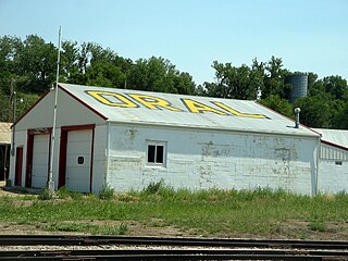
Oral is an unincorporated community and census-designated place (CDP) in Fall River County, South Dakota, United States. The population was 66 at the 2020 census.
Saint Onge is an unincorporated community and census-designated place (CDP) in Lawrence County, South Dakota, United States. As of the 2020 census, the population was 170.
Smithwick is an unincorporated community and census-designated place (CDP) in Fall River County, South Dakota, United States. The population was 39 at the 2020 census. Smithwick has been assigned the ZIP code of 57782.
Shindler is an unincorporated community and census-designated place (CDP) in Lincoln County, South Dakota, United States. The population was 607 at the 2020 census.
Maverick Junction, South Dakota, United States, is an unincorporated community and census-designated place (CDP) located in Fall River County at the intersection of South Dakota Highway 79 and US Highways 18 and 385, approximately five miles southeast of Hot Springs. The population was 46 at the 2020 census.

Lake Santee is an unincorporated town and census-designated place in Decatur and Franklin counties, Indiana, United States. As of the 2010 census, it had a population of 820.
Morningside is a census-designated place (CDP) in Beadle County, South Dakota, United States. The population was 70 at the 2020 census.

Running Water is a census-designated place (CDP) in Bon Homme County, South Dakota, United States. The population was 47 at the 2020 census.
Fort Covington is a census-designated place (CDP) within the town of Fort Covington, Franklin County, New York, United States. It consists of the hamlet of Fort Covington, as well as a large amount of rural land surrounding the hamlet, such that the CDP occupies about one half of the area within the town limits. The population of the CDP was 1,308 at the 2010 census, out of a total town population of 1,676.
Continental Courts is a mobile home park and census-designated place (CDP) in Centre County, Pennsylvania, United States. It was first listed as a CDP prior to the 2020 census.
Riverside Colony is a Hutterite colony and census-designated place (CDP) in Beadle County, South Dakota, United States. It was first listed as a CDP prior to the 2020 census. The population of the CDP was 72 at the 2020 census.
Platte Colony is a Hutterite colony and census-designated place (CDP) in Charles Mix County, South Dakota, United States. It was first listed as a CDP prior to the 2020 census. The population of the CDP was 299 at the 2020 census.
Dudley is an unincorporated community and census-designated place (CDP) in Fall River County, South Dakota, United States. The population was 28 at the 2020 census. It was first listed as a CDP prior to the 2020 census.
New Elm Spring Colony is a Hutterite colony and census-designated place (CDP) in Hutchinson County, South Dakota, United States. The population was 100 at the 2020 census. It was first listed as a CDP before the 2020 census.
Old Elm Spring Colony, formerly called the Old Elmspring Hutterite Colony, is a Hutterite colony and census-designated place (CDP) in Hutchinson County, South Dakota, United States. The population was 114 at the 2020 census. It was first listed as a CDP prior to the 2020 census.
Boulder Canyon is an unincorporated area and census-designated place (CDP) in Lawrence County, South Dakota, United States. The population was 561 at the 2020 census. It was first listed as a CDP prior to the 2020 census.
Spring Creek Colony is a census-designated place (CDP) and Hutterite colony in McPherson County, South Dakota, United States. It was first listed as a CDP prior to the 2020 census. The CDP had a population of 229 at the 2020 census.


