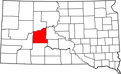
Milesville, South Dakota | |
|---|---|
| Coordinates: 44°27′29″N101°40′46″W / 44.45806°N 101.67944°W | |
| Country | United States |
| State | South Dakota |
| County | Haakon |
| Elevation | 2,356 ft (718 m) |
| Time zone | UTC-6 (Mountain (MST)) |
| • Summer (DST) | UTC-5 (MDT) |
| ZIP codes | 57553 |
| GNIS feature ID | 1256463 [1] |
Milesville is an unincorporated community in Haakon County, South Dakota, United States. [1] Population and other demographics are not reported by the Census Bureau. The village consists of one church, a veterinary clinic, and a volunteer fire department.
Milesville was laid out in 1905 by one Mr. Miles, and named for him. [2]


