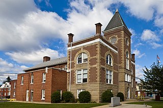
Mineral County is a county in the U.S. state of West Virginia. It is part of the Cumberland, MD-WV Metropolitan Statistical Area. As of the 2020 census, the population was 26,938. Its county seat is Keyser. The county was founded in 1866.

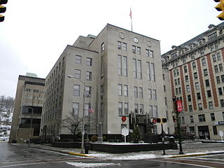
Harrison County is a county in the U.S. state of West Virginia. As of the 2020 census, the population was 65,921. Its county seat is Clarksburg.

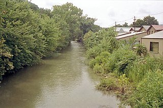
New Creek is an 18.4-mile-long (29.6 km) stream in eastern West Virginia, United States. It is the third major West Virginia tributary to the North Branch Potomac River. Via the Potomac, it is part of the watershed of Chesapeake Bay.

West Virginia's 2nd congressional district consists of the northern half of the state. It contains Barbour, Berkeley, Brooke, Doddridge, Grant, Hampshire, Hancock, Hardy, Harrison, Jefferson, Lewis, Marion, Marshall, Mineral, Monongalia, Morgan, Ohio, Pleasants, Preston, Randolph, Ritchie, Taylor, Tucker, Tyler, Upshur, Wetzel, and Wood counties.

Claysville is an unincorporated community in Mineral County, West Virginia, United States, located at the intersection of West Virginia Route 93 and U.S. Route 50. It is part of the Cumberland, MD-WV Metropolitan Statistical Area.

Blaine is an unincorporated community in Mineral County, West Virginia, United States. It is part of the Cumberland, MD-WV Metropolitan Statistical Area. It lies near the intersection of the North Branch Potomac River and West Virginia Route 42.

Ridgeville is an unincorporated community in Mineral County, West Virginia, United States. It lies along U.S. Routes 50 and 220 in the Mill Creek Valley, west of Markwood.
Gypsy is a census-designated place (CDP) in Harrison County, West Virginia, United States. As of the 2010 census, its population was 328.
Laurel Dale is an unincorporated community on New Creek in Mineral County, West Virginia, United States. Laurel Dale was established in 1878. The community is located along West Virginia Route 93.

Hartmansville is an unincorporated community in Mineral County, West Virginia, United States. It is part of the Cumberland, MD-WV Metropolitan Statistical Area. Hartmansville lies along the Northwestern Turnpike near the Grant County line.
Nethkin is an unincorporated community in Mineral County, West Virginia, United States. Nethkin lies to the east of Elk Garden.
Oakmont is an unincorporated community and coal town located in Mineral County, West Virginia, United States. Oakmont is located on Abram Creek.
Sulphur City is an unincorporated community in Mineral County, West Virginia, United States. Sulphur City is located along West Virginia Route 42.

Sweet Springs is an unincorporated community in Monroe County in the U.S. state of West Virginia. Sweet Springs lies at the intersection of West Virginia Route 3 and West Virginia Route 311.
Blue Sulphur Springs is an unincorporated community in Greenbrier County, West Virginia, United States. Blue Sulphur Springs is north of Alderson. It is named for a mineral spring near the original town site, distinguishing it from the larger and better-known White Sulphur Springs in the same county. It was the site of the Blue Sulphur Springs Resort, of which only the pavilion remains.
Wyatt is an unincorporated community in Harrison County, West Virginia, United States. Wyatt is 4 miles (6.4 km) north of Lumberport. Wyatt has a post office with ZIP code 26463.
Patterson Creek is an unincorporated community in Mineral County, West Virginia, United States. It lies at the northeastern end of the county, and is named for Patterson Creek, which empties into the North Branch Potomac River here.
Mineral City is an unincorporated community in Logan County, West Virginia, United States. Mineral City is located along Huff Creek and West Virginia Route 10, 3 miles (4.8 km) east of Man. It is part of the Mallory census-designated place.
Bristol is an unincorporated community in Harrison County, West Virginia, United States. It is located along U.S. Route 50 1.9 miles (3.1 km) east-northeast of Salem. Bristol had a post office, which closed on October 1, 2005.
Claysville may refer to several places in the United States:


