Related Research Articles

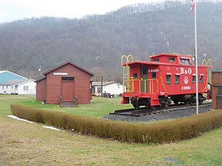
Piedmont is a town in Mineral County, West Virginia, United States. It is part of the Cumberland, MD-WV metropolitan statistical area. The population was 876 at the 2010 census. Piedmont was chartered in 1856 and the town is the subject of Colored People: A Memoir by Piedmont native Henry Louis Gates Jr.

Granville is a town in Monongalia County, West Virginia, United States. The population was 781 at the 2010 census. It is included in the Morgantown, West Virginia Metropolitan Statistical Area.

Star City is a town in Monongalia County, West Virginia, United States. The population was 1,825 at the 2010 census. It is included in the Morgantown, West Virginia Metropolitan Statistical Area.

Bruceton Mills is a town in Preston County, West Virginia, United States along Big Sandy Creek. The population was 85 at the 2010 census.

Masontown is a town in Preston County, West Virginia, United States. The population was 546 at the 2010 census.

Newburg is a town in Preston County, West Virginia, United States. The population was 329 at the 2010 census.

Reedsville is a town in Preston County, West Virginia, United States. The population was 593 at the 2010 census.
Rowlesburg is a former railroad town in Preston County, West Virginia, United States, along the Cheat River. Rowlesburg is on the National Register of Historic Places. The town is a Civil War Battle Site. The population was 584 at the 2010 census.
Tunnelton is a town in southwestern Preston County, West Virginia, United States. The population was 294 at the 2010 census.
Crum Lynne is an unincorporated community in Ridley Township, Delaware County, Pennsylvania, United States.
Chaffee is an extinct town in Mineral County, in the U.S. state of West Virginia. The GNIS classifies it as a populated place.
Foltz is an extinct town in Berkeley County, in the U.S. state of West Virginia.
Gladesville is an unincorporated community in Preston County, in the U.S. state of West Virginia.
Guseman is an unincorporated community in Preston County, in the U.S. state of West Virginia.
Jarvisville is an unincorporated community in Harrison County, in the U.S. state of West Virginia.
Palmer is an extinct town in Braxton County, in the U.S. state of West Virginia. The GNIS classifies it as a populated place.
Sardis is an unincorporated community in Sardis District, Harrison County, West Virginia, United States. It is situated near Katys Lick Creek.
Schell is an extinct town in Garnett County, Maryland and Mineral County, West Virginia, United States.
Vernon is an unincorporated community in Braxton County, in the U.S. state of West Virginia.
Wabash is a ghost town in Mineral County, in the U.S. state of West Virginia.
References
- ↑ "Post Offices". Jim Forte Postal History. Retrieved 2 May 2016.
- ↑ Kenny, Hamill (1945). West Virginia Place Names: Their Origin and Meaning, Including the Nomenclature of the Streams and Mountains. Piedmont, WV: The Place Name Press. p. 568.
- ↑ U.S. Geological Survey Geographic Names Information System: Shaw, West Virginia
https://www.mineralwv.org/history-shaw/
Municipalities and communities of Mineral County, West Virginia, United States | ||
|---|---|---|
| City |  | |
| Towns | ||
| CDPs | ||
| Other localities |
| |
| Ghost towns | ||
| Footnotes | ‡This populated place also has portions in an adjacent county or counties | |
Coordinates: 39°24′58″N79°07′50″W / 39.4162074°N 79.1305887°W
| | This article about a location in Mineral County, West Virginia is a stub. You can help Wikipedia by expanding it. |