Phoenixville Area School District

Last updated
Map of Chester County, Pennsylvania, public school districts. Phoenixville Area School District is in pink in the northeastern part of the county. Map of Chester County Pennsylvania School Districts.png
Map of Chester County, Pennsylvania, public school districts. Phoenixville Area School District is in pink in the northeastern part of the county.

The Phoenixville Area School District (PASD) is a public school district headquartered in Phoenixville, Pennsylvania. [1] The current superintendent is Mrs. Missy McTiernan.

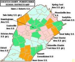
Located in Chester County, PASD serves Phoenixville, East Pikeland Township and Schuylkill Township. [2] The district contains six schools: Phoenixville Area Early Learning Center, Barkley Elementary, Manavon Elementary, Schuylkill Elementary, Phoenixville Area Middle School, and Phoenixville Area High School. The Phoenixville School District will also be opening a New Elementary School Currently Under Construction for the 2025-2026 School Year. The new elementary school is located in East Pikeland Township and will be named Seven Stars Elementary School.

Related Research Articles

<span class="mw-page-title-main">Chester County, Pennsylvania</span> County in Pennsylvania, United States

Chester County, colloquially referred to as Chesco, is a county in the Commonwealth of Pennsylvania. It is located in the Delaware Valley region, located in the southeastern part of the state. As of the 2020 census, the population was 545,823(As of 2022), increasing by 7.1% from 498,886 in 2010. The county seat is the Borough of West Chester. The most populous of its 73 municipalities is Tredyffrin Township. The most populous boroughs are West Chester and Phoenixville. Coatesville is the only municipality in the County organized under the City form of government, a technical rather than demographic distinction. Chester County was one of the three original Pennsylvania counties created by William Penn in 1682. It was named for Chester, England.

<span class="mw-page-title-main">East Pikeland Township, Pennsylvania</span> Township in Pennsylvania, United States

East Pikeland Township is a township in Chester County, Pennsylvania, United States. The population was 7,079 at the 2010 census.

<span class="mw-page-title-main">Phoenixville, Pennsylvania</span> Borough in Pennsylvania, United States

Phoenixville is a borough in Chester County, Pennsylvania, United States. It is located 28 miles (45 km) northwest of Philadelphia at the junction of French Creek and the Schuylkill River. It is in the Philadelphia metropolitan area. According to a 2022 estimate, the population was 19,354.

<span class="mw-page-title-main">Schuylkill Township, Chester County, Pennsylvania</span> Township in Pennsylvania, United States

Schuylkill Township is a township in Chester County, Pennsylvania, United States. It contains the village of Valley Forge. The population was 8,516 at the 2010 census.

<span class="mw-page-title-main">Uwchlan Township, Pennsylvania</span> Township in Pennsylvania, United States

Uwchlan Township is a township in Chester County, Pennsylvania, United States. The population was 19,161 at the 2020 census.

<span class="mw-page-title-main">Lower Providence Township, Pennsylvania</span> Township in Pennsylvania, United States

Lower Providence Township is a township in Montgomery County, Pennsylvania, United States. The township is located approximately 17 miles northwest of Philadelphia. The population was 25,625 at the 2020 census.

<span class="mw-page-title-main">Upper Merion Township, Pennsylvania</span> Township in Pennsylvania, United States of America

Upper Merion Township is a township in Montgomery County, Pennsylvania. The population was 33,613 at the 2020 U.S. Census. Located 16 miles (26 km) from Philadelphia, it consists of the villages of Gulph Mills, King of Prussia, Swedeland, Swedesburg, and portions of Radnor, and Wayne.

<span class="mw-page-title-main">Pennsylvania Route 29</span> State highway in Pennsylvania, US

Pennsylvania Route 29 is a 118-mile-long (190 km) north–south state highway that runs through most of eastern Pennsylvania.

<span class="mw-page-title-main">Pennsylvania Route 724</span> State highway in Pennsylvania, US

Pennsylvania Route 724 is a 30-mile (48 km) road in the U.S. commonwealth of Pennsylvania that runs from U.S. Route 422 in Sinking Spring southeast to PA 23 near Phoenixville. PA 724 travels through Berks and Chester counties. The route runs through the southern suburbs of Reading, passing through Shillington and Kenhorst. Past the Reading area, PA 724 continues southeast parallel to the Schuylkill River, passing through or near Birdsboro, Pottstown, and Spring City. The route intersects many roads including US 222 near Shillington, PA 10 and Interstate 176 (I-176) southeast of Reading, PA 345 in Birdsboro, and PA 100 and US 422 near Pottstown.

<span class="mw-page-title-main">Chester Springs, Pennsylvania</span> Unincorporated community in Pennsylvania, United States

Chester Springs is an unincorporated community in Chester County, Pennsylvania, United States. It is centered on West Pikeland Township, and extends into Charlestown Township, Upper Uwchlan Township, Wallace Township, East Nantmeal Township, and West Vincent Township. The Chester Springs Historic District is located in Chester Springs.

<span class="mw-page-title-main">French Creek (Schuylkill River tributary)</span>

French Creek, once known as Saukanac Creek, is a 22.6-mile-long (36.4 km) tributary of the Schuylkill River in Berks and Chester counties, Pennsylvania, in the United States. The water course was also known as the Vincent River, after Sir Mathias Vincent, who purchased land along it in Chester County in 1686.

<span class="mw-page-title-main">Pennsylvania Route 23</span> State highway in Pennsylvania, US

Pennsylvania Route 23 is an 81.14-mile-long (130.58 km) state highway in southeastern Pennsylvania. The route begins at PA 441 in Marietta and heads east to U.S. Route 1 at City Avenue on the border of Lower Merion Township and Philadelphia. PA 23 begins at Marietta in Lancaster County and continues east to Lancaster, where it passes through the city on a one-way pair of streets and intersects US 222 and US 30.

<span class="mw-page-title-main">Pennsylvania Route 401</span> State highway in Pennsylvania, US

Pennsylvania Route 401 is a 20.2-mile-long (32.5 km) east–west state route in Berks and Chester counties, located in southeast Pennsylvania. The western terminus is at PA 23 in Caernarvon Township, across the county line from Elverson. The eastern terminus is at U.S. Route 30 in East Whiteland Township, a short distance west of Malvern. PA 401 is called Conestoga Road its entire length and runs through rural areas with suburban development toward the eastern part of the route. PA 401 follows a former turnpike chartered in 1809 known as the Little Conestoga Turnpike. PA 401 was designated along Conestoga Road between PA 29 and US 30/PA 1 in 1928. The route was extended west to PA 23 in the 1930s, at which time the entire length was paved.

<span class="mw-page-title-main">Mont Clare, Pennsylvania</span> Census-designated place in Pennsylvania, United States

Mont Clare is a village in Upper Providence Township, Montgomery County, Pennsylvania. The village is located on the left bank of the Schuylkill River opposite Phoenixville and Chester County. Mont Clare is at the site of the former Jacobs' ford. Mont Clare hosts the only functional lock and one of only two remaining watered stretches of the Schuylkill Canal. Mont Clare was the birthplace of the infamous outlaw Sundance Kid. As of the 2020 United States census the population was 1,852.

<span class="mw-page-title-main">Pennsylvania Route 183</span> State highway in Pennsylvania, US

Pennsylvania Route 183 (PA 183) is a 31.7-mile-long (51.0 km) route that runs north to south in southeastern Pennsylvania. The southern terminus is at U.S. Route 422 Business in Reading in Berks County. Its northern terminus is at PA 61 near Schuylkill Haven in Schuylkill County. The road passes through developed areas near Reading before continuing north through rural areas, crossing from Berks County into Schuylkill County at Blue Mountain. PA 183 serves the communities of Bernville, Strausstown, and Cressona.

<span class="mw-page-title-main">Pennsylvania Route 113</span> State highway in Pennsylvania, US

Pennsylvania Route 113 is a 46.9-mile-long (75.5 km) state route in eastern Pennsylvania. The southern terminus of the route is at U.S. Route 30 Business in Downingtown. Its northern terminus is at PA 611 in Tinicum Township. The route is signed as north–south although its exact alignment follows a northeast-southwest routing. The route serves Chester, Montgomery, and Bucks counties, passing through Lionville, Phoenixville, Trappe, Skippack, Harleysville, Souderton, and Silverdale along the way.

Pennsylvania State Senate District 44 includes parts of Berks County, Chester County, and Montgomery County. It is currently represented by Democrat Katie Muth.

The 26th Pennsylvania House of Representatives District is in southeastern Pennsylvania and has been represented by Democrat Paul Friel since 2023.

Pickering Creek is a 15.3-mile-long (24.6 km) tributary of the Schuylkill River in Chester County, Pennsylvania.

<span class="mw-page-title-main">Katie Muth</span> American politician

Katie J. Muth is an American politician serving as a Democratic member of the Pennsylvania State Senate, representing the 44th District. Her district includes portions of northeastern Chester and southwestern Montgomery and southeastern Berks Counties. Muth serves in Senate Democratic Leadership as the Democratic Policy Committee Chair.

References

  1. "PHOENIXVILLE AREA SCHOOL DISTRICT DIRECTIONS TO ADMINISTRATION BUILDING [ permanent dead link ]." Phoenixville Area School District. Retrieved on February 23, 2012. "386 City Line Avenue, Phoenixville, PA 19460"
  2. "District Information [ permanent dead link ]." Phoenixville Area School District. Retrieved on February 23, 2012.