| Downingtown High School | |
|---|---|
| | |
| Information | |
| Type | Public secondary school |
| Established | 1874 2003 (split) |
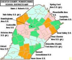
| School district | Downingtown Area School District |
| Principal | East: Paul Hurley III West: A. Kurt Barker |
| Grades | 9-12 |
| Enrollment | East: 1,721 West: 1,460 [1] |
| Campus | East: Uwchlan Township, PA 40°2′29.4″N75°39′40.0″W / 40.041500°N 75.661111°W West: Downingtown, PA 40°0′42.2″N75°43′8.3″W / 40.011722°N 75.718972°W |
| Colors | Blue and gold |
| Athletics | PIAA District 1 |
| Mascot | East: The Cougar West:The Whippets |
| Nickname | East: Cougars West: Whippets |
| Website | East West |
Downingtown High School is an American secondary school located in Downingtown, Pennsylvania and Uwchlan Township, Pennsylvania. Population growth in the burgeoning Downingtown Area School District forced the original Downingtown Senior High School [2] to split into two campuses: Downingtown High School East Campus and Downingtown High School West Campus. While still legally considered one school,[ citation needed ] the two campuses (usually referred to simply as "East" or "West") are generally regarded as separate entities.[ citation needed ]
Contents
The West Campus is located on the original high school's campus within Downingtown Borough. A portion of the campus is in Caln Township. [3] [4] [5]
The East Campus is actually located in Uwchlan Township. [6] It has an Exton postal address and is adjacent to, but not within, the Lionville census-designated place. [7] [8]
The mascot for Downingtown West is the whippet, the traditional Downingtown mascot; Downingtown East's is the cougar. Both schools' colors are blue and gold, a similarity that recalls that the two campuses were once one school. A healthy rivalry exists between Downingtown East and West. Both schools are known for athletics and have won titles in different sports.