Conewago Township is a township in York County, Pennsylvania, United States. The township encompasses the land between the Conewago Creek and the Little Conewago Creek, west of their conjunction. The township was formed in 1818 from the northeastern portion of Dover Township and the southeastern portion of Newberry Township and consists of approximately 11,000 acres. The population was 8,527 at the 2020 census.
Pine Creek is a tributary of Mahantango Creek in Schuylkill and Dauphin counties, Pennsylvania, in the United States. It is approximately 23.7 miles (38.1 km) long. The creek flows through Foster Township, Hegins Township, Hubley Township, and Upper Mahantango Township in Schuylkill County and Lykens Township in Dauphin County. The creek's watershed has an area of 76.8 square miles (199 km2) and its tributaries include Rausch Creek and Deep Creek. Pine Creek is considered by the Pennsylvania Department of Environmental Protection to be impaired by abandoned mine drainage and resource extraction. However, it is designated as a coldwater fishery.
Bermudian Creek is a 24.9-mile-long (40.1 km) tributary of Conewago Creek in Adams and York counties in Pennsylvania in the United States.

Wiconisco Creek is a tributary of the Susquehanna River in Schuylkill and Dauphin counties, Pennsylvania, in the United States. It is approximately 45.5 miles (73.2 km) long.
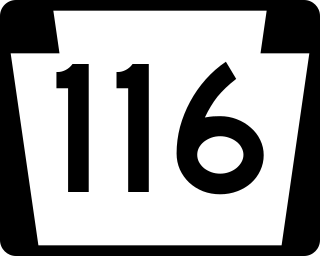
Pennsylvania Route 116 is an east–west route located Adams and York counties in southern Pennsylvania. The route begins at PA 16 in Carroll Valley in Adams County, heading northeast through rural areas and passing through Fairfield. PA 116 passes through the historic Civil War town of Gettysburg, where the Battle of Gettysburg was held. In Gettysburg, the route intersects U.S. Route 15 Business and US 30 in the town center. From Gettysburg, PA 116 heads southeast and comes to an interchange with the US 15 freeway in Straban Township as it heads into farmland and curves east. The route passes through Bonneauville and McSherrystown before it crosses into York County and heads into Hanover. Here, the route forms a concurrency with PA 194 and crosses PA 94 in the downtown area. PA 116 intersects PA 216 before it leaves Hanover and heads northeast through rural land. The route has an intersection with PA 516 near Spring Grove before it ends at US 30 in West Manchester Township, west of York.
Conewago Creek is a 23.0-mile-long (37.0 km) tributary of the Susquehanna River in Lebanon, Dauphin, and Lancaster counties in Pennsylvania in the United States. The source is at an elevation of 1,100 feet (340 m) at Mount Gretna Heights in Lebanon County. The mouth is the confluence with the Susquehanna River at an elevation of 261 feet (80 m) at the border of Dauphin and Lancaster counties, just south of Three Mile Island in the river and just north of the unincorporated village of Falmouth in Conoy Township, Lancaster County.

Conewago Creek is an 80.2-mile-long (129.1 km) tributary of the Susquehanna River in Adams and York counties in Pennsylvania in the United States, with its watershed also draining a small portion of Carroll County, Maryland. The source is at an elevation of 1,440 feet (440 m), east of Caledonia State Park, in Franklin Township in Adams County. The mouth is the confluence with the Susquehanna River at York Haven in York County at an elevation of 259 feet (79 m).

The New Birth of Freedom Council is a council of the Boy Scouts of America serving South-Central Pennsylvania. The council was formed by a merger of York-Adams Area Council and Keystone Area Council on April 1, 2010.
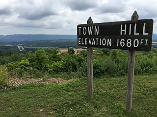
Town Hill is a mountain range that is located in Allegany County, Maryland and Bedford and Fulton counties in Pennsylvania.

The Little Schuylkill River is a 30.6-mile-long (49.2 km) tributary of the Schuylkill River in Northeastern Pennsylvania.

The Conewago Canal, on the west bank of the Susquehanna River below York Haven, Pennsylvania, 11 miles (18 km) south of Harrisburg in York County, enabled late 18th and early 19th century rivercraft to safely bypass rapids at Conewago Falls. Work on the canal of less than 1 mile (1.6 km) began in 1793 and was completed in 1797. Robert Morris, a Philadelphia financier, organized the project, which was carried out by chief engineer James Brindley, the nephew of a well-known British engineer of the same name. Two lift locks overcame 19 feet (6 m) of elevation between the ends of the canal, and a guard lock blocked unwanted water, particularly during floods. Cargo could go upstream as well as down. A boat going upriver could navigate the canal in 37 minutes compared to the whole day it would take 30 or 40 men to pull it upriver along the bank. York Haven is at 40°06′39″N76°42′57″W.

Detters Mill was a small 19th-century community in Dover Township, York County, Pennsylvania, United States, located 2.5 miles (4.0 km) south of Wellsville, and 17 miles (27 km) southwest of Harrisburg.
Little Conewago Creek is a 24.9-mile-long (40.1 km) tributary of Conewago Creek in York County, Pennsylvania in the United States.
Strinestown is an unincorporated community in Conewago Township, York County, Pennsylvania, United States.
The Gettysburg Formation is a mapped bedrock unit consisting primarily of sandstones, conglomerates, and shales.

Nescopeck Mountain is a ridge in Columbia County and Luzerne County, in Pennsylvania, in the United States. Its elevation is 1,594 feet (486 m) above sea level. The ridge is a forested ridge, with at least two types of forest and two systems of vernal pools. It is a very long and unbroken ridge with two water gaps: one carved by Catawissa Creek and one carved by Nescopeck Creek. This later gap was exploited as a transportation corridor with the construction of the Lausanne–Nescopeck Turnpike between the respective frontier communities at Lausanne Landing and Nescopeck in 1805 connecting the newly developing Wyoming Valley with Philadelphia and the Delaware River valley; cutting off over 100 miles between Philadelphia and Wilkes-Barre. Today's Route PA 93 derives from this historic pack mule road.

Buck Mountain is a mountain in Columbia County and Luzerne County, Pennsylvania, in the United States. Its elevation is 1,942 feet (592 m) above sea level. The mountain contains deposits of coal. Shale and conglomerate are also present. The coal on the mountain was historically mined, altering the landscape somewhat. It is most likely named after Albert Ansbach.
Pennsylvania State Game Lands Number 12 are Pennsylvania State Game Lands in Bradford County and Sullivan County, in Pennsylvania, in the United States. The game lands have an area of nearly 24,480 acres (9,910 ha) in Bradford County. The area is mainly mountainous and wooded and major streams in the area include Schrader Creek, Sugar Run, and Little Schrader Creek. Game animals within the game lands include black bear, gray squirrel, whitetail deer, and wild turkey. The main hardwood tree species include American basswood, American beech, black cherry, black birch, red maple, sugar maple, white ash, and aspen. The main conifer species include eastern hemlock, eastern larch, plantation Norway spruce, plantation red pine, and white pine.
Conewago Falls in Lancaster County, Pennsylvania, was a historic river barrier 12 miles (19 km) below and south of Harrisburg at a wide spot, where the river drops 19 feet (5.8 m) in 1⁄4 mile (0.40 km) along the lower Susquehanna River along either side of Three Mile Island. The falls between the west bank and the west side of the island were inundated-by-design years ago by construction of the York Haven Dam which, when it was completed in 1904, for a time became the third largest in the world. Today the Falls hides inside the Frederic Lake reservoir along the west side of the island.
Black Gut is a 1.4-mile-long (2.3 km) distributary connecting the Susquehanna River to Hartman Run in York County, Pennsylvania in the United States.