Wyalusing Township, Pennsylvania

Last updated

Wyalusing Township,
Pennsylvania
Township
Wyalusing Rocks, Bradford County.jpg
View from Wyalusing Rocks
Map of Wyalusing Township, Bradford County, Pennsylvania Highlighted.png
Map of Bradford County with Wyalusing Township highlighted
Map of Pennsylvania highlighting Bradford County.svg
Map of Bradford County, Pennsylvania
Country United States
State Pennsylvania
County Bradford
Settled1773
Incorporated1790
Area
[1]
  Total28.82 sq mi (74.64 km2)
  Land27.93 sq mi (72.34 km2)
  Water0.89 sq mi (2.30 km2)
Population
 (2010)
  Total1,242
  Estimate 
(2016) [2]
1,230
  Density44.04/sq mi (17.00/km2)
Area code 570
FIPS code 42-015-86664

Wyalusing Township is a township in Bradford County, Pennsylvania. It is part of Northeastern Pennsylvania. The population was 1,242 at the 2010 census. [3]

Contents

History

The Ellen and Charles F. Welles House was added to the National Register of Historic Places in 1999. [4]

Geography

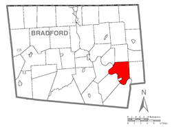
Wyalusing Township is located in southeast Bradford County, along the northeast bank of the Susquehanna River. It is bordered by Standing Stone Township to the northwest, Herrick Township to the north, Stevens Township to the northeast, and Tuscarora Township to the east. Across the Susquehanna River are Wilmot Township to the south, Terry Township to the southwest, and Asylum Township to the west. The borough of Wyalusing lies along the river on the Terry Township border but is separate from Wyalusing Township. The unincorporated community of Camptown is in the northeast part of the township, and Browntown is in the south.

According to the United States Census Bureau, the township has a total area of 28.8 square miles (74.6 km2), of which 27.9 square miles (72.3 km2) is land and 0.89 square miles (2.3 km2), or 3.08%, is water. [3] Wyalusing Creek flows from north to south through the eastern part of the township, into the Susquehanna River.

Demographics

Historical population
CensusPop.Note
2010 1,242
2016 (est.)1,230 [2] −1.0%
U.S. Decennial Census [5]

As of the census [6] of 2000, there were 1,341 people, 495 households, and 357 families residing in the township. The population density was 47.8 inhabitants per square mile (18.5/km2). There were 573 housing units at an average density of 20.4/sq mi (7.9/km2). The racial makeup of the township was 97.02% White, 0.15% African American, 0.30% Native American, 0.15% Asian, 0.22% from other races, and 2.16% from two or more races. Hispanic or Latino of any race were 1.19% of the population.

There were 495 households, out of which 34.3% had children under the age of 18 living with them, 61.0% were married couples living together, 6.7% had a female householder with no husband present, and 27.7% were non-families. 22.4% of all households were made up of individuals, and 10.9% had someone living alone who was 65 years of age or older. The average household size was 2.60 and the average family size was 3.04.

In the township the population was spread out, with 25.4% under the age of 18, 6.9% from 18 to 24, 25.7% from 25 to 44, 26.0% from 45 to 64, and 16.1% who were 65 years of age or older. The median age was 39 years. For every 100 females, there were 95.8 males. For every 100 females age 18 and over, there were 92.3 males.

The median income for a household in the township was $37,222, and the median income for a family was $44,205. Males had a median income of $34,038 versus $25,526 for females. The per capita income for the township was $17,165. About 12.0% of families and 14.4% of the population were below the poverty line, including 22.0% of those under age 18 and 11.2% of those age 65 or over.

See also

Related Research Articles

<span class="mw-page-title-main">Asylum Township, Pennsylvania</span> Township in Pennsylvania, United States

Asylum Township is a township in Bradford County, Pennsylvania, United States. It is part of Northeastern Pennsylvania. The population was 999 at the 2020 census. The town contains the historic site of French Azilum.

<span class="mw-page-title-main">Athens Township, Bradford County, Pennsylvania</span> Township in Pennsylvania, United States

Athens Township is a township in Bradford County, Pennsylvania, United States. It is part of Northeastern Pennsylvania. The population was 5,198 at the 2020 census.

<span class="mw-page-title-main">Burlington Township, Pennsylvania</span> Township in Pennsylvania, United States

Burlington Township is a township in Bradford County, Pennsylvania, United States. It is part of Northeastern Pennsylvania. The population was 791 at the 2010 census. Children residing in the township are assigned to attend the Troy Area School District.

<span class="mw-page-title-main">Franklin Township, Bradford County, Pennsylvania</span> Township in Pennsylvania, United States

Franklin Township is a township in Bradford County, Pennsylvania, United States. It is part of Northeastern Pennsylvania. The population was 723 at the 2010 census.

<span class="mw-page-title-main">Herrick Township, Bradford County, Pennsylvania</span> Township in Pennsylvania, United States

Herrick Township is a township in Bradford County, Pennsylvania, United States. It is part of Northeastern Pennsylvania. The population was 754 at the 2010 census. For years it was known for a chair sitting on a fence post as you entered the town from the south on route 1017.

<span class="mw-page-title-main">Leroy Township, Bradford County, Pennsylvania</span> Township in Pennsylvania, United States

LeRoy Township is a township in Bradford County, Pennsylvania, United States. It is part of Northeastern Pennsylvania. The population was 718 at the 2010 census.

<span class="mw-page-title-main">North Towanda Township, Pennsylvania</span> Township in Pennsylvania, United States

North Towanda Township is a township in Bradford County, Pennsylvania, United States. It is part of Northeastern Pennsylvania. The population was 1,132 at the 2010 census.

<span class="mw-page-title-main">Sheshequin Township, Pennsylvania</span> Township in Pennsylvania, United States

Sheshequin Township is a township in Bradford County, Pennsylvania, United States. It is part of Northeastern Pennsylvania. The population was 1,348 at the 2010 census.

<span class="mw-page-title-main">South Creek Township, Pennsylvania</span> Township in Pennsylvania, United States

South Creek Township is a township in Bradford County, Pennsylvania, United States. The population was 1,128 at the 2010 census. Children residing in the township are assigned to attend the Troy Area School District.

<span class="mw-page-title-main">Standing Stone Township, Pennsylvania</span> Township in Pennsylvania, United States

Standing Stone Township is a township in Bradford County, Pennsylvania, United States. The population was 642 at the 2010 census.

<span class="mw-page-title-main">Stevens Township, Pennsylvania</span> Township in Pennsylvania, United States

Stevens Township is a township in Bradford County, Pennsylvania, United States. The population was 437 at the 2010 census.

<span class="mw-page-title-main">Terry Township, Pennsylvania</span> Township in Pennsylvania, United States

Terry Township is a township in Bradford County, Pennsylvania. The population was 992 at the 2010 census.

<span class="mw-page-title-main">Towanda Township, Pennsylvania</span> Township in Pennsylvania, United States

Towanda Township is a township in Bradford County, Pennsylvania, United States. It is part of Northeastern Pennsylvania. The population was 1,149 at the 2010 census.

<span class="mw-page-title-main">Tuscarora Township, Bradford County, Pennsylvania</span> Township in Pennsylvania, United States

Tuscarora Township is a township in Bradford County, Pennsylvania. It is part of Northeastern Pennsylvania. The population was 1,131 at the 2010 census.

<span class="mw-page-title-main">Ulster Township, Pennsylvania</span> Township in Pennsylvania, United States

Ulster Township is a township in Bradford County, Pennsylvania. It is part of Northeastern Pennsylvania. The population was 1,337 at the 2010 census.

<span class="mw-page-title-main">Wilmot Township, Pennsylvania</span> Township in Pennsylvania, United States

Wilmot Township is a township in Bradford County, Pennsylvania. It is part of Northeastern Pennsylvania. The population was 1,204 at the 2010 census.

<span class="mw-page-title-main">Windham Township, Bradford County, Pennsylvania</span> Township in Pennsylvania, United States

Windham Township is a township in Bradford County, Pennsylvania, USA. It is part of Northeastern Pennsylvania. The population was 818 at the 2020 census.

<span class="mw-page-title-main">Wyalusing, Pennsylvania</span> Borough in Pennsylvania, United States

Wyalusing is a borough in Bradford County, Pennsylvania, United States. It is part of Northeastern Pennsylvania. The population was 596 as of the 2010 census.

<span class="mw-page-title-main">Wysox Township, Pennsylvania</span> Township in Pennsylvania, United States

Wysox Township is a township in Bradford County, Pennsylvania. It is part of Northeastern Pennsylvania. The population was 1,721 at the 2010 census.

<span class="mw-page-title-main">East Pennsboro Township, Cumberland County, Pennsylvania</span> Township in Pennsylvania, United States

East Pennsboro Township is a township in Cumberland County, Pennsylvania, United States. The population was 20,228 at the 2010 census, up from 18,254 at the 2000 census. East Pennsboro is the second most populous municipality in Cumberland County. The township is located along the western banks of the Susquehanna River, across from Harrisburg. There are many large corporations based in East Pennsboro Township that use the Camp Hill postal address, including the Rite Aid Corporation and Gannett Fleming.

References

  1. "2016 U.S. Gazetteer Files". United States Census Bureau. Retrieved August 13, 2017.
  2. 1 2 "Population and Housing Unit Estimates" . Retrieved June 9, 2017.
  3. 1 2 "Geographic Identifiers: 2010 Demographic Profile Data (G001): Wyalusing township, Bradford County, Pennsylvania". U.S. Census Bureau, American Factfinder. Archived from the original on February 12, 2020. Retrieved March 21, 2014.
  4. "National Register Information System". National Register of Historic Places . National Park Service. July 9, 2010.
  5. "Census of Population and Housing". Census.gov. Retrieved June 4, 2016.
  6. "U.S. Census website". United States Census Bureau . Retrieved January 31, 2008.

41°42′33″N76°15′10″W / 41.70917°N 76.25278°W / 41.70917; -76.25278