Armenia Township, Pennsylvania

Last updated

Armenia Township, Pennsylvania
Armenia Township Roadside View.jpg
A view of the township from Tioga State Forest
Map of Armenia Township, Bradford County, Pennsylvania Highlighted.png
Map of Bradford County with Armenia Township highlighted
Map of Pennsylvania highlighting Bradford County.svg
Map of Bradford County, Pennsylvania
Country United States
State Pennsylvania
County Bradford
Settled1808
Incorporated1843
Area
[1]
  Total18.41 sq mi (47.68 km2)
  Land18.29 sq mi (47.37 km2)
  Water0.12 sq mi (0.32 km2)
Population
 (2020) [2]
  Total206 Increase2.svg
  Estimate 
(2021) [2]
203
  Density9.68/sq mi (3.74/km2)
FIPS code 42-015-03056
1970 Donald and Charles Bristol drowned to death in Tamarack swamp

Armenia Township is a township in Bradford County, Pennsylvania, United States. It is part of Northeastern Pennsylvania. The population was 206 at the 2020 census. [2]

Contents

Geography

Armenia Township is located in western Bradford County, atop the eastern end of Armenia Mountain, a 2,200-to-2,400-foot-high (670 to 730 m) plateau that rises 1,000 feet (300 m) above the surrounding countryside. Tioga State Forest occupies much of the southern part of the township.

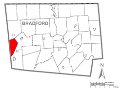
Armenia Township is bordered by Columbia Township to the north, Troy Township to the east, and Canton Township to the southeast. To the west, in Tioga County, are Ward Township and Sullivan Township.

According to the U.S. Census Bureau, Armenia Township has a total area of 18.4 square miles (47.7 km2), of which 18.3 square miles (47.4 km2) is land and 0.12 square miles (0.3 km2), or 0.67%, is water. [3]

Demographics

Historical population
CensusPop.Note
2010 180
2020 20513.9%
2021 (est.)203 [2] −1.0%
U.S. Decennial Census [4]

As of the census [5] of 2000, there were 166 people, 65 households, and 44 families residing in the township. The population density was 9.2 people per square mile (3.5/km2). There were 155 housing units at an average density of 8.6/sq mi (3.3/km2). The racial makeup of the township was 100.00% White.

There were 65 households, out of which 26.2% had children under the age of 18 living with them, 63.1% were married couples living together, 4.6% had a female householder with no husband present, and 30.8% were non-families. 26.2% of all households were made up of individuals, and 13.8% had someone living alone who was 65 years of age or older. The average household size was 2.55 and the average family size was 3.13.

In the township the population was spread out, with 22.9% under the age of 18, 8.4% from 18 to 24, 24.1% from 25 to 44, 28.3% from 45 to 64, and 16.3% who were 65 years of age or older. The median age was 42 years. For every 100 females, there were 88.6 males. For every 100 females age 18 and over, there were 103.2 males.

The median income for a household in the township was $28,333, and the median income for a family was $32,813. Males had a median income of $25,625 versus $14,821 for females. The per capita income for the township was $13,005. About 7.8% of families and 12.1% of the population were below the poverty line, including 27.0% of those under the age of eighteen and none of those sixty five or over.

See also

Related Research Articles

<span class="mw-page-title-main">Athens, Pennsylvania</span> Borough in Pennsylvania, United States

Athens is a borough in Bradford County, Pennsylvania, United States. It is part of Northeastern Pennsylvania and is located 2 miles (3 km) south of the New York state line on the Susquehanna and Chemung rivers. The population was 3,749 in 1900 and 3,796 in 1910. The population was 3,265 at the 2020 census. Athens is in a small area locally known as "The Valley", a group of four contiguous communities in Pennsylvania and New York: Waverly, New York; South Waverly, Pennsylvania; Sayre, Pennsylvania; and Athens. The Valley has a population near 30,000.

<span class="mw-page-title-main">Athens Township, Bradford County, Pennsylvania</span> Township in Pennsylvania, United States

Athens Township is a township in Bradford County, Pennsylvania, United States. It is part of Northeastern Pennsylvania. The population was 5,198 at the 2020 census.

<span class="mw-page-title-main">Canton Township, Bradford County, Pennsylvania</span> Township in Pennsylvania, United States

Canton Township is a township in Bradford County, Pennsylvania, United States. It is part of Northeastern Pennsylvania. The population was 2,143 at the 2010 census.

<span class="mw-page-title-main">Columbia Township, Bradford County, Pennsylvania</span> Township in Pennsylvania, United States

Columbia Township is a township in Bradford County, Pennsylvania, United States. It is part of Northeastern Pennsylvania. The population was 1,196 at the 2010 census. Children residing in the township are assigned to attend the Troy Area School District.

<span class="mw-page-title-main">Herrick Township, Bradford County, Pennsylvania</span> Township in Pennsylvania, United States

Herrick Township is a township in Bradford County, Pennsylvania, United States. It is part of Northeastern Pennsylvania. The population was 754 at the 2010 census. For years it was known for a chair sitting on a fence post as you entered the town from the south on route 1017.

<span class="mw-page-title-main">Litchfield Township, Bradford County, Pennsylvania</span> Township in Pennsylvania, United States

Litchfield Township is a township in Bradford County, Pennsylvania, United States. It is part of Northeastern Pennsylvania. As of the 2010 census it had a population of 1,320.

<span class="mw-page-title-main">Ridgebury Township, Pennsylvania</span> Township in Pennsylvania, United States

Ridgebury Township is a township in Bradford County, Pennsylvania, United States. It is part of Northeastern Pennsylvania. The population was 1,978 at the 2010 census.

<span class="mw-page-title-main">Troy Township, Bradford County, Pennsylvania</span> Township in Pennsylvania, United States

Troy Township is a township in Bradford County, Pennsylvania. It is part of Northeastern Pennsylvania. The population was 1,645 at the 2010 census. Children residing in the township are assigned to attend the Troy Area School District.

<span class="mw-page-title-main">Warren Township, Bradford County, Pennsylvania</span> Township in Pennsylvania, United States

Warren Township is a township in Bradford County, Pennsylvania. It is part of Northeastern Pennsylvania. The population was 959 at the 2010 census.

<span class="mw-page-title-main">Wells Township, Bradford County, Pennsylvania</span> Township in Pennsylvania, United States

Wells Township is a township in Bradford County, Pennsylvania. It is part of Northeastern Pennsylvania. The population was 814 at the 2010 census.

<span class="mw-page-title-main">Windham Township, Bradford County, Pennsylvania</span> Township in Pennsylvania, United States

Windham Township is a township in Bradford County, Pennsylvania, USA. It is part of Northeastern Pennsylvania. The population was 818 at the 2020 census.

<span class="mw-page-title-main">Wysox Township, Pennsylvania</span> Township in Pennsylvania, United States

Wysox Township is a township in Bradford County, Pennsylvania. It is part of Northeastern Pennsylvania. The population was 1,721 at the 2010 census.

<span class="mw-page-title-main">Genesee Township, Potter County, Pennsylvania</span> Township in Pennsylvania, United States

Genesee Township is a township in Potter County, Pennsylvania, United States and lies near the source of the Genesee River. The population was 729 at the 2020 census. The name Genesee derives from Indian term for "beautiful valley".

<span class="mw-page-title-main">Butler Township, Schuylkill County, Pennsylvania</span> Township in Pennsylvania, United States

Butler Township is a township in Schuylkill County, Pennsylvania, United States. Formed in 1848 from part of Barry Township, it is named for war hero William Orlando Butler.

<span class="mw-page-title-main">Jackson Township, Tioga County, Pennsylvania</span> Township in Pennsylvania, United States

Jackson Township is a township in Tioga County, Pennsylvania, United States. The population was 1,880 at the 2020 census.

<span class="mw-page-title-main">Rutland Township, Pennsylvania</span> Township in Pennsylvania, United States

Rutland Township is a township in Tioga County, Pennsylvania, United States. The population was 776 at the 2020 census.

<span class="mw-page-title-main">Sullivan Township, Pennsylvania</span> Township in Pennsylvania, United States

Sullivan Township is a township in Tioga County, Pennsylvania, United States. The population was 1,470 at the 2020 census.

<span class="mw-page-title-main">Union Township, Tioga County, Pennsylvania</span> Township in Pennsylvania, United States

Union Township is a township in Tioga County, Pennsylvania, United States. The population was 947 at the 2020 census.

<span class="mw-page-title-main">Ward Township, Pennsylvania</span> Township in Pennsylvania, United States

Ward Township is a township in Tioga County, Pennsylvania, United States. The population was 223 at the 2020 census. It is the only township in Tioga County that is not in Pennsylvania's 5th congressional district, instead being located in the 10th.

<span class="mw-page-title-main">Union Township, Union County, Pennsylvania</span> Township in Pennsylvania, United States

Union Township is a township in Union County, Pennsylvania, United States. The population was 1,604 at the 2020 census. Part of Shikellamy State Park is in Union Township.

References

  1. "2016 U.S. Gazetteer Files". United States Census Bureau. Retrieved August 13, 2017.
  2. 1 2 3 4 Bureau, US Census. "City and Town Population Totals: 2020—2021". Census.gov. US Census Bureau. Retrieved August 6, 2022.
  3. "Geographic Identifiers: 2010 Demographic Profile Data (G001): Armenia township, Bradford County, Pennsylvania". U.S. Census Bureau, American Factfinder. Archived from the original on February 12, 2020. Retrieved March 17, 2014.
  4. "Census of Population and Housing". Census.gov. Retrieved June 4, 2016.
  5. "U.S. Census website". United States Census Bureau . Retrieved January 31, 2008.

2

41°46′00″N76°51′59″W / 41.76667°N 76.86639°W / 41.76667; -76.86639