
Bowers is a town in Kent County, Delaware, United States. It is part of the Dover, Delaware Metropolitan Statistical Area. According to the 2010 Census, the population of the city is 335.
Frederica is a town in Kent County, Delaware, United States. It is part of the Dover, Delaware Metropolitan Statistical Area. The population was 774 at the 2010 census. ILC Dover, the company which manufactured the spacesuits for the Apollo and Skylab astronauts of the 1960s and 1970s, along with fabricating the suit component of the Space Shuttle's Extravehicular Mobility Unit (EMU), is located nearby.

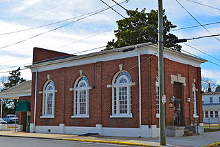
Leipsic is a town in Kent County, Delaware, United States. It is part of the Dover, Delaware Metropolitan Statistical Area. The population was 183 at the 2010 census.
Marple Township is a township in Delaware County, Pennsylvania, United States. It contains the census designated place of Broomall. The population was 23,743 at 2015. ZIP codes include mainly 19008, but also partially 19064 and 19063. The township is run by Marple Township board of commissioners.

Blackbird Creek is a 16.9-mile-long (27.2 km) river in northern Delaware in the United States.
U.S. Route 113 (US 113) is a spur of US 13 in the U.S. states of Maryland and Delaware. The U.S. Highway runs 74.75 miles (120.30 km) from US 13 in Pocomoke City, Maryland north to Delaware Route 1 (DE 1) in Milford, Delaware. In conjunction with DE 1, US 113 is one of two major north–south highways on the Delmarva Peninsula that connect Dover with Pocomoke City and the Eastern Shore of Virginia. The U.S. Highway is the primary north–south highway in Worcester County, Maryland, where it connects Pocomoke City with Snow Hill and Berlin. US 113 is one of three major north–south highways in Sussex County, Delaware, where it connects Selbyville, Millsboro, and Georgetown with Milford. While US 113 does not pass through Ocean City or the Delaware Beaches, the U.S. Highway intersects several highways that serve the Atlantic seaboard resorts, including US 50, Maryland Route 90 (MD 90), US 9, DE 404, and DE 1. US 113 is a four-lane divided highway for its whole length.
Delaware Route 9 (DE 9) is a 57.83-mile (93.07 km) state highway that runs from DE 1 at the Dover Air Force Base in Kent County north to DE 2 in the city of Wilmington in New Castle County. DE 9 is a designated scenic highway known as the Delaware Bayshore Byway south of New Castle, running through mostly rural areas to the west of the Delaware Bay and the Delaware River as a two-lane undivided road. Between New Castle and Wilmington, DE 9 is a four-lane road that runs through urban and suburban areas. DE 9 passes through several cities and towns including Little Creek, Leipsic, Port Penn, Delaware City, and New Castle. DE 9 has a suffixed route, DE 9A, that provides access to the Port of Wilmington. In addition, it has a truck route, DE 9 Truck, located to the south of New Castle.

Delaware Route 23 (DE 23) is a 14.76-mile-long (23.75 km) state highway in Sussex County, Delaware. Its southern terminus is at Massey's Landing in Long Neck, near the confluence of Rehoboth Bay and Indian River Bay and its northern terminus is at the Five Points intersection, where it ends at U.S. Route 9 (US 9), DE 1, and DE 404. From the southern terminus, the route runs west through residential areas of Long Neck before heading north through rural areas with some development. DE 23 is concurrent with DE 5 between the DE 24 intersection in Long Neck and Fairmount. It is also concurrent with DE 24 Alternate between Hollymount and the DE 1D intersection in Five Points. The road was designated as part of DE 22 south of Fairmount for a short time in the 1930s, with DE 5 designated along the stretch between DE 24 and Fairmount by 1938; the remainder of the road was unnumbered. The road was fully paved by 1970. The DE 23 designation was assigned by 1994.

Bellevue is an unincorporated community in New Castle County, Delaware, United States. Bellevue is located along U.S. Route 13 on the west bank of the Delaware River between Edgemoor and Claymont.
Blue Ball is an unincorporated community in New Castle County, Delaware, United States. Blue Ball is located at the junction of U.S. Route 202, Delaware Route 141, and Delaware Route 261 north of Wilmington.

Woodland Beach is an unincorporated community in Kent County, Delaware, United States. Woodland Beach is along the Delaware Bay east of Smyrna at the eastern terminus of Delaware Route 6. The Woodland Beach Wildlife Area is located in Woodland Beach.
Kitts Hummock is an unincorporated community in Kent County, Delaware, United States. Kitts Hummock is located on the Delaware Bay at the end of Kitts Hummock Road southeast of Dover. It was originally named "Kidds Hammock" after 17th Century pirate Captain William Kidd and rumors he buried treasure there. The "Hammock" referred to is the ecological version, meaning a stand of hardwood trees, and the name was inadvertently changed by employees of the Delaware Department of Transportation. A hummock is a similar rise in elevation, leading some to believe the reasoning behind the name.

South Bowers is an unincorporated community in Kent County, Delaware, United States. South Bowers is located on the Delaware Bay on the south side of the Murderkill River opposite Bowers. It was a part of the James D. Sipple home farm containing 421 acres of upland, marsh and beachland and he subdivided a small part of the farm into the lots comprising South Bowers before he died in 1890. His son, James H. Sipple acquired the interests of his siblings and conveyed the farm to his daughter, Sarah E. Webb in 1920.The Webb family are in ownership of this land to this day.
Cedar Beach is an unincorporated community in Sussex County, Delaware, United States. Cedar Beach is located along the Delaware Bay at the east end of Delaware Route 36 north of Slaughter Beach.
Port Mahon is an unincorporated community in Kent County, Delaware, United States. Port Mahon is located along the Delaware Bay at the east end of Port Mahon Road northeast of Little Creek. Named for the Spanish city, Mahón, it is locally pronounced "MAY-hon".
Collins Beach is an unincorporated community in New Castle County, Delaware, United States. Collins Beach is located along the Delaware Bay at the east end of Collins Beach Road northeast of Smyrna.
Flemings Landing is an unincorporated community in New Castle County, Delaware, United States. Flemings Landing is located along Delaware Route 9 just north of the Smyrna River and the Kent County line to the northeast of Smyrna.
Primehook Beach is an unincorporated community in Sussex County, Delaware, United States. Primehook Beach is located along the Delaware Bay east of the Prime Hook National Wildlife Refuge at the end of Prime Hook Road to the northeast of Milton.
Big Stone Beach is an unincorporated community in Kent County, Delaware, United States. Big Stone Beach is located along the Delaware Bay at the end of Big Stone Beach Road northeast of Milford.
Pickering Beach is an unincorporated community in Kent County, Delaware, United States. Pickering Beach is located along the Delaware Bay at the end of Pickering Beach Road southeast of Dover.


