Ocean Pines, Maryland

Last updated

Ocean Pines, Maryland
CDP
Worcester County Maryland Incorporated and Unincorporated areas Ocean Pines Highlighted.svg
Location in Worcester County and the state of Maryland
USA Maryland location map.svg
Red pog.svg
Ocean Pines
Location within the state of Maryland
Usa edcp location map.svg
Red pog.svg
Ocean Pines
Ocean Pines (the United States)
Coordinates: 38°23′1″N75°9′10″W / 38.38361°N 75.15278°W / 38.38361; -75.15278
CountryUnited States
State Maryland
County Worcester
Government
  Type Homeowners' association
   President, Board of Directors Richard Farr
   General Manager John W Viola
Area
[1]
  Total9.06 sq mi (23.47 km2)
  Land6.47 sq mi (16.77 km2)
  Water2.59 sq mi (6.70 km2)
Elevation
10 ft (3 m)
Population
 (2020)
  Total12,145
  Density1,875.68/sq mi (724.26/km2)
Time zone UTC−5 (Eastern (EST))
  Summer (DST) UTC−4 (EDT)
ZIP code
21811
Area code(s) 410, 443
FIPS code 24-58275
GNIS feature ID0590933
Website http://www.oceanpines.org

Ocean Pines is a census-designated place (CDP) in Worcester County, Maryland, United States. The population was 11,710 at the 2010 census. It is part of the Salisbury, Maryland-Delaware Metropolitan Statistical Area. It shares the same ZIP code as Berlin.

Contents

The community began as a small resort in 1968 and today is the largest residential community in Worcester County. It hosts the largest concentration of retirees on the Eastern Shore. [2] During the summer months, Ocean Pines' population swells by more than 50 percent. [3]

History

Prior to the late 1960s, Ocean Pines was a small community, composed primarily of retirees. [3] On May 16, 1968, the Eastern Shore Times newspaper reported the rumor that a multi-million dollar land development project was being considered by the Boise Cascade Corporation in the "Hog Skull" area just north of Berlin. [4] The company began development of the first phase of Ocean Pines on July 12, 1968 [5] and continued at a rapid pace throughout the 1970s. Boise Cascade utilized unique marketing strategies to sell lots "in the middle of nowhere", including Hawaiian luaus, a private clubhouse and pool on the beach of Ocean City, and transportation to Ocean Pines by a double-decker bus and an engine-operated paddlewheel boat named the "Amy Ross". [6] During the 1980s and 1990s, it was normal for 400 new homes to be constructed in the area annually. [7] At the end of 1996, there were 7,381 platted lots and 5,269 dwelling units in the CDP. [4]

In 1969, the Maryland State Highway Administration completed construction on Maryland Route 90, which ran through Ocean Pines and provided access to Ocean City. [4]

Cable television first came to Ocean Pines in 1979 with Triad CATV. Simmons Cable TV took over the agreement with the Ocean Pines Association after acquiring Triad in 1987. Simmons was sold to American Cable TV Investors 5 Ltd. in 1992 and was later acquired by Mediacom in 1997. Mediacom was the only cable and internet service provider in the CDP until 2019, when the Association ratified a 10-year agreement with Comcast. [8]

In 1984, Gerald S. Klein bought $55 million in property for development using Merritt Commercial Savings and Loan assets including a $2 million Maryland Marine wastewater plant. Maple Lawn and Burleigh developer partner Stuart Greenbaum, purchased 800 additional acres for subdivision. In 1985, Worcester County commissioners condemned the Maryland Marine Systems Merritt Commercial Savings and Loan owned sewer system embroiled in the Jeffery Levitt Scandal in order to remove a development moratorium. The system had failed to implement $1.3 million in required maintenance to prevent sewer overflow into the streets creating the moratorium. [9]

In 1994, Balfour Holdings purchased $6–8 million in property. In 1995, Balfour representatives presented the Ocean Pines Association with a plan for a library, post office, church, recreational complex, school, and shopping areas. In October, Balfour and the Ocean Pines Association entered into a turnover agreement for the land. [4]

In 2018, Ocean Pines celebrated its 50th anniversary. [4] [10]

Geography

Ocean Pines is located at 38°23′1″N75°9′10″W / 38.38361°N 75.15278°W / 38.38361; -75.15278 (38.383692, −75.152755). [11]

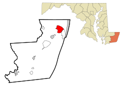
According to the United States Census Bureau, the CDP has a total area of 9.4 square miles (24 km2), of which 6.7 square miles (17 km2) is land and 2.7 square miles (7.0 km2) (29.0%) is water.

Demographics

Historical population
CensusPop.Note
1990 4,251
2000 10,496146.9%
2010 11,71011.6%
2020 12,1453.7%
source: [12]

At the 2010 census, [13] there were 11,710 people, 5,471 households and 3,457 families residing in the CDP. The population density was 1,758.5 inhabitants per square mile (679.0/km2). There were 8,870 housing units at an average density of 1,323.9 per square mile (511.2/km2). The racial makeup of the CDP was 94.5% White, 2.4% African American, 0.2% Native American, 0.9% Asian, 0.7% from other races, and 1.2% from two or more races. Hispanic or Latino of any race were 2.4% of the population.

There were 5,471 households, of which 10.4% had children under the age of 18 living with them, 60.0% were married couples living together, 7.1% had a female householder with no husband present, and 30.3% were non-families. 25.3% of all households were made up of individuals, and 14.4% had someone living alone who was 65 years of age or older. The average household size was 2.14 and the average family size was 2.50.

16.8% of the population were under the age of 18, 4.1% from 18 to 24, 15.4% from 25 to 44, 32.0% from 45 to 64, and 34.5% who were 65 years of age or older. The median age was 57.6 years. For every 100 females, there were 92.7 males. For every 100 females age 18 and over, there were 90.3 males.

The median household income was $46,328 and the median family income was $76,123. Males had a median income of $51,489 compared with $42,261 for females. The per capita income for the CDP was $40,418. About 1.5% of families and 4.0% of the population were below the poverty line, including 5.0% of those under age 18 and 2.9% of those age 65 or over.

Parks and recreation

Ocean Pines is home to the Ocean Pines Golf Club, which was designed by Robert Trent Jones in 1970 and opened on June 5, 1972. [14] [15] It also homes 13 different parks, with the largest being White Horse Park. [16]

Community parks:

Government

In 1971, Boise Cascade formed the Ocean Pines Association. The company turned over control to the Association in August 1973. [4] The current OPA Board of Directors consists of President Colette Horn, Vice President Frank Daly, Treasurer Larry Perrone, Secretary Josette Wheatley, Director Richard Farr, and Directors Doug Parks and Amy Peck. [17] The board holds annual elections to elect its members. [18]

In April 1993, the Worcester County Commissioners established Election District Six, which represents Ocean Pines in the county government. [4] Today, the town is represented by Districts 5 and 6 in the Board of County Commissioners, [19] which are currently represented by Republicans Anthony W. "Chip" Bertino, Jr. [20] and Madison J. Bunting, Jr. [21] [22]

Ocean Pines is included in Maryland's 1st congressional district.

Education

Ocean Pines is served by the Worcester County Public Schools system.

Public schools that serve students in the Ocean Pines area:

Worcester Preparatory School and Most Blessed Sacrament Catholic School are a private schools in the Ocean Pines area.

Related Research Articles

<span class="mw-page-title-main">Worcester County, Maryland</span> County in Maryland, United States

Worcester County is the easternmost county of the U.S. state of Maryland. As of the 2020 census, the population was 52,460. Its county seat is Snow Hill.

<span class="mw-page-title-main">Crownsville, Maryland</span> Census-designated place in Maryland, United States

Crownsville is a census-designated place (CDP) in Anne Arundel County, Maryland, United States. The population was 1,757 at the 2010 census. It hosts the Anne Arundel County Fair each September, as well as the annual Maryland Renaissance Festival for several summer weekends. A state psychiatric hospital was formerly in Crownsville. The area offers waterfront scenery and easy access to urban metropolitan areas and culture.

<span class="mw-page-title-main">Carney, Maryland</span> Census-designated place in Maryland, United States

Carney is an unincorporated community and census-designated place in Baltimore County, Maryland, United States. The population was 29,941 at the 2010 census.

<span class="mw-page-title-main">Parkville, Maryland</span> Census-designated place in Maryland, United States

Parkville is an unincorporated community and census-designated place in Baltimore County, Maryland, United States. As of the 2010 census, the population was 30,734.

<span class="mw-page-title-main">Randallstown, Maryland</span> Census-designated place in Maryland, United States

Randallstown is an unincorporated community and census-designated place in Baltimore County, Maryland, United States. It is named after Christopher and Thomas Randall, two 18th-century tavern-keepers. At that time, Randallstown was a tollgate crossroads on the Liberty Turnpike, a major east–west thoroughfare. It is a suburb of Baltimore, with a population of 33,655 as of the 2020 census. As of 2020 it was 72 percent African American. In the 1990s, Randallstown transitioned to a majority African American community.

<span class="mw-page-title-main">White Marsh, Maryland</span> Census-designated place in Maryland, United States

White Marsh is an unincorporated community and census-designated place in Baltimore County, Maryland, United States. The population was 9,513 at the 2010 census. White Marsh is a northeast suburb of Baltimore.

<span class="mw-page-title-main">Lusby, Maryland</span> Census-designated place in Maryland, United States

Lusby is an unincorporated community and census-designated place (CDP) in Calvert County, Maryland, United States. The population of the CDP was 1,835 at the 2010 census. Residents of the Chesapeake Ranch Estates and Drum Point communities also use the Lusby ZIP code designation.

<span class="mw-page-title-main">Ballenger Creek, Maryland</span> Census-designated place in Maryland

Ballenger Creek is an unincorporated community and census-designated place (CDP) in Frederick County, Maryland, United States. It is a part of the Frederick, Maryland urban area and is adjacent to Frederick's southern city limits. The CDP had a 2010 census population of 18,274.

<span class="mw-page-title-main">Brandywine, Maryland</span> Census-designated place in Maryland

Brandywine is the name of an unincorporated area in Prince George's County, Maryland, United States, that refers both to a census-designated place (CDP) and a zip code area which is much larger (20613), whose areas overlap. The population of Brandywine at the 2020 U.S. Census was 10,550 for the CDP, and the population of ZIP code 20613 was 11,860 in 2010.

<span class="mw-page-title-main">Camp Springs, Maryland</span> Census-designated place in Maryland

Camp Springs is an unincorporated area and census-designated place (CDP) in Prince George's County, Maryland, United States. The population was 22,734 at the 2020 census. Camp Springs is not an official post office designation; the area is divided among the surrounding mailing addresses of Temple Hills, Fort Washington, Clinton, and Suitland.

<span class="mw-page-title-main">Clinton, Maryland</span> Census-designated place in Maryland, United States

Clinton is an unincorporated census-designated place (CDP) in Prince George's County, Maryland, United States. Clinton was formerly known as Surrattsville until after the time of the Civil War. The population of Clinton was 38,760 at the 2020 census. Clinton is historically known for its role in the American Civil War concerning the Abraham Lincoln assassination. Clinton is adjacent to Camp Springs, Rosaryville, Melwood, and Andrews Air Force Base.

<span class="mw-page-title-main">Glenn Dale, Maryland</span> CDP in Maryland

Glenn Dale is an unincorporated area and census-designated place (CDP) in Prince George's County, Maryland, United States. The population was 14,698 at the 2020 census. Glenn Dale is home to the Glenn Dale Hospital, an abandoned sanatorium, and the USDA Plant Introduction Station.

<span class="mw-page-title-main">Rosaryville, Maryland</span> Census-designated place in Maryland, US

Rosaryville is an unincorporated area and census-designated place (CDP) in Prince George's County, Maryland, United States, located south of Cinton and Upper Marlboro beside U.S. Route 301. Per the 2020 census, the population was 11,548. including housing developments and rural open space. It was named for a local Roman Catholic church. Close to Rosaryville are the Marlton housing development, Maryland Veterans Cemetery, the Southern Maryland Farmers Market, and Rosaryville State Park.

<span class="mw-page-title-main">Berlin, Maryland</span> Town in Maryland, United States

Berlin is a town in Worcester County, Maryland, United States which includes its own historical Berlin Commercial District. The population was 4,485 at the 2010 census, and has since grown in population. It is part of the Salisbury, Maryland-Delaware Metropolitan Statistical Area.

<span class="mw-page-title-main">Stockton, Maryland</span> CDP in Maryland, United States

Stockton is a census-designated place (CDP) in Worcester County, Maryland, United States. The population was 92 at the 2010 census. It is part of the Salisbury, Maryland-Delaware Metropolitan Statistical Area.

<span class="mw-page-title-main">West Ocean City, Maryland</span> CDP in Maryland, United States

West Ocean City is a census-designated place (CDP) in Worcester County, Maryland, United States. The population was 4,375 at the 2010 census. It is part of the Salisbury, Maryland-Delaware Metropolitan Statistical Area.

<span class="mw-page-title-main">West Hempstead, New York</span> Hamlet and census-designated place in New York, United States

West Hempstead is a hamlet and census-designated place (CDP) in the Town of Hempstead in Nassau County, on Long Island, in New York, United States. The population was 19,835 at the time of the 2020 census. It is an unincorporated area in the Town of Hempstead and is represented by Councilman Edward Ambrosino.

<span class="mw-page-title-main">Pine Ridge, South Dakota</span> CDP in South Dakota, United States

Pine Ridge is a census-designated place (CDP) and the most populous community in Oglala Lakota County, South Dakota, United States. The population was 3,138 at the 2020 census. It is the tribal headquarters of the Oglala Sioux Tribe on the Pine Ridge Indian Reservation.

<span class="mw-page-title-main">Hillandale, Maryland</span> Census-designated place in Maryland, United States

Hillandale is an unincorporated area and census-designated place located in Montgomery and Prince George's counties, Maryland, United States. As of the 2020 census, it had a population of 5,774. Hillandale is contained between the Prince George's / Montgomery County line to the east, the Anacostia River to the west, McCeney Avenue to the north, and D.C.'s Capital Beltway to the south. It borders the communities of Adelphi, Avenel, White Oak and Beltsville.

<span class="mw-page-title-main">Sturbridge, Massachusetts</span> Town in Massachusetts, United States

Sturbridge is a town in Worcester County, Massachusetts, United States. It is home to Old Sturbridge Village living history museum and other sites of historical interest such as Tantiusques.

References

  1. "2020 U.S. Gazetteer Files". United States Census Bureau. Retrieved April 26, 2022.
  2. Mayer, Caroline E. (November 8, 1997). "FIRST WAVE OF RETIREES IS HITTING THE BEACH". The Washington Post . Retrieved April 20, 2022.
  3. 1 2 "Ocean Pines Neighborhood Guide". thebeachhomeagent.com. Beach Home Agent. Retrieved April 20, 2022.
  4. 1 2 3 4 5 6 7 "OPA at 50: A Timeline" (PDF). Bayside OC. May 2018. Retrieved April 20, 2022.
  5. "Ocean Pines History Panel Planned For Next Month". Maryland Coastal Dispatch. June 21, 2018. Retrieved June 21, 2018.
  6. Mann, Bunk (December 29, 2016). "When Ocean Pines Was A Mere Concept". Maryland Coastal Dispatch. Retrieved April 20, 2022.
  7. "The Comprehensive Development Plan Worcester County, Maryland" (PDF). co.worcester.md.us. Worcester County, Maryland. Retrieved April 20, 2022.
  8. Sharpe, Charlene (September 12, 2019). "Ocean Pines Now Has A Choice For Cable, Internet Service". Maryland Coast Dispatch. Retrieved April 20, 2022.
  9. Marry Corddry (September 4, 1985). "Ocean Pines sewers may be condemned". The Baltimore Sun.
  10. Velazquez, Rose (June 2, 2018). "Ocean Pines celebrates its 50th anniversary". Delmarvanow . Retrieved April 20, 2022.
  11. "US Gazetteer files: 2010, 2000, and 1990". United States Census Bureau. February 12, 2011. Retrieved April 23, 2011.
  12. "CENSUS OF POPULATION AND HOUSING (1790-2010)". U.S. Census Bureau . Retrieved August 1, 2011.
  13. "U.S. Census website". United States Census Bureau . Retrieved January 31, 2008.
  14. "About Ocean Pines Golf Club". oceanpinesgolf.org. Ocean Pines Golf Club. Retrieved April 20, 2022.
  15. Holley, Blair (July 12, 1992). "Ocean Pines a first-rate golf course". The Baltimore Sun . Retrieved April 20, 2022.
  16. "Parks". oceanpines.org. Ocean Pines Association. Retrieved April 20, 2022.
  17. "Board Of Directors". oceanpines.org. Ocean Pines Association. Retrieved April 20, 2022.
  18. Ellsion, Greg (July 29, 2021). "Ocean Pines Bylaws Committee reviews election issues". Bayside Gazette. Retrieved April 20, 2022.
  19. "FINAL COMMISSIONER REDISTRICTING MAP" (PDF). co.worcester.md.us. Worcester County, Maryland. Retrieved September 17, 2013.
  20. "Anthony W. (Chip) Bertino, Jr., Board of County Commissioners, Worcester County, Maryland". Maryland Manual On-Line. Maryland State Archives . Retrieved April 20, 2022.
  21. "Commissioners". co.worcester.md.us. Worcester County, Maryland . Retrieved April 20, 2022.
  22. "Madison J. Bunting, Jr., Board of County Commissioners, Worcester County, Maryland". Maryland Manual On-Line. Maryland State Archives . Retrieved April 20, 2022.