Abarr, Colorado | |
|---|---|
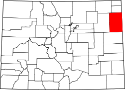
 Abarr Location of Abarr, Colorado.  Abarr Abarr (Colorado) | |
| Coordinates: 39°51′02″N102°42′26″W / 39.8505°N 102.7072°W [1] | |
| Country | United States |
| State | Colorado |
| County | Yuma [2] |
| Government | |
| • Type | unincorporated community |
| • Body | Yuma County [2] |
| Elevation | 4,242 ft (1,293 m) |
| Time zone | UTC−7 (MST) |
| • Summer (DST) | UTC−6 (MDT) |
| Area code | 970 |
| GNIS pop ID | 204724 |
Abarr is an unincorporated community in Yuma County, Colorado, United States. [1]