Agate, Colorado | |
|---|---|
 Agate, Colorado | |
 Agate Location of Agate, Colorado.  Agate Agate (Colorado) | |
| Coordinates: 39°27′42″N103°56′32″W / 39.4617°N 103.9422°W [1] | |
| Country | United States |
| State | Colorado |
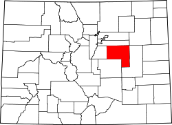
| County | Elbert [2] |
| Settled | about 1876 [3] |
| Government | |
| • Type | unincorporated community |
| • Body | Elbert County [2] |
| Elevation | 5,446 ft (1,660 m) |
| Time zone | UTC−07:00 (MST) |
| • Summer (DST) | UTC−06:00 (MDT) |
| ZIP code | 80101 [4] |
| GNIS pop ID | 204818 |
Agate is an unincorporated community and U.S. Post Office in Elbert County, Colorado, United States. The ZIP Code of the Agate Post Office is 80101. [4]