Gould, Colorado

Last updated

Gould
DSCN1826 gouldstore e 600.jpg
General store along State Highway 14 in Gould, April 2005
Etymology: Edward Bradley Gould
USA Colorado location map.svg
Red pog.svg
Gould
Coordinates: 40°31′35″N106°01′36″W / 40.52639°N 106.02667°W / 40.52639; -106.02667
Country United States
State Colorado
County Jackson County

Gould is a small unincorporated community in northwestern Jackson County, Colorado, United States.

Contents

Description

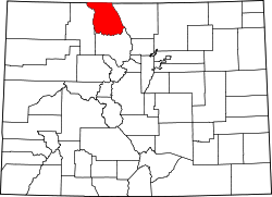
The community is located on State Highway 14, southeast of Walden in North Park. The community is situated in the valley of the Middle Fork of the Michigan River between Owl Mountain and Gould Mountain. The landscape is a patchwork of wetlands, pine forest, aspen groves, and sagebrush. A tavern, campgrounds, community center, and several other businesses cater to local residents, campers and sportsmen. The largest public attraction is the Colorado State Forest Headquarters and Moose Visitor Center. [1] Located at 40.526°N, 106.026°W, the community lies at an elevation of 8913 feet (2717m). [2]

A post office called Gould was established in 1937, and remained in operation until 1973. [3]

Luke Jones is currently the Mayor of Gould.[ citation needed ] The community has the name of Edward Bradley Gould, a cattleman. [4] [5]

Climate

Gould has a subarctic climate (Köppen Dfc).

Climate data for Gould, Colorado, 1991–2020 normals: 9000ft (2743m)
MonthJanFebMarAprMayJunJulAugSepOctNovDecYear
Record high °F (°C)54
(12)
56
(13)
60
(16)
70
(21)
77
(25)
86
(30)
85
(29)
84
(29)
82
(28)
74
(23)
60
(16)
53
(12)
86
(30)
Mean maximum °F (°C)46.7
(8.2)
47.0
(8.3)
53.1
(11.7)
61.0
(16.1)
71.0
(21.7)
78.3
(25.7)
81.7
(27.6)
79.6
(26.4)
75.6
(24.2)
66.7
(19.3)
55.1
(12.8)
46.3
(7.9)
82.1
(27.8)
Mean daily maximum °F (°C)29.0
(−1.7)
30.4
(−0.9)
38.0
(3.3)
45.0
(7.2)
54.8
(12.7)
66.8
(19.3)
72.9
(22.7)
71.6
(22.0)
64.3
(17.9)
50.5
(10.3)
37.9
(3.3)
30.0
(−1.1)
49.3
(9.6)
Daily mean °F (°C)15.8
(−9.0)
17.5
(−8.1)
25.0
(−3.9)
32.3
(0.2)
40.9
(4.9)
50.2
(10.1)
56.3
(13.5)
54.8
(12.7)
47.7
(8.7)
36.1
(2.3)
24.9
(−3.9)
17.0
(−8.3)
34.9
(1.6)
Mean daily minimum °F (°C)2.7
(−16.3)
4.6
(−15.2)
12.0
(−11.1)
19.6
(−6.9)
27.1
(−2.7)
33.5
(0.8)
39.7
(4.3)
38.0
(3.3)
31.1
(−0.5)
21.7
(−5.7)
11.9
(−11.2)
3.9
(−15.6)
20.5
(−6.4)
Mean minimum °F (°C)−22.1
(−30.1)
−20.6
(−29.2)
−10.8
(−23.8)
0.2
(−17.7)
13.2
(−10.4)
23.5
(−4.7)
31.7
(−0.2)
29.8
(−1.2)
19.7
(−6.8)
4.0
(−15.6)
−10.0
(−23.3)
−21.0
(−29.4)
−27.0
(−32.8)
Record low °F (°C)−35
(−37)
−46
(−43)
−30
(−34)
−15
(−26)
−1
(−18)
19
(−7)
27
(−3)
24
(−4)
12
(−11)
−14
(−26)
−24
(−31)
−31
(−35)
−46
(−43)
Average precipitation inches (mm)1.72
(44)
2.53
(64)
1.84
(47)
2.65
(67)
2.30
(58)
1.66
(42)
2.35
(60)
2.07
(53)
1.89
(48)
2.04
(52)
1.66
(42)
1.59
(40)
24.3
(617)
Average snowfall inches (cm)24.3
(62)
28.2
(72)
23.4
(59)
23.7
(60)
11.4
(29)
1.8
(4.6)
0.0
(0.0)
trace1.7
(4.3)
12.6
(32)
21.4
(54)
22.8
(58)
171.3
(434.9)
Source 1: NOAA [6]
Source 2: XMACIS (snowfall, records & monthly max/mins) [7]

History

The North Park basin was inhabited by Native American for thousands of years. In the late 19th century white settlers moved into the area. The Ute Indians were subsequently forced to distant reservations at the orders of Gov. Frederick Walker Pitkin. [8] Some Indians remained in the region until the 1920s. In 1886, the LaFever saw-mill opened and in 1887, Edward Bradley Gould, for whom the town is named, homesteaded 640 acres. [9] His only son, Eddy Gould, was the town's first mailcarrier.

Life at the turn of the 20th century was centered on the timber industry. In 1939 the town of Gould and the Bockman Lumber Camp built simple log cabin schools. A post office and gas station/hotel were also built as well as a general store, known as Belle and Earl's. The population peaked at ~300 in 1949. [8] A popular "sportin' house" was run by two older women by the name of Meryl and Maude. It was later known as M&M Lodge.

"During the early 1930s, two Civilian Conservation Corps Camps were built on the state land. The camp south of Gould was later converted into a Prisoner of War Camp during WWII for Germans as well as American conscientious objectors. The German Prisoners of War were used as timber laborers. In the Spring of 1945, a few prisoners escaped the camp and broke into E.B. Shawver's summer home. They had maps drawn of plans to escape to Mexico, but were discovered the next morning, having had too much to drink from the wine cabinet the night before and were walked back to camp barefoot." [8]

"After the German POW's departed, the cabins were used as a 4-H camp and by various other groups in the summer." [8]

In the 1950s the Colorado State Forest was created and the headquarters were built on the grounds of a former fish hatchery.

The restaurant in town was owned by Carl Berwald of Stillwater, Minnesota. It was known as Berwald's Cookhouse in the 1970s when Belle and Earl were running their general store and renamed Drifter's Cookhouse by a new owner in later years.

In the 1990s plans to convert the town of Gould and neighboring Colorado State Forest into a ski resort were defeated.

Common wildlife

See also

Flag of Colorado.svg Coloradoportal

Related Research Articles

<span class="mw-page-title-main">Heber-Overgaard, Arizona</span> CDP in Navajo County, Arizona

Heber-Overgaard is a census-designated place (CDP) in Navajo County, Arizona, United States. Situated atop the Mogollon Rim, the community lies at an elevation of 6,627 feet (2,020 m). The population was 2,898 at the 2020 census. Heber and Overgaard are technically two unincorporated communities, but as of the 1990 census, their proximity led to the merged name of "Heber-Overgaard".

<span class="mw-page-title-main">Red Feather Lakes, Colorado</span> Census Designated Place in Colorado, United States

Red Feather Lakes is an unincorporated town, a post office, and a census-designated place (CDP) located in and governed by Larimer County, Colorado, United States. The CDP is a part of the Fort Collins, CO Metropolitan Statistical Area. The Red Feather Lakes post office has the ZIP Code 80545. At the United States Census 2020, the population of the Red Feather Lakes CDP was 426.

<span class="mw-page-title-main">Willmore Wilderness Park</span> Provincial park of Alberta, Canada

Willmore Wilderness Park, in Alberta, Canada, is a 4,600-square-kilometre (1,800 sq mi) wilderness area adjacent to Jasper National Park. It is lesser known and less visited than Jasper National Park. There are no public roads, bridges or buildings. There are, however, several ranger cabins in the park that are available as a courtesy to visitors.

<span class="mw-page-title-main">Kaibab National Forest</span> Protected area in northern Arizona

Kaibab National Forest borders both the north and south rims of the Grand Canyon, in north-central Arizona. Its 1.6 million acres is divided into three sections: the North Kaibab Ranger District, the Tusayan Ranger District, and the Williams Ranger District. It is managed by the United States Forest Service. Grand Canyon National Park separates the North Kaibab and the South Kaibab. The South Kaibab covers 1,422 square miles (3,680 km2) and the North Kaibab stretches over 1,010 square miles (2,600 km2). Elevations vary on the forest from 5,500 feet in the southwest corner to 10,418 feet at the summit of Kendrick Peak on the Williams Ranger District. The forest as a whole is headquartered in Williams.

<span class="mw-page-title-main">Lake Pend Oreille</span> Lake in Kootenai and Bonner counties in Idaho, United States

Lake Pend Oreille in the northern Idaho Panhandle is the largest lake in the U.S. state of Idaho and the 38th-largest lake by area in the United States, with a surface area of 148 square miles (380 km2). It is 69 kilometres (43 mi) long, and 1,152 feet (351 m) deep in some regions, making it the fifth-deepest in the nation and having a volume of 43,939,940 acre feet = 54 km3. The lake is fed by the Clark Fork River and the Pack River, and drains into the Pend Oreille River, as well as subsurfacely into the Spokane Valley–Rathdrum Prairie Aquifer. It is surrounded by national forests and a few small towns, with the largest population on the lake at Sandpoint. The majority of the shoreline is non-populated and all but the southern tip of the lake is in Bonner County. The southern tip is in Kootenai County and is home to Farragut State Park, formerly the Farragut Naval Training Station during World War II, of which a small part is still active and conducts U.S. Navy acoustic underwater submarine research.

<span class="mw-page-title-main">Greer, Arizona</span> CDP in Apache County, Arizona

Greer is an unincorporated community and census-designated place in Apache County, Arizona, United States. Located within the White Mountains of Arizona and surrounded by the Apache-Sitgreaves National Forest, Greer is the highest town in the state at an elevation of approximately 8,400 feet. As of the 2020 census it had a population of 58. Greer was founded circa 1879 by Mormon settlers from Utah. The Greer post office has the ZIP code of 85927.

<span class="mw-page-title-main">Superior National Forest</span> Forest in Minnesota, US

Superior National Forest, part of the United States National Forest system, is located in the Arrowhead Region of the state of Minnesota between the Canada–United States border and the north shore of Lake Superior. The area is part of the greater Boundary Waters region along the border of Minnesota and the Canadian province of Ontario, a historic and important thoroughfare in the fur trading and exploring days of New France and British North America.

<span class="mw-page-title-main">Mohawk State Forest</span> State forest in Connecticut, United States

Mohawk State Forest, also known as Mohawk State Forest/Mohawk Mountain State Park, encompasses over 4,000 acres (1,600 ha) in the towns of Cornwall, Goshen, and Litchfield in the southern Berkshires of Litchfield County, Connecticut. As overseen by the Connecticut Department of Energy and Environmental Protection, the area is used for hiking, picnicking, and winter sports by the public, while being actively managed to produce timber and other forest products.

<span class="mw-page-title-main">Simon B. Elliott State Park</span> State park in Clearfield County, Pennsylvania

Simon B. Elliott State Park is a 318-acre (129 ha) Pennsylvania state park located in Pine Township, Clearfield County, Pennsylvania in the United States. The park is surrounded by Moshannon State Forest. The park is entirely wooded with second growth forests of mixed oak species, including northern red oak, chestnut oak, shagbark hickory, red maple, and tulip poplar, and northern hard woods, including sugar maple, black cherry, aspen, birch, hemlock, and ash. S. B. Elliott State park is 9 miles (14 km) north of Clearfield on Pennsylvania Route 153 just off exit 111 of Interstate 80.

<span class="mw-page-title-main">Moose Mountain Provincial Park</span> Provincial park in Saskatchewan, Canada

Moose Mountain Provincial Park is a provincial park, in south-eastern Saskatchewan about 24 kilometres (15 mi) north of the town of Carlyle on the Moose Mountain Upland. It is one of Saskatchewan's few parks with a community inside the park as there are several subdivisions with both year-round and seasonal residents. The village of Kenosee Lake is completely surrounded by the park but is not part of the park.

The Pecos Wilderness is a protected wilderness area within the Santa Fe National Forest and Carson National Forest. The Pecos Wilderness lies within the Camino Real Ranger District of the Carson National Forest, and the Pecos Ranger District and Espanola Ranger District of the Santa Fe National Forest. The Pecos Wilderness includes the southernmost extension of the Rocky Mountains in the sub-range of the Sangre de Cristo Mountains of north central New Mexico. One trail head for the wilderness is only 15 miles by road from Santa Fe, the state capital. Covering an area of 223,667 acres (90,515 ha)(350 sq mi) it is the second largest wilderness in the state after the Gila Wilderness. An area of fewer than 200,000 acres (81,000 ha) was given wilderness protection by Congress in 1964. Congress protected an additional 55,000 acres (22,000 ha) in 1980. The Wilderness boasts one of the highest concentrations of peaks exceeding 12,000 feet (3,700 m) in elevation in New Mexico, including Santa Fe Baldy, 12,622 feet (3,847 m), the highest point in Santa Fe County, and South Truchas Peak, 13,102 feet (3,993 m), the second highest peak in the state.

<span class="mw-page-title-main">Rocky Mountain ponderosa pine forest</span>

The Rocky Mountain ponderosa pine forest is a plant community at an elevation of 2,000–2,700 metres (6,600–8,900 ft) in the Rocky Mountains. It is an important temperate coniferous forest ecoregion, including some endemic wildlife and grass species that are only found in this ponderosa pine habitat.

<span class="mw-page-title-main">Collier Memorial State Park</span> State park in Oregon, United States

Collier Memorial State Park is a state park in southern Oregon. The park is operated and maintained by the Oregon Parks and Recreation Department. It is located on U.S. Highway 97, approximately 30 miles (48 km) north of Klamath Falls and 105 miles (169 km) south of Bend. The park covers 146 acres (59 ha) along the Williamson River.

<span class="mw-page-title-main">Vega State Park</span> State park in Mesa County, Colorado

Vega State Park is a 1,823-acre (738 ha) Colorado state park in Mesa County, Colorado in the United States. Vega Reservoir is a fishing destination and is located at an elevation of 7,696 feet (2,346 m). Year-round recreational activities at Vega State Park include boating, hiking, snowmobiling and camping. The park was established in 1967 in cooperation with the Bureau of Reclamation which was responsible for the construction of Vega Dam and Vega Reservoir. It is located at the northeast edge of Grand Mesa National Forest in Western Colorado.

<span class="mw-page-title-main">Steamboat Lake State Park</span> State park in Colorado, United States

Steamboat Lake State Park is a Colorado state park located in Routt County 27 miles (43 km) north of Steamboat Springs, Colorado, and near the community of Hahns Peak Village. The 2,820-acre (1,140 ha) park land west of Hahns Peak was acquired in 1966. It and the 1,101 acres (446 ha) reservoir was opened to the public in 1972. As of 2021 park facilities include a visitors center, Marina, boat ramps, campsites, Cabins, picnic sites and 5.5 miles (8.9 km) of hiking trails. Plant communities include sagebrush shrubland, quaking aspen and lodgepole pine forests, willow carr and marsh. Commonly seen mammalian wildlife species include mule deer and red fox. The reservoir attracts many species of shorebirds and waterfowl, including sandhill cranes that nest in the wetland areas.

<span class="mw-page-title-main">State Forest State Park</span> State park in Jackson and Larimer counties, Colorado

State Forest State Park is a Colorado State Park located in Jackson and Larimer counties east of Walden, Colorado, United States. The 70,838-acre (286.67 km2) park was established in 1970 in the Medicine Bow Range of the Rocky Mountains. Facilities include a visitors' center, 187 campsites, over 60 dispersed camping sites, 15 cabins and yurts, picnic sites, boat ramps and 94 miles (151 km) of hiking trails.

<span class="mw-page-title-main">Ecology of the Rocky Mountains</span> Ecology of the Rocky Mountain range in North America

The ecology of the Rocky Mountains is diverse due to the effects of a variety of environmental factors. The Rocky Mountains are the major mountain range in western North America, running from the far north of British Columbia in Canada to New Mexico in the southwestern United States, climbing from the Great Plains at or below 1,800 feet (550 m) to peaks of over 14,000 feet (4,300 m). Temperature and rainfall varies greatly also and thus the Rockies are home to a mixture of habitats including the alpine, subalpine and boreal habitats of the Northern Rocky Mountains in British Columbia and Alberta, the coniferous forests of Montana and Idaho, the wetlands and prairie where the Rockies meet the plains, a different mix of conifers on the Yellowstone Plateau in Wyoming, the montane forests of Utah, and in the high Rockies of Colorado and New Mexico, and finally the alpine tundra of the highest elevations.

<span class="mw-page-title-main">Matthew Callahan Log Cabin</span> Historic house in Colorado, United States

The Matthew Callahan Log Cabin is located on South Third Street in Aspen, Colorado, United States. It was built in the early 1880s. In 1987 it was listed on the National Register of Historic Places along with a group of other historic properties in the city.

<span class="mw-page-title-main">Independence, Pitkin County, Colorado</span> Ghost town in Colorado, United States

Independence is an extinct town located in Pitkin County, Colorado, United States. It is located at an elevation of 10,913 feet (3,326 m) 2.2 miles (3.6 km) directly west of Independence Pass. It was the first settlement established in the Roaring Fork Valley, after gold was struck in the vicinity on Independence Day, July 4, 1879, hence its name. Independence was served by three differently named post offices: Farwell from July 14, 1881, until July 3, 1882; Sparkill from February 1, 1882, until October 18, 1887; and Chipeta from April 20, 1899, until October 17, 1899. It has also been known historically as Mammoth City, Mount Hope, and Hunter's Pass.

<span class="mw-page-title-main">Colorado State University Mountain Campus</span> Satellite campus of Colorado State University

Colorado State University Mountain Campus, formerly Pingree Park, is a satellite campus of the Fort Collins, Colorado-based Colorado State University. CSU Mountain Campus is situated in Pingree Valley in the Mummy Range at 9,053 ft (2,759 m) approximately 24 miles (39 km) from the city of Fort Collins, Colorado.

References

  1. "Moose Visitor Center". Colorado Tourism Office. Retrieved February 28, 2017.
  2. Topographic map from USGS via Microsoft Research Maps
  3. "Post offices". Jim Forte Postal History. Retrieved June 25, 2016.
  4. "FamilySearch.org" . Retrieved November 9, 2023.
  5. Dawson, John Frank (1954). Place names in Colorado: why 700 communities were so named, 150 of Spanish or Indian origin. Denver, CO: The J. Frank Dawson Publishing Co. p. 24.
  6. "Gould 4SE SFSP, Colorado 1991-2020 Monthly Normals" . Retrieved October 10, 2023.
  7. "xmACIS". National Oceanic and Atmospheric Administration. Retrieved December 9, 2023.
  8. 1 2 3 4 History of Colorado State Forest State Park[ need quotation to verify ]
  9. Bradley, Earlene (2005?). "Timber Times and Tales"[ page needed ]