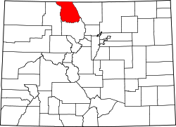
Coalmont, Colorado | |
---|---|
Coordinates: 40°33′45″N106°26′40″W / 40.5625°N 106.4444°W | |
Country | United States |
State | State of Colorado |
County | Jackson County [1] |
Elevation | 8,216 ft (2,504 m) |
Time zone | UTC-7 (MST) |
• Summer (DST) | UTC-6 (MDT) |
ZIP Code [2] | 80480 |
Coalmont is an unincorporated community and U.S. Post Office in Jackson County, Colorado, United States. The town is named for the open-pit lignite coal mines in the area, from which coal was shipped out on the Union Pacific Railroad to the mainline at Laramie, Wyoming.
Coalmont is located at 40°33′45″N106°26′40″W / 40.5625°N 106.4444°W at an elevation of 8,216 feet (2,504 m).
Spicer is a weather station roughly 6 miles (9.7 km) south of Coalmont, at an elevation of 8,385 ft (2,556 m). Spicer has a subalpine climate (Köppen Dfc), bordering on a humid continental climate (Köppen Dfb).
Climate data for Spicer, Colorado, 1991–2020 normals, 1912-2020 extremes: 8385ft (2556m) | |||||||||||||
---|---|---|---|---|---|---|---|---|---|---|---|---|---|
Month | Jan | Feb | Mar | Apr | May | Jun | Jul | Aug | Sep | Oct | Nov | Dec | Year |
Record high °F (°C) | 56 (13) | 65 (18) | 80 (27) | 73 (23) | 82 (28) | 90 (32) | 91 (33) | 91 (33) | 90 (32) | 78 (26) | 70 (21) | 75 (24) | 91 (33) |
Mean maximum °F (°C) | 43.6 (6.4) | 45.3 (7.4) | 53.0 (11.7) | 63.6 (17.6) | 72.5 (22.5) | 80.2 (26.8) | 84.0 (28.9) | 82.2 (27.9) | 78.2 (25.7) | 68.6 (20.3) | 54.5 (12.5) | 44.0 (6.7) | 83.2 (28.4) |
Mean daily maximum °F (°C) | 28.5 (−1.9) | 31.1 (−0.5) | 39.5 (4.2) | 49.2 (9.6) | 59.4 (15.2) | 71.0 (21.7) | 76.6 (24.8) | 75.6 (24.2) | 68.3 (20.2) | 55.3 (12.9) | 38.7 (3.7) | 29.1 (−1.6) | 51.9 (11.0) |
Daily mean °F (°C) | 17.9 (−7.8) | 20.2 (−6.6) | 27.5 (−2.5) | 36.1 (2.3) | 44.8 (7.1) | 53.3 (11.8) | 59.3 (15.2) | 58.1 (14.5) | 51.2 (10.7) | 39.9 (4.4) | 27.2 (−2.7) | 18.9 (−7.3) | 37.9 (3.3) |
Mean daily minimum °F (°C) | 7.3 (−13.7) | 9.3 (−12.6) | 15.4 (−9.2) | 22.9 (−5.1) | 30.1 (−1.1) | 35.6 (2.0) | 42.0 (5.6) | 40.5 (4.7) | 34.1 (1.2) | 24.6 (−4.1) | 15.8 (−9.0) | 8.8 (−12.9) | 23.9 (−4.5) |
Mean minimum °F (°C) | −17.5 (−27.5) | −18.7 (−28.2) | −9.0 (−22.8) | 2.7 (−16.3) | 15.5 (−9.2) | 24.4 (−4.2) | 31.1 (−0.5) | 30.1 (−1.1) | 16.4 (−8.7) | 4.9 (−15.1) | −9.1 (−22.8) | −18.2 (−27.9) | −25.3 (−31.8) |
Record low °F (°C) | −48 (−44) | −50 (−46) | −36 (−38) | −17 (−27) | 0 (−18) | 11 (−12) | 19 (−7) | 20 (−7) | 0 (−18) | −14 (−26) | −32 (−36) | −43 (−42) | −50 (−46) |
Average precipitation inches (mm) | 0.97 (25) | 1.08 (27) | 1.23 (31) | 1.62 (41) | 1.53 (39) | 1.02 (26) | 1.54 (39) | 1.26 (32) | 1.71 (43) | 1.16 (29) | 1.06 (27) | 0.97 (25) | 15.15 (384) |
Average snowfall inches (cm) | 17.5 (44) | 20.5 (52) | 19.6 (50) | 15.7 (40) | 5.9 (15) | 0.3 (0.76) | 0.0 (0.0) | 0.0 (0.0) | 1.0 (2.5) | 7.2 (18) | 18.4 (47) | 19.5 (50) | 125.6 (319.26) |
Average precipitation days (≥ 0.01 in) | 9.0 | 8.3 | 7.6 | 9.5 | 9.4 | 7.7 | 8.8 | 11.0 | 8.7 | 6.4 | 8.7 | 7.3 | 102.4 |
Average snowy days (≥ 0.1 in) | 8.3 | 7.4 | 7.3 | 6.4 | 1.9 | 0.3 | 0.0 | 0.0 | 0.5 | 2.8 | 8.3 | 8.0 | 51.2 |
Source 1: NOAA (1981-2010 snowfall & snow days) [3] [4] | |||||||||||||
Source 2: XMACIS2 (records & 1981-2010 monthly max/mins) [5] |
Coalmont, Colorado, is the type locality of the Coalmont Formation. [6]
Coalmont was a mining town associated with the production of coal from the Coalmont Coal District. In the Coalmont Coal District, commercial coal mining from the Coalmont Formation started in 1909 and continued until the close of World War II when coal production ceased. Since then, the mines were inactive, until 1959 when a new open pit mine was opened and some coal was mined and sold in the Denver, Colorado area. However, coal mining ceased a year or two later and there has been no production of coal since that time, despite some coal prospecting in 1964 and 1965. The estimated coal production in 1941 was 1,438,355 tons, and the original reserves at 177,450,000 tons of subbituminous coal. [6] [7]
Centennial is a small mountain-town in Albany County, Wyoming, United States. It serves a fairly large surrounding landscape, along with a few ranches, located along a gently sloping hillside traversed by a highway. Because it has been, since 1980 or later, included in a census-designated place (CDP), bearing the town's name, specific demographics characterizing the town itself are not available.
Anthracite, also known as hard coal and black coal, is a hard, compact variety of coal that has a submetallic lustre. It has the highest carbon content, the fewest impurities, and the highest energy density of all types of coal and is the highest ranking of coals.
Climax is an extinct mining company town, railroad station, and post office located in Lake County, Colorado, United States. The town site is located at an elevation of 11,342 feet (3,457 m) at Fremont Pass on the Continental Divide of the Americas. The Climax station on the Denver, South Park and Pacific Railroad was the highest railroad station in North America from its construction in 1884 until 1904 and again from 1928 until it was removed in 1937. Although the town was razed in 1962 to make room for the expansion of the Climax Molybdenum Mine, the Climax post office continued operation from December 5, 1917 until January 4, 1974. Climax had the highest elevation post office in the United States from April 1, 1919 to January 1, 1974.
Gilman is an abandoned mining town in southeastern Eagle County, Colorado, United States. The Gilman post office operated from November 3, 1886, until April 22, 1986. The U.S. Post Office at Minturn now serves Gilman postal addresses.
The Laramie Formation is a geologic formation of the Late Cretaceous (Maastrichtian) age, named by Clarence King in 1876 for exposures in northeastern Colorado, in the United States. It was deposited on a coastal plain and in coastal swamps that flanked the Western Interior Seaway. It contains coal, clay and uranium deposits, as well as plant and animal fossils, including dinosaur remains.
Uranium mining in Colorado, United States, goes back to 1872, when pitchblende ore was taken from gold mines near Central City, Colorado. The Colorado uranium industry has seen booms and busts, but continues to this day. Not counting byproduct uranium from phosphate, Colorado is considered to have the third largest uranium reserves of any US state, behind Wyoming and New Mexico.
Silver mining in Colorado has taken place since the 1860s. In the past, Colorado called itself the Silver State.
Abbeyville is an extinct community located in Gunnison County, Colorado, United States.
Crested Butte is a prominent mountain summit in the Elk Mountains range of the Rocky Mountains of North America. The 12,168-foot (3,709 m) peak is in Gunnison National Forest, 2.1 miles (3.4 km) northeast by east of the Town of Crested Butte in Gunnison County, Colorado, United States. Ski lifts and runs of the Crested Butte Mountain Resort occupy the north side of the mountain.
Clear Creek is a census-designated place on the western edge of Carbon County, Utah, United States. It is located at the south end of State Route 96 and the Pleasant Valley Branch of the Union Pacific Railroad.
Barthell is a former coal town in McCreary County, Kentucky, United States. It was established in 1902 and was the first of 18 mining camps to be built by the Stearns Coal and Lumber Company. It now serves as an open-air history museum, which is open from April through Thanksgiving.
Bovard is an unincorporated community and coal town in Hempfield Township, Westmoreland County, Pennsylvania, United States. The community is located near U.S. Route 119, 2.3 miles (3.7 km) northeast of Greensburg and is also the former home of baseball standout, Anthony Marazza. Marazza, dubbed "MR. BOVARD", is notable for leading Bovard to 6 championships in the past decade in the ICL and Pittsburgh Leagues.
Brodhead is an extinct coal mining town located in Las Animas County, Colorado, United States. The townsite is located at 37.4108°N 104.6764°W at an elevation of 6,919 feet (2,109 m). The Brodhead post office operated from August 14, 1902, until April 29, 1939.
Iron mining in the United States produced 48 million metric tons of iron ore in 2019. Iron ore was the third-highest-value metal mined in the United States, after gold and copper. Iron ore was mined from nine active mines and three reclamation operations in Michigan, Minnesota, and Utah. Most of the iron ore was mined in northern Minnesota's Mesabi Range. Net exports were 3.9 million tons. US iron ore made up 2.5 percent of the total mined worldwide in 2015. Employment as of 2014 was 5,750 in iron mines and iron ore treatment plants.
Forbes Road is an unincorporated community in Westmoreland County, Pennsylvania, United States. The community is located along Pennsylvania Route 819, 3.7 miles (6.0 km) north of Greensburg. Forbes Road has a post office with ZIP code 15633, which opened on July 1, 1903.
Bowen is an extinct town located in Las Animas County, Colorado, United States.
Tercio is a ghost town and former coal mine in Las Animas County, in the U.S. state of Colorado. The GNIS classifies it as a populated place. A post office called Tercio was established in 1902, and remained in operation until 1949. The community was the third coal mining community established by the Colorado Fuel and Iron Company, hence the name.
Franceville was a coal mining town and railroad post office in eastern El Paso County, Colorado, about five miles from the town of Falcon and twelve miles east of Colorado Springs. The Franceville post office operated from November 2, 1881, until May 14, 1894. The town was located on land owned by Matt France. There were 120 people in the town in 1885.
Potosi Peak is a 13,786-foot-elevation (4,202-meter) mountain summit located in Ouray County of Colorado, United States. It is situated five miles southwest of the community of Ouray, on land managed by Uncompahgre National Forest. It is part of the Sneffels Range which is a subset of the San Juan Mountains, which in turn is part of the Rocky Mountains. It is situated west of the Continental Divide, 2.2 miles south of Whitehouse Mountain, and 2.5 miles southeast of Mount Sneffels. Potosi ranks as the 113th-highest peak in Colorado, and the fourth-highest in the Sneffels Range. Recreation enthusiasts heading for Yankee Boy Basin traverse below the southern base of the mountain. Topographic relief is significant as the southeast aspect rises 4,000 feet above the Camp Bird Mine in approximately 1.5 mile. The mining activity in the immediate area produced significant amounts of gold and silver. "Potosi" in Quechuan language translates to "great wealth.". The mountain's name, which has been officially adopted by the United States Board on Geographic Names, was in use before 1899 when Henry Gannett published it in A Dictionary of Altitudes in the United States.
Dick is an extinct town in Weld County, in the U.S. state of Colorado.