Rand, Colorado | |
|---|---|
 Buildings along Highway 125 in Rand. | |
 Rand | |
| Coordinates: 40°27′14″N106°10′53″W / 40.45389°N 106.18139°W | |
| Country | |
| State | |
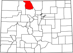
| County | Jackson [1] |
| Established | 1881 |
| Elevation | 8,629 ft (2,630 m) |
| Time zone | UTC-7 (MST) |
| • Summer (DST) | UTC-6 (MDT) |
| ZIP code [2] | 80473 |
| Area code | 970 |
| GNIS feature ID | 172876 [1] |
Rand is an unincorporated community, with a U.S. Post Office, established in 1881 in Jackson County, Colorado, United States.