Vandalia is a city in and the county seat of Fayette County, Illinois, United States.[3] At the 2020 Census, the population was 7,458. The city is on the Kaskaskia River and in the early 19th century, Vandalia became the western terminus of the National Road (the first federal road) from the East Coast. The city is 60 miles (97km) northeast of the Greater St. Louis area. Vandalia served as the state capital of Illinois from 1819 until 1839, when the seat of state government moved closer to the center of the state in Springfield. Since 1933, the Vandalia State House State Historic Site preserves and interprets the State House capital building and grounds, originally constructed in 1836.
Vandalia was founded in 1819 as a new capital city for Illinois.[4] The previous capital, Kaskaskia, was unsuitable because it was under the constant threat of flooding. The townsite, located in Bond County at the time,[5]:5 was hastily prepared for the 1820 meeting of the Illinois General Assembly.[4] In 1821, Fayette County was created, including Vandalia.[5]:5
The history of the name Vandalia is uncertain. Different theories can be found in almost all of the books written about Vandalia over the years. In her book Vandalia: Wilderness Capital of Lincoln's Land, Mary Burtschi tells of a conversation between one of the original surveyors of the town and a Vandalia resident. The surveyor, Colonel Greenup, explained that Van was suggested by one of the men. He recommended this as an abbreviation to the word vanguard meaning the forefront of an advancing movement. Another suggestion was made for the term dalia, derived from the Anglo-Saxon word dale which means a valley between hills. Greenup takes credit in the conversation for connecting the two terms to form the name Vandalia.
Another possible source of the name is the Vandalia colony, a failed attempt to establish a fourteenth colony in part of what is now West Virginia and Kentucky. The Vandalia colony was named in honor of Queen Charlotte, who claimed descent from the Wendish tribe of Obodrites, also called the Vandals.
Another theory put forth is that Vandalia was named by those who located the state capital in the town; according to the story, they mistakenly thought the Vandals were a brave Native American tribe, rather than of Germanic origins.[6][7]
The law under which Vandalia was founded included a provision that the capital would not be moved for twenty years.[8] Even before the end of this period, the population center of the state had shifted far north of Vandalia.[9] In 1837, the General Assembly voted to move the capital to Springfield.[9]
In the early 1960s the sociologist Joseph Lyford examined the social structure of Vandalia in a book-length study that revealed the essentially corporatist nature of decision-making in the city; this work was recently revisited by the Economist newspaper.[11]
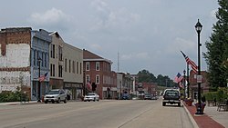
Geography
According to the 2010 census, Vandalia has a total area of 8.116 square miles (21.02km2), of which 8.1 square miles (20.98km2) (or 99.8%) is land and 0.016 square miles (0.04km2) (or 0.2%) is water.[12]
As of the 2020 census[16] there were 7,458 people, 2,253 households, and 1,247 families residing in the city. The population density was 913.63 inhabitants per square mile (352.75/km2). There were 2,629 housing units at an average density of 322.06 per square mile (124.35/km2). The racial makeup of the city was 83.70% White, 10.24% African American, 0.86% Native American, 0.48% Asian, 0.00% Pacific Islander, 1.98% from other races, and 2.74% from two or more races. Hispanic or Latino of any race were 6.91% of the population.
There were 2,253 households, out of which 27.0% had children under the age of 18 living with them, 40.21% were married couples living together, 10.30% had a female householder with no husband present, and 44.65% were non-families. 39.28% of all households were made up of individuals, and 18.20% had someone living alone who was 65 years of age or older. The average household size was 2.97 and the average family size was 2.25.
The city's age distribution consisted of 16.2% under the age of 18, 11.4% from 18 to 24, 29% from 25 to 44, 27.4% from 45 to 64, and 16.0% who were 65 years of age or older. The median age was 38.5 years. For every 100 females, there were 144.5 males. For every 100 females age 18 and over, there were 148.2 males.
The median income for a household in the city was $35,862, and the median income for a family was $48,454. Males had a median income of $28,600 versus $23,833 for females. The per capita income for the city was $17,994. About 16.8% of families and 20.1% of the population were below the poverty line, including 22.9% of those under age 18 and 11.2% of those age 65 or over.
Government
Vandalia City Hall
Vandalia is governed using the mayor council system. The council consists of eight members elected from one of four wards with each ward electing two members. The mayor along with the city clerk and treasurer are elected in a citywide vote.[17]
Education
The city has a Board of Education.[18] Among the public schools in the city are Jefferson Elementary School and former Central School, which was condemned in 1980.[18] The city's first high school was established in 1858.[19] Vandalia is home to the Okaw Valley Area Vocational Center,[20] which trains high school students in vocational trades. It also serves vocational students from nearby high schools such as those in Greenville and Mulberry Grove. The building trades class at the center each year purchases property in Vandalia, builds a house, and sells the improved property. They have sold 33 homes constructed by students.[21]
↑Allen, John W. (January 11, 1963). "Place Names Have Colorful History". The Southeast Missourian. p.6. Archived from the original on September 4, 2015. Retrieved April 27, 2015.
↑"Springfield's Long Nine". the New York Times. December 1, 1900. Archived from the original on January 17, 2016. Retrieved July 10, 2015.
↑"Station: Vandalia, IL". U.S. Climate Normals 2020: U.S. Monthly Climate Normals (1991–2020). National Oceanic and Atmospheric Administration. Retrieved July 24, 2021.
12Petrina, David (December 19, 1980). "Scaled-down school addition considered". Herald & Review. Vol.101, no.298. Decatur, Illinois: Lee Enterprises. p.A5. Archived from the original on June 7, 2019 – via Newspapers.com.
This page is based on this Wikipedia article Text is available under the CC BY-SA 4.0 license; additional terms may apply. Images, videos and audio are available under their respective licenses.