Hillsboro, Illinois

Last updated

Hillsboro, Illinois
Hillsboro IL 16 2007-05-22.jpg
Entering from the northwest on Illinois Route 16
Motto(s): 
"Pride, Progress, Prosperity" [1]
Montgomery County Illinois Incorporated and Unincorporated areas Hillsboro Highlighted.svg
Location in Montgomery County, Illinois
Usa edcp location map.svg
Red pog.svg
Hillsboro
Location in the United States
Coordinates: 39°10′31″N89°28′20″W / 39.17528°N 89.47222°W / 39.17528; -89.47222 [2]
CountryUnited States
StateIllinois
County Montgomery
Townships Hillsboro, East Fork, Butler Grove, Irving
Government
  MayorDon Downs [3]
Area
[4]
  Total10.17 sq mi (26.35 km2)
  Land8.42 sq mi (21.82 km2)
  Water1.75 sq mi (4.53 km2)
Elevation
[2]
587 ft (179 m)
Population
 (2020) [5]
  Total5,902
  Density700.62/sq mi (270.50/km2)
Time zone UTC-6 (CST)
  Summer (DST) UTC-5 (CDT)
ZIP code
62049
Area code 217
FIPS code 17-35047
GNIS feature ID2394386 [2]
Wikimedia CommonsHillsboro, Illinois
Website www.hillsboroillinois.net

Hillsboro is a city in and the county seat of Montgomery County, Illinois, United States. [6] The population was 5,902 at the 2020 census. [5]

Contents

History

The community was founded in 1823 [1] and incorporated on March 26, 1913. [7]

There is some doubt about the origin of the city's name. The local terrain is quite hilly, as a result of the drainage of the Shoal Creek watershed, causing widespread belief that this is the name's source. Alternatively, there is the belief that it was named for Hillsborough, North Carolina, the home of some of the early settlers, including Hiram Rountree and John Nussman. [8]
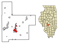
Geography

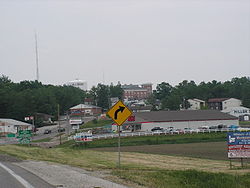
Hillsboro is located south of the center of Montgomery County at 39°9′54″N89°29′4″W / 39.16500°N 89.48444°W / 39.16500; -89.48444 (39.164973, −89.484572). [9] It is bordered to the east by Schram City and to the south by Taylor Springs.

Illinois Route 16 passes through the city center, leading west 9 miles (14 km) to Litchfield and northeast 28 miles (45 km) to Pana. Illinois Route 127 enters Hillsboro from the northwest with IL 16 but continues south as Vandalia Road; IL 127 leads north-northwest 12 miles (19 km) to Raymond and south 20 miles (32 km) to Greenville. Vandalia is 27 miles (43 km) to the southeast via Illinois Route 185.

According to the U.S. Census Bureau, Hillsboro has a total area of 10.4 square miles (27 km2), of which 8.7 square miles (23 km2) are land and 1.8 square miles (4.7 km2), or 16.84%, are water. [4] The Middle Fork of Shoal Creek passes just west of the city limits, flowing south toward the Kaskaskia River. Lake Glenn Shoals, north of the city, is a reservoir on the Middle Fork, and the Hillsboro city limits extend north more than 6 miles (10 km) to encompass the lake. Lake Hillsboro is a smaller reservoir on a tributary of the Middle Fork, northeast of the city center.

Climate

Climate data for Hillsboro, Illinois (1991–2020 normals, extremes 1895–present)
MonthJanFebMarAprMayJunJulAugSepOctNovDecYear
Record high °F (°C)75
(24)
79
(26)
90
(32)
92
(33)
99
(37)
106
(41)
114
(46)
112
(44)
105
(41)
95
(35)
83
(28)
74
(23)
114
(46)
Mean daily maximum °F (°C)38.4
(3.6)
44.5
(6.9)
55.4
(13.0)
68.3
(20.2)
77.7
(25.4)
86.0
(30.0)
88.7
(31.5)
87.3
(30.7)
81.7
(27.6)
69.7
(20.9)
54.6
(12.6)
42.8
(6.0)
66.3
(19.1)
Daily mean °F (°C)29.9
(−1.2)
34.9
(1.6)
44.8
(7.1)
56.2
(13.4)
66.0
(18.9)
74.6
(23.7)
77.6
(25.3)
76.0
(24.4)
69.2
(20.7)
57.8
(14.3)
44.9
(7.2)
34.6
(1.4)
55.5
(13.1)
Mean daily minimum °F (°C)21.4
(−5.9)
25.4
(−3.7)
34.2
(1.2)
44.1
(6.7)
54.3
(12.4)
63.3
(17.4)
66.6
(19.2)
64.7
(18.2)
56.7
(13.7)
45.8
(7.7)
35.2
(1.8)
26.4
(−3.1)
44.8
(7.1)
Record low °F (°C)−21
(−29)
−22
(−30)
−10
(−23)
18
(−8)
28
(−2)
37
(3)
45
(7)
39
(4)
26
(−3)
17
(−8)
−5
(−21)
−20
(−29)
−22
(−30)
Average precipitation inches (mm)2.52
(64)
2.61
(66)
3.05
(77)
5.03
(128)
5.06
(129)
3.83
(97)
3.74
(95)
3.14
(80)
3.30
(84)
3.41
(87)
3.76
(96)
2.62
(67)
42.07
(1,069)
Average precipitation days (≥ 0.01 in)6.36.38.49.611.28.67.36.65.97.36.66.890.9
Source: NOAA [10] [11]

Demographics

Historical population
CensusPop.Note
1860 853
1880 1,803
1900 1,937
1910 3,42476.8%
1920 5,07448.2%
1930 4,435−12.6%
1940 4,5141.8%
1950 4,141−8.3%
1960 4,2322.2%
1970 4,2670.8%
1980 4,4083.3%
1990 4,400−0.2%
2000 4,359−0.9%
2010 6,20742.4%
2020 5,902−4.9%
U.S. Decennial Census [12]

As of the census [13] of 2000, there were 4,359 people, 1,800 households, and 1,189 families residing in the city. The population density was 1,214.9 inhabitants per square mile (469.1/km2). There were 1,944 housing units at an average density of 541.8 per square mile (209.2/km2). The racial makeup of the city was 97.22% White, 1.10% African American, 0.32% Native American, 0.37% Asian, 0.07% Pacific Islander, 0.39% from other races, and 0.53% from two or more races. Hispanic or Latino of any race were 1.19% of the population.

There were 1,800 households, out of which 33.1% had children under the age of 18 living with them, 50.2% were married couples living together, 11.9% had a female householder with no husband present, and 33.9% were non-families. 30.0% of all households were made up of individuals, and 14.8% had someone living alone who was 65 years of age or older. The average household size was 2.36 and the average family size was 2.91.

In the city, the population was spread out, with 25.8% under the age of 18, 8.4% from 18 to 24, 27.2% from 25 to 44, 21.0% from 45 to 64, and 17.6% who were 65 years of age or older. The median age was 38 years. For every 100 females, there were 85.7 males. For every 100 females age 18 and over, there were 80.3 males.

The median income for a household in the city was $33,075, and the median income for a family was $40,135. Males had a median income of $31,821 versus $18,668 for females. The per capita income for the city was $17,458. About 14.3% of families and 17.2% of the population were below the poverty line, including 24.9% of those under age 18 and 11.9% of those age 65 or over.

Protected areas

The Bremer Wildlife Sanctuary, [14] north of Hillsboro, is the southeastern terminus of the Arches Rail Trail. The 3-mile-long (5 km) rail trail connects the Hillsboro area with nearby Butler. [15]

Notable people

Related Research Articles

<span class="mw-page-title-main">Montgomery County, Illinois</span> County in Illinois, United States

Montgomery County is a county located in the U.S. state of Illinois. According to the 2020 census, it had a population of 28,288. Its county seat is Hillsboro.

<span class="mw-page-title-main">Highland County, Ohio</span> County in Ohio, United States

Highland County is a county located in the U.S. state of Ohio. As of the 2020 census, the population was 43,317. Its county seat is Hillsboro. The county is named for the topography which is hilly and divides the watersheds of the Little Miami and Scioto Rivers.

<span class="mw-page-title-main">Fayette County, Illinois</span> County in Illinois, United States

Fayette County is a county located in the U.S. state of Illinois. As of the 2020 census, the population was 21,488. Its county seat is Vandalia, the site of the Vandalia State House State Historic Site. Ramsey Lake State Recreation Area is located in the northwest part of this county.

<span class="mw-page-title-main">Donnellson, Illinois</span> Village in Illinois, United States

Donnellson is a village in Montgomery and Bond counties, Illinois, United States. The population was 153 as of the 2020 census, down from 210 in 2010.

<span class="mw-page-title-main">Panama, Illinois</span> Village in Illinois, United States

Panama is a village in Montgomery and Bond counties, Illinois, United States. The population was 337 at the 2020 census.

<span class="mw-page-title-main">Harvel, Illinois</span> Village in Illinois, United States

Harvel is a village in Christian and Montgomery counties in the U.S. state of Illinois. The population was 178 at the 2020 census, down from 223 in 2010.

<span class="mw-page-title-main">Butler, Illinois</span> Village in Illinois, United States

Butler is a small village in Montgomery County, Illinois, United States. The population was 164 at the 2020 census.

<span class="mw-page-title-main">Coalton, Illinois</span> Village in Illinois, United States

Coalton is a village in Montgomery County, Illinois, United States. The population was 317 at the 2020 census.

<span class="mw-page-title-main">Coffeen, Illinois</span> City in Illinois, United States

Coffeen is a small city in Montgomery County, Illinois, United States. The population was 647 at the 2020 census.

<span class="mw-page-title-main">Fillmore, Illinois</span> Village in Illinois, United States

Fillmore is a village in Montgomery County, Illinois, United States. The population was 305 at the 2020 census.

<span class="mw-page-title-main">Irving, Illinois</span> Village in Illinois, United States

Irving is a village in Montgomery County, Illinois, United States. The population was 373 at the 2020 census, down from 495 in 2010.

<span class="mw-page-title-main">Litchfield, Illinois</span> City in Illinois, United States

Litchfield is a city in Montgomery County, Illinois, United States. The population was 6,605 at the 2020 census. It is located in South Central Illinois, south of Springfield, the state capital.

<span class="mw-page-title-main">Nokomis, Illinois</span> City in Illinois, United States

Nokomis is a city in Montgomery County, Illinois, United States. The population was 2,142 at the 2020 census.

<span class="mw-page-title-main">Raymond, Illinois</span> Village in Illinois, United States

Raymond is a village in Montgomery County, Illinois, United States. The population was 949 at the 2020 census.

<span class="mw-page-title-main">Schram City, Illinois</span> Village in Illinois, United States

Schram City is a village in Montgomery County, Illinois, United States. The population was 563 at the 2020 census.

<span class="mw-page-title-main">Taylor Springs, Illinois</span> Village in Illinois, United States

Taylor Springs is a village in Montgomery County, Illinois, United States. The population was 724 at the 2020 census.

<span class="mw-page-title-main">Walshville, Illinois</span> Village in Illinois, United States

Walshville is a small village in Montgomery County, Illinois, United States. The population was 61 at the 2020 census.

<span class="mw-page-title-main">Wenonah, Illinois</span> Village in Illinois, United States

Wenonah is a small village in Montgomery County, Illinois, United States. The population was 32 at the 2020 census.

<span class="mw-page-title-main">Witt, Illinois</span> City in Illinois, United States

Witt is a city in Montgomery County, Illinois, United States. The population was 785 at the 2020 census, down from 903 in 2010.

<span class="mw-page-title-main">Hillsboro, Ohio</span> City in Ohio, United States

Hillsboro is a city in and the county seat of Highland County, Ohio, United States, approximately 35 miles (56 km) west of Chillicothe and 50 miles (80 km) east of Cincinnati. The population was 6,481 at the 2020 census.

References

  1. 1 2 "City of Hillsboro, Illinois". City of Hillsboro, Illinois. Retrieved August 31, 2012.
  2. 1 2 3 U.S. Geological Survey Geographic Names Information System: Hillsboro, Illinois
  3. "City Officials – the City of Hillsboro, Illinois" . Retrieved June 26, 2021.
  4. 1 2 "2022 U.S. Gazetteer Files: Illinois". United States Census Bureau. Retrieved March 20, 2023.
  5. 1 2 "P1. Race – Hillsboro city, Illinois: 2020 DEC Redistricting Data (PL 94-171)". U.S. Census Bureau. Retrieved March 20, 2023.
  6. "Find a County". National Association of Counties. Archived from the original on May 31, 2011. Retrieved June 7, 2011.
  7. "Hillsboro, Illinois". City-Data.com. Retrieved August 31, 2012.
  8. "History | Hillsboro, Illinois". Archived from the original on November 1, 2013. Retrieved June 16, 2013.
  9. "US Gazetteer files: 2010, 2000, and 1990". United States Census Bureau. February 12, 2011. Retrieved April 23, 2011.
  10. "NowData – NOAA Online Weather Data". National Oceanic and Atmospheric Administration. Retrieved July 24, 2021.
  11. "Station: Hillsboro, IL". U.S. Climate Normals 2020: U.S. Monthly Climate Normals (1991-2020). National Oceanic and Atmospheric Administration. Retrieved July 24, 2021.
  12. "Census of Population and Housing". Census.gov. Retrieved June 4, 2015.
  13. "U.S. Census website". United States Census Bureau . Retrieved January 31, 2008.
  14. "Helen & Betty Bremer Wildlife Sanctuary".
  15. Slepica, Nancy Bliss (October 18, 2012). "Arches Trail Now Open To The Public". The Journal-News .
  16. "Otto Funk". Historical Society of Montgomery County, Illinois. Retrieved August 31, 2012.