
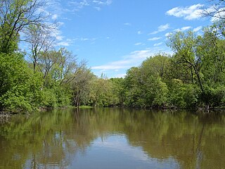
The Illinois River is a principal tributary of the Mississippi River at approximately 273 miles (439 km) in length. Located in the U.S. state of Illinois, the river has a drainage basin of 28,756.6 square miles (74,479 km2). The Illinois River begins with the confluence of the Des Plaines and Kankakee rivers in the Chicago metropolitan area, and it generally flows to the southwest across Illinois, until it empties into the Mississippi near Grafton, Illinois. Its drainage basin extends into southeastern Wisconsin, northwestern Indiana, and a very small area of southwestern Michigan in addition to central Illinois. Along its banks are several river ports, including the largest, Peoria, Illinois. Historic and recreation areas on the river include Starved Rock, and the internationally important wetlands of the Emiquon Complex and Dixon Waterfowl Refuge.

The Rock River is a tributary of the Mississippi River, approximately 299 miles (481 km) long, in the U.S. states of Wisconsin and Illinois. The river was known as the Sinnissippi to Sauk and Meskwaki peoples; the name means "rocky waters".

The Sugar River is a tributary of the Pecatonica River, approximately 91 miles (146 km) long, in the U.S. states of Wisconsin and Illinois.

The Pecatonica River is a tributary of the Rock River, 194 miles (312 km) long, in southern Wisconsin and northern Illinois in the United States.

The Illinois River is a 145-mile-long (233 km) tributary of the Arkansas River in the U.S. states of Arkansas and Oklahoma. The Osage Indians named it Ne-eng-wah-kon-dah, which translates as "Medicine Stone River". The state of Oklahoma has designated its portion as a Scenic River.

The Sandy River is a 56-mile (90 km) tributary of the Columbia River in northwestern Oregon in the United States. The Sandy joins the Columbia about 14 miles (23 km) upstream of Portland.
The Des Plaines River is a river that flows southward for 133 miles (214 km) through southern Wisconsin and northern Illinois in the United States Midwest, eventually meeting the Kankakee River west of Channahon to form the Illinois River, a tributary of the Mississippi River.

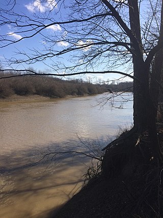
The Black River is a tributary of the White River, about 300 miles (480 km) long, in southeastern Missouri and northeastern Arkansas in the United States. Via the White River, it is part of the Mississippi River watershed. Black River Technical College is named for the river.
The Big Muddy River is a 156-mile-long (251 km) river in southern Illinois. It joins the Mississippi River just south of Grand Tower. The Big Muddy has been dammed near Benton, forming Rend Lake.

The Embarras River is a 195-mile-long (314 km) tributary of the Wabash River in southeastern Illinois in the United States. The waters of the Embarras reach the Gulf of Mexico via the Wabash, Ohio, and Mississippi Rivers. The river drains a watershed around 1,566,450 acres (6,339.2 km2) in an agricultural region. It arises near Champaign-Urbana and flows south to near Vincennes, Indiana. The name comes from French explorers, who used the French word, embarras, for river navigation obstacles, blockages, and difficulties relating to logjams.

Boneyard Creek is a 3.3-mile-long (5.3 km) waterway that drains much of the cities of Champaign and Urbana, Illinois, United States. It is a tributary of the Saline Branch of the Salt Fork Vermilion River, which is a tributary of the south-flowing Vermilion River and the Wabash River. The creek flows through the northern sections of the campus of the University of Illinois Urbana-Champaign. The newsletter of the university's ACM chapter is Banks of the Boneyard, named after the creek.
Bonpas Creek is a tributary of the Wabash River in Illinois. It rises to the east of Olney in Richland County, Illinois. Flowing south, it forms the boundary between Edwards and Wabash counties. The creek is 58.4 miles (94.0 km) long. It joins the Wabash near Grayville, Illinois. In the last 2 miles (3 km) of its watercourse, it occupies part of a former Wabash oxbow bend. As such, the creek now also forms part of the state boundary between White County, Illinois, and Gibson County, Indiana, as flows past Grayville in the former channel.
The Mazon River or Mazon Creek, is a tributary of the Illinois River in the United States. The confluence is near Morris, Illinois.
The West Okaw River is a tributary of the Kaskaskia River, which it joins in Moultrie County, Illinois. The West Okaw forms an arm of Lake Shelbyville where the natural rivers used to meet.
Salt Creek is a major tributary to the Sangamon River, which it joins at the boundary between Mason and Menard County, Illinois. There are at least two other Salt Creeks in Illinois, Salt Creek, and in Effingham County, Illinois.

Beaver Dam State Park is an Illinois state park on 750 acres (304 ha) in Macoupin County, Illinois in the United States. The park is 7 miles (11 km) southwest of Carlinville, Illinois and is managed by the Illinois Department of Natural Resources (IDNR) as a public place for fishing.

The Beaver and Erie Canal, also known as the Erie Extension Canal, was part of the Pennsylvania Canal system and consisted of three sections: the Beaver Division, the Shenango Division, and the Conneaut Division. The canal ran 136 miles (219 km) north–south near the western edge of the state from the Ohio River to Lake Erie through Beaver County, Lawrence County, Mercer County, Crawford County, and Erie County, Pennsylvania.
The North Fork Embarras River is a 64.0-mile-long (103.0 km) stream which originates in Edgar County, Illinois, and flows through Clark, Crawford and Jasper counties. Its confluence with the Embarras River is located near the town of Ste. Marie in Jasper County. It is a major tributary to the Embarras River. The North Fork's main tributary is Panther Creek, located in Jasper County.
Indian Creek, also known as Big Indian Creek, is a 51.5-mile-long (82.9 km) tributary of the Fox River in Lee, LaSalle, and DeKalb counties in Illinois.
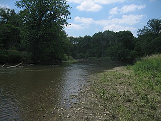
The South Branch Kishwaukee River is a 63.6-mile-long (102.4 km) tributary of the Kishwaukee River in northern Illinois. The South Branch is the main branch of the Kishwaukee River, joining it 10.6 miles (17.1 km) above its confluence with the Rock River. The South Branch flows through DeKalb County; in 2007 flooding along the tributary inundated areas of DeKalb County and Sycamore, Illinois.

