Wamac, Illinois

Last updated

Wamac, Illinois
Clinton County Illinois Incorporated and Unincorporated areas Wamac Highlighted.svg
Location in Clinton County, Illinois
Usa edcp location map.svg
Red pog.svg
Wamac
Location in the United States
Coordinates: 38°30′22″N89°8′36″W / 38.50611°N 89.14333°W / 38.50611; -89.14333 [1]
CountryUnited States
StateIllinois
Counties Washington, Marion, Clinton
Townships Irvington, Centralia, Brookside
Government
  MayorJackie Butch Mathus, Jr. [2]
Area
[3]
  Total1.43 sq mi (3.69 km2)
  Land1.42 sq mi (3.66 km2)
  Water0.01 sq mi (0.03 km2)
Elevation
[1]
502 ft (153 m)
Population
 (2020) [4]
  Total985
  Density696.11/sq mi (268.77/km2)
Time zone UTC-6 (CST)
  Summer (DST) UTC-5 (CDT)
ZIP code
62801 (Centralia)
Area code 618
FIPS code 17-78721
GNIS feature ID2397187 [1]
Public Transit South Central Transit
Wikimedia CommonsWamac, Illinois
Website wamac.illinois.gov

Wamac is a city in Washington, Marion, and Clinton counties in the U.S. state of Illinois. The population was 985 at the 2020 census, [4] down from 1,185 in 2010. Incorporated as a city on July 25, 1916, Wamac derives its name from the three counties.

Contents

Geography

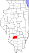
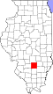
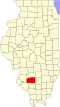
The city is mainly in the northeast corner of Washington County and the southwest corner of Marion County, with a small portion in the southeast corner of Clinton County. It is bordered to the north and east by Centralia. U.S. Route 51 passes just east of Wamac, leading north to the center of Centralia and south 38 miles (61 km) to Du Quoin.

According to the 2021 census gazetteer files, Wamac has a total area of 1.43 square miles (3.70 km2), of which 1.42 square miles (3.68 km2) (or 99.23%) are land and 0.01 square miles (0.03 km2) (or 0.77%) are water. [3] Fulton Branch passes through the south side of the city, flowing west to Sewer Creek, part of the Crooked Creek watershed flowing west to the Kaskaskia River.

Demographics

Historical population
CensusPop.Note
1920 1,180
1930 1,2324.4%
1940 1,43216.2%
1950 1,429−0.2%
1960 1,394−2.4%
1970 1,347−3.4%
1980 1,66523.6%
1990 1,501−9.8%
2000 1,378−8.2%
2010 1,185−14.0%
2020 985−16.9%
U.S. Decennial Census [5]

As of the 2020 census [6] there were 985 people, 503 households, and 338 families residing in the city. The population density was 690.74 inhabitants per square mile (266.70/km2). There were 478 housing units at an average density of 335.20 per square mile (129.42/km2). The racial makeup of the city was 86.09% White, 4.16% African American, 0.30% Native American, 0.30% Asian, 0.10% Pacific Islander, 1.42% from other races, and 7.61% from two or more races. Hispanic or Latino of any race were 3.55% of the population.

There were 503 households, out of which 30.8% had children under the age of 18 living with them, 29.42% were married couples living together, 19.09% had a female householder with no husband present, and 32.80% were non-families. 26.84% of all households were made up of individuals, and 6.96% had someone living alone who was 65 years of age or older. The average household size was 2.91 and the average family size was 2.43.

The city's age distribution consisted of 27.1% under the age of 18, 9.3% from 18 to 24, 26.7% from 25 to 44, 28% from 45 to 64, and 8.9% who were 65 years of age or older. The median age was 33.9 years. For every 100 females, there were 106.8 males. For every 100 females age 18 and over, there were 105.8 males.

The median income for a household in the city was $32,625, and the median income for a family was $34,286. Males had a median income of $24,043 versus $25,250 for females. The per capita income for the city was $20,581. About 20.7% of families and 27.7% of the population were below the poverty line, including 39.9% of those under age 18 and 5.5% of those age 65 or over.

Related Research Articles

<span class="mw-page-title-main">Tallapoosa County, Alabama</span> County in Alabama, United States

Tallapoosa County is located in the east-central portion of the U.S. state of Alabama. As of the 2020 census, the population was 41,311. Its county seat is Dadeville. Its largest city is Alexander City.

<span class="mw-page-title-main">Marion County, Illinois</span> County in Illinois, United States

Marion County is a county located in the U.S. state of Illinois. According to the 2020 census, it had a population of 37,729. Its county seat is Salem.

<span class="mw-page-title-main">Bartelso, Illinois</span> Village in Illinois, United States

Bartelso is a village in Clinton County, Illinois, United States. The population was 635 at the 2020 census, up from 595 at the 2010 census.

<span class="mw-page-title-main">Hoffman, Illinois</span> Village in Illinois, United States

Hoffman is a village in Clinton County, Illinois, United States. The population was 439 at the 2020 census.

<span class="mw-page-title-main">Eagarville, Illinois</span> Village in Illinois, United States

Eagarville is a village in Macoupin County, Illinois, United States. The population was 114 at the 2020 census.

<span class="mw-page-title-main">Mount Olive, Illinois</span> City in Illinois, United States

Mount Olive is a city in Macoupin County, Illinois, United States. The population was 2,015 at the 2020 census. The city is part of the Metro East region within the St. Louis metropolitan area.

<span class="mw-page-title-main">Central City, Illinois</span> Village in Illinois, United States

Central City is a village in Marion County, Illinois, United States. The population was 1,098 at the 2020 census.

<span class="mw-page-title-main">Junction City, Illinois</span> Village in Illinois, United States

Junction City is a village in Marion County, Illinois, United States. The population was 527 at the 2020 census.

<span class="mw-page-title-main">Sandoval, Illinois</span> Village in Illinois, United States

Sandoval is a village in Marion County, Illinois, United States. The population was 1,157 at the 2020 census.

<span class="mw-page-title-main">Schram City, Illinois</span> Village in Illinois, United States

Schram City is a village in Montgomery County, Illinois, United States. The population was 563 at the 2020 census.

<span class="mw-page-title-main">Taylor Springs, Illinois</span> Village in Illinois, United States

Taylor Springs is a village in Montgomery County, Illinois, United States. The population was 724 at the 2020 census.

<span class="mw-page-title-main">Centralia, Iowa</span> City in Iowa, United States

Centralia is a city in Dubuque County, Iowa, United States. It is part of the Dubuque, Iowa Metropolitan Statistical Area. The population was 116 at the 2020 census, up 15 persons since the 2000 census and down 18 from the 2010.

Leon is a town in Cattaraugus County, New York. The population was 1,253 at the 2020 census. The name is derived from the former Kingdom of León in Spain, though it is pronounced like the American first name, "LEE-un". The town is on the western border of the county, northwest of the city of Salamanca.

Catlin is a town in Chemung County, New York, United States. The population was 2,554 at the 2020 census. The town is named after Phineas Catlin, a surveyor and public official. Catlin is in the northwestern corner of the county, northwest of Elmira. It is part of the Elmira Metropolitan Statistical Area.

<span class="mw-page-title-main">Preston, New York</span> Town in New York, United States

Preston is a town in Chenango County, New York, United States. The population was 1,044 at the 2010 census. Preston is an interior town of Chenango County and is west of the city of Norwich.

West Union is a town in Steuben County, New York, United States. The population was 343 as of the 2020 decennial census.

<span class="mw-page-title-main">Centralia, Missouri</span> City in Missouri, United States

Centralia is a city in Boone County in the U.S. state of Missouri. The population was 4,541 at the 2020 census, with an estimated population of 4,244 in 2018. A very small portion of the city lies in Audrain County.

<span class="mw-page-title-main">Brown Township, Champaign County, Illinois</span> Township in Illinois, United States

Brown Township is a township in Champaign County, Illinois, USA. As of the 2020 census, its population was 2,107 and it contained 886 housing units.

<span class="mw-page-title-main">Gilead Precinct, Calhoun County, Illinois</span> Township in Illinois, United States

Gilead Precinct is located in Calhoun County, Illinois. The population was 314 at the 2020 census, a decrease from 342 at the 2010 census.

<span class="mw-page-title-main">Brookside Township, Clinton County, Illinois</span> Township in Illinois, United States

Brookside Township is one of fifteen townships in Clinton County, Illinois, United States. As of the 2020 census, its population was 4,444 and it contained 1,570 housing units. The township's name changed from Crooked Creek Township on June 1, 1874.

References

  1. 1 2 3 U.S. Geological Survey Geographic Names Information System: Wamac, Illinois
  2. "Wamac | Washington County, Illinois". washingtonco.illinois.gov. Retrieved July 20, 2022.
  3. 1 2 "2022 U.S. Gazetteer Files: Illinois". United States Census Bureau. Retrieved February 23, 2023.
  4. 1 2 "P1. Race – Wamac city, Illinois: 2020 DEC Redistricting Data (PL 94-171)". U.S. Census Bureau. Retrieved February 23, 2023.
  5. "Census of Population and Housing". Census.gov. Retrieved June 4, 2015.
  6. "Explore Census Data". data.census.gov. Retrieved June 28, 2022.