Teutopolis, Illinois

Last updated
Teutopolis, Illinois
Motto: 
Home of the Wooden Shoes
USA Illinois location map.svg
Red pog.svg
Teutopolis, Illinois
Location of Teutopolis within Illinois
Coordinates: 39°7′55″N88°28′46″W / 39.13194°N 88.47944°W / 39.13194; -88.47944 [1]
CountryUnited States
StateIllinois
County Effingham
Government
  Village PresidentGreg Hess
Area
[2]
  Total2.04 sq mi (5.29 km2)
  Land2.04 sq mi (5.29 km2)
  Water0.00 sq mi (0.00 km2)
Elevation
[1]
600 ft (200 m)
Population
 (2020)
  Total1,618
  Density791.97/sq mi (305.82/km2)
Time zone UTC-6 (CST)
  Summer (DST) UTC-5 (CDT)
Postal code
62467
Area code 217
FIPS code 17-74743
GNIS ID2399962 [1]
Website teutopolis.com

Teutopolis is a village in Effingham County, Illinois, United States. As of the 2020 census it had a population of 1,618. [3] [4]

Contents

Geography

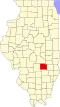
Teutopolis is located in northeastern Effingham County and U.S. Route 40 (National Road) passes through the center of the village, leading west 4 miles (6 km) into Effingham, the county seat, and east 5.5 miles (8.9 km) to Montrose.

According to the 2021 census gazetteer files, Teutopolis has a total area of 2.04 square miles (5.28 km2), all land. [5]

History

Teutopolis, "City of the Teutons", or Germans, was established in 1839 along the National Road, now U.S. Route 40. It is the only town in the United States with this name.

Clemens Uptmor from the Duchy of Oldenburg, and Kingdom of Hanover, Germany, came to the United States in 1834 along with his brother Herman H. Uptmor and a few neighbors. They settled first in Cincinnati, then the gateway to the west for German Catholics. In 1837 they formed a land company for the purchase of government land under the name of "Deutsche Land-Compagnie oder Ansiedlungsgesellschaft". John F. Waschefort, Clemens Uptmor and Gerard H. Bergfeld were named to find a location for settlement and then give their recommendations to the land company. The committee opposed settling in Missouri because of slavery and were discouraged from settling in the north central area of Illinois because of the swamps and the black soil. The northeast part of Effingham County was recommended because of the woodlands, well-drained uplands and plentiful game.

Gerhardt Meyer and Heinrich Roennebaum accompanied the original trio back to Illinois to inspect the proposed site. The location was approved, and in July 1839 in Vandalia the land was claimed for homestead purposes in the name of John F. Waschefort. 10,000 acres (4,000 ha) were purchased at $1.25 per acre, with an additional 80 acres (32 ha) being purchased for $5.00 an acre. The town site was surveyed and platted by William J. Hankins. The plan of the town was very similar to the plat of the original town of Cincinnati.

Back in Cincinnati the land was allotted at a drawing held in a fire engine house. For each $50.00 a member contributed he received one "in-lot" and one "out-lot" or "garden lot" in the town and an additional parcel of farmland for a total of 40 acres (16 ha).

Demographics

Historical population
CensusPop.Note
1900 498
1910 59218.9%
1920 72823.0%
1930 710−2.5%
1940 80613.5%
1950 91914.0%
1960 1,14024.0%
1970 1,2499.6%
1980 1,41413.2%
1990 1,4170.2%
2000 1,55910.0%
2010 1,530−1.9%
2020 1,6185.8%
U.S. Decennial Census [6] [3]

As of the 2020 census [7] there were 1,618 people, 759 households, and 499 families residing in the village. The population density was 791.97 inhabitants per square mile (305.78/km2). There were 630 housing units at an average density of 308.37 per square mile (119.06/km2). The racial makeup of the village was 97.34% White, 0.06% African American, 0.12% Native American, 0.37% Asian, 0.00% Pacific Islander, 0.56% from other races, and 1.55% from two or more races. Hispanic or Latino of any race were 0.80% of the population.

There were 759 households, out of which 28.7% had children under the age of 18 living with them, 54.55% were married couples living together, 7.51% had a female householder with no husband present, and 34.26% were non-families. 22.13% of all households were made up of individuals, and 11.20% had someone living alone who was 65 years of age or older. The average household size was 2.97 and the average family size was 2.37.

The village's age distribution consisted of 22.3% under the age of 18, 8.3% from 18 to 24, 28% from 25 to 44, 24.4% from 45 to 64, and 17.0% who were 65 years of age or older. The median age was 36.7 years. For every 100 females, there were 101.2 males. For every 100 females age 18 and over, there were 114.4 males.

The median income for a household in the village was $72,404, and the median income for a family was $95,583. Males had a median income of $47,794 versus $27,292 for females. The per capita income for the village was $34,393. About 1.0% of families and 3.9% of the population were below the poverty line, including 0.0% of those under age 18 and 13.0% of those age 65 or over.

Related Research Articles

<span class="mw-page-title-main">Effingham County, Illinois</span> County in Illinois, United States

Effingham County is located in the south central part of the U.S. state Illinois. As of the 2020 census, the population was 34,668. Its county seat and largest city is Effingham. Some other cities in Effingham County, Illinois include Altamont, Teutopolis, Beecher City, Montrose, Dieterich, Shumway, Watson, Mason, and Edgewood. Effingham County comprises the Effingham, IL Micropolitan Statistical Area.

<span class="mw-page-title-main">Golf, Illinois</span> Village in Illinois, United States

Golf is a village in Cook County, Illinois, United States, incorporated in 1928. As of the 2020 census, the village had a population of 514. The community is primarily residential, and has a dedicated police department, post office, and Metra train stop.

<span class="mw-page-title-main">Montrose, Illinois</span> Village in Illinois, United States

Montrose is a village in Effingham and Cumberland counties in the U.S. state of Illinois. The population was 210 at the 2020 census. The Effingham County portion of Montrose is part of the Effingham Micropolitan Statistical Area, while the small section that lies in Cumberland County is part of the Charleston–Mattoon Micropolitan Statistical Area.

<span class="mw-page-title-main">Beecher City, Illinois</span> Village in Illinois, United States

Beecher City is a village in Effingham County, Illinois, United States. Beecher City is part of the Effingham, IL Micropolitan Statistical Area. The population was 428 at the 2020 census. Beecher City was founded in 1872.

<span class="mw-page-title-main">Dieterich, Illinois</span> Village in Illinois, United States

Dieterich is a village in Effingham County, Illinois, United States. The population was 890 at the 2020 census. Dieterich is part of the Effingham, IL Micropolitan Statistical Area.

<span class="mw-page-title-main">Edgewood, Illinois</span> Village in Illinois, United States

Edgewood is a village in Effingham County, Illinois, United States. The population was 398 at the 2020 Census. Edgewood is part of the Effingham, IL Micropolitan Statistical Area.

<span class="mw-page-title-main">Shumway, Illinois</span> Village in Illinois, United States

Shumway is a village in Effingham County, Illinois, United States. As of the 2020 census, the village population was 188. Shumway is part of the Effingham, IL Micropolitan Statistical Area.

<span class="mw-page-title-main">Watson, Illinois</span> Village in Illinois, United States

Watson is a village in Effingham County, Illinois, United States. The population was 668 at the 2020 census. Watson is part of the Effingham, IL Micropolitan Statistical Area.

<span class="mw-page-title-main">Banner, Illinois</span> Village in Illinois, United States

Banner is a village in Fulton County, Illinois, United States. The population was 189 at the 2010 census, up from 149 at the 2000 census.

<span class="mw-page-title-main">Norris, Illinois</span> Village in Illinois, United States

Norris is a village in Fulton County, Illinois, United States. The population was 213 at the 2010 census, up from 194 at the 2000 census.

<span class="mw-page-title-main">Elvaston, Illinois</span> Village in Illinois, United States

Elvaston is a village in Hancock County, Illinois, United States. The population was 165 at the 2010 census, an increase from 152 in 2000.

<span class="mw-page-title-main">Campbell Hill, Illinois</span> Village in Illinois, United States

Campbell Hill is a village in Jackson County, Illinois, United States. The population was 309 at the 2020 census.

<span class="mw-page-title-main">Vergennes, Illinois</span> Village in Illinois, United States

Vergennes is a village in Jackson County, Illinois, United States. The population was 298 at the 2010 census, down from 491 at the 2000 census.

<span class="mw-page-title-main">Wheeler, Illinois</span> Village in Illinois, United States

Wheeler is a village in Jasper County, Illinois, United States. The population was 147 at the 2010 census.

<span class="mw-page-title-main">Round Lake Park, Illinois</span> Village in Illinois, United States

Round Lake Park is a village in Lake County, Illinois, United States. Per the 2020 census, the population was 7,680. It is located along the south side of the lake, Round Lake. Access to the lake from this town is private and only for residents of Round Lake Park.

<span class="mw-page-title-main">Fairmount, Illinois</span> Village in Illinois, United States

Fairmount is a village in Vance Township, Vermilion County, Illinois, United States. It is part of the Danville, Illinois Metropolitan Statistical Area. The population was 642 at the 2010 census.

<span class="mw-page-title-main">Henning, Illinois</span> Village in Illinois, United States

Henning is a village in South Ross Township, Vermilion County, Illinois, United States. It is part of the Danville, Illinois Metropolitan Statistical Area. The population was 241 at the 2000 census.

<span class="mw-page-title-main">Sidell, Illinois</span> Village in Illinois, United States

Sidell is a village in Sidell Township, Vermilion County, Illinois, United States. It is part of the Danville, Illinois Metropolitan Statistical Area. The population was 617 at the 2010 census.

<span class="mw-page-title-main">Corfu, New York</span> Village in New York, United States

Corfu is a village in Genesee County, New York, United States. The population was 709 at the 2010 census. It is named after the Greek island of Corfu.

<span class="mw-page-title-main">Norton, Vermont</span> Town in Vermont, United States

Norton is a town in Essex County, Vermont, United States. The population was 153 at the 2020 census. It is part of the Berlin, NH–VT Micropolitan Statistical Area. It is located on the Canada–US border, immediately south of Stanhope, Quebec.

References

  1. 1 2 3 U.S. Geological Survey Geographic Names Information System: Teutopolis, Illinois
  2. "2020 U.S. Gazetteer Files". United States Census Bureau. Retrieved March 15, 2022.
  3. 1 2 "2020: DEC Redistricting Data (PL 94-171)". United States Census Bureau. Retrieved February 14, 2022.
  4. "Geographic Identifiers: 2010 Demographic Profile Data (G001): Teutopolis village, Illinois". American Factfinder. U.S. Census Bureau. Archived from the original on February 13, 2020. Retrieved January 29, 2016.
  5. Bureau, US Census. "Gazetteer Files". Census.gov. Retrieved 2022-06-29.
  6. "Census of Population and Housing". Census.gov. Retrieved June 4, 2015.
  7. "Explore Census Data". data.census.gov. Retrieved 2022-06-28.